Past

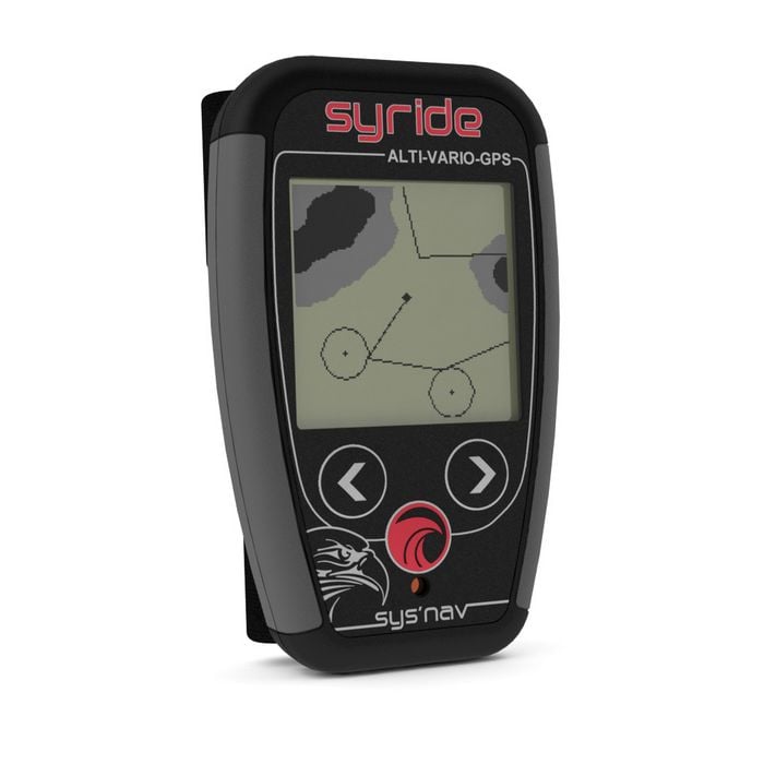
Syride SYS'Nav (PAST MODEL)

£299.00 Excl. Tax: £249.17
Out of stock Out of stock Sold out, not expected in stock in future. See our Shipping and Stock page for more info.

Model Status: Past model

SKU
SYRDE-SYSNAV

Shipping to Germany: Due to customs and shipping regulations, products containing batteries cannot be shipped to Germany

See the latest flight instruments on Flybubble.

Superseded by Syride SYS'Nav V3.

SYS'Nav is an alti vario GPS with G-meter. Lightweight, powerful, practical and affordable, it is a great option for cross country flying and can be used for competitions.

SYS'Nav: Complete

  • GPS
  • Airspaces
  • Compatible competition
  • AGL
  • GOTO features

Powerful 

  • Ultra fast response (10cm)
  • Thermal-sniffer feature
  • 20h autonomy 

Practical 

  • Fixed on the risers for easy reading
  • Customizable screen
  • G-force feature
  • Online flightbook 

Lightweight 

  • Only 83 grams
  • The lightest alti-vario-GPS ever

Technical specs

Function : Alti-Vario-GPS with G-force meter
Size : 10cm x 6.1cm x 1.7cm
Weight : 83 gr including battery
Rising threshold : from +0.1 m/s to +2.0m/s
Falling threshold : from -0.5 m/s to -5.5m/s
Thermal sniffer : activable from -0.1m/s to +0.1m/s
Height above ground : with topography
Backlighted display : 100% customizable
Volume : 3 levels plus 'OFF' position
Autonomy : 25h
Memory : 90h of flight @ 1 point per second
Airspaces : over 50 000 points
Waypoints* : 600
Routes* : 10 routes of 150 points max
Output files : IGC, GPX and KML
Online flightbook : included
Risers fixing : included
Cockpit fixing : with hook and loop fastener (included)
USB cable : included

Video

Manual

Download the SYS'Nav manual (PDF)

Syride Tools

Syride have gathered some useful 'tools' on their website.

  • Software: Necessary for downloading flights, customizing screens, upgrading instrument...
  • Screen customizer: Enables you to freely customize the informations your instrument displays.
  • Airspaces: Avoid flying into forbidden airspaces by uploading OpenAir files into your instrument.
  • Topography: Gives access to height above ground information, airspaces with AGL and grayscaled topography on the MAP screen of SYS'Nav.
  • Route maker: Build your route or a waypoints list in a few clicks. A piece of cake!
More Information
Condition New
Model Status Past model