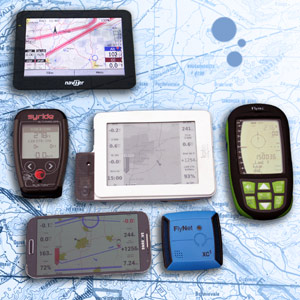
In this article I will evaluate a range of instruments in the search for a useful, reliable and simple mapping display. I have flown extensively with all these instruments to identify the practical issues they raise.
Getting the right instrument is about understanding what your information needs are, and matching a device with your typical flying environment and aspirations.
Setup 1
Phone Vario GPS
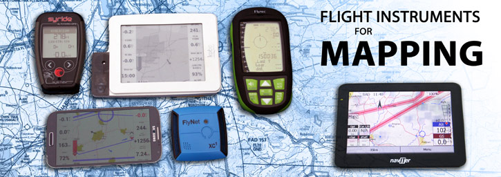
In this article I will evaluate a range of instruments in the search for a useful, reliable and simple mapping display. I have flown extensively with all these instruments to identify the practical issues they raise.
Ever since Garmin introduced affordable handheld GPS devices in the 90s, a moving map display has been an integral part of a cross country pilot's flight deck. As devices have become more sophisticated so have the mapping solutions. The mass market technology found in phones, tablets and e-readers has encroached on the territory of the traditional flight instruments, and at first glance it seems the flight instruments are lagging behind. But there's more to the story: flight instruments are designed with flying in mind, and offer many benefits.
There is no perfect instrument: there are strengths and weaknesses to every unit, and the technology continually improves. Getting the right instrument is about understanding what your information needs are, and matching a device with your typical flying environment and aspirations.
Presently, for a fully detailed moving map display, there are three options: phone/tablet, Kobo, or Oudie 3. Although I haven't found all of them to be ideal, I consider them here to give a balanced overview of the solutions available to you. Garmin units used to be popular and might be considered in an 'old school' setup, but the small screens, difficulty in loading current airspace files and the expense of the aviation versions have removed them from consideration for mapping.
Setup 1: Phone Vario GPS
Instruments: phone running XCSoar + audio vario + Garmin
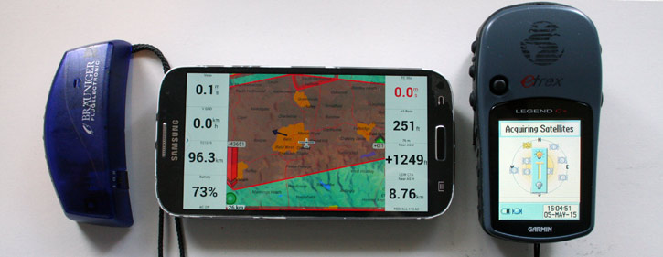
If you're using the phone to run any flight apps and you need it to be visible, the best solution is the external battery charging case cover which gives you some protection for the phone and triples the power. I've assumed this in all setups. For a Samsung Galaxy S4, it adds only 113g and costs £16 for the cheapest version on Amazon.
It's best to switch on the flying app then stow the phone safely in a pocket for launch and landing. Only once flying, put it in the exposed position on the flight deck. This reduces the risk of smashing up your phone - a vital link to emergency services. Or keep an older phone in a chest pocket.
UP:
+ cheap (most pilots have a smartphone already)
+ XCsoar is free, customisable and fully featured (but designed for sailplanes not PG)
+ high screen quality: colour screen for terrain maps, high resolution, easy screen lock
+ phone in useable inflight position means you can access SMS, xcweather live station update map, livetracking, notams, xcplanner, glympse etc.
DOWN:
- delicate phone on flight deck - it is not designed as a flight instrument!
- difficult to see the screen in sunlight, so needs to be on the brightest setting.
- screen does not operate unless you have e-tip gloves (or stylus).
- vario on phone is too delayed (if present at all) so you need at least a separate audio vario (20g £52) which has limited 'descriptive tones' due to small processor.
- XCsoar is not simple to operate at first. There's no 15 second averager, only 30 seconds, which is too long for PG. (iPhone has the better flyskyhi app which doesn't have this problem. Other apps are available for Android but none as complete as XCsoar.)
- phone GPS reputed to cut out at high altitudes (above 4000m).
If phone app crashes (as it is prone to do) you have nothing, so a Garmin for UKXCL compliant tracklog (180g, second hand on ebay from £30) adds reliability (and basic airspace maps if you can figure out how to do it). It also can display groundspeed and GPS altitude, so enables you to switch off the phone screen from time to time to save power.
Watch our video on how to download a Garmin tracklog >
IN A NUTSHELL: el cheapo. works, but not ideal.
WEIGHT: Total solution adds 313g (in addition to standard phone)
COST: £98
RUNTIME: 10 hours (assuming phone in battery case and screen on max brightness. Dimmed, you might get 20 hours)
Setup 2
Phone Booster
Instruments: FlyNet XC1 (50g) + phone running XCsoar
.jpg)
Sometimes an audio vario and tracklog is all you need, so if there's no airspace, no need for an averager and no need for groundspeed info, you can keep your phone in your pocket and go very light with this setup. The XC1's tiny battery charges quickly and will run for 20 hours.
UP:
+ light (50g + 113g phone battery case)
+ simple, reliable tracklog recording (UKXCL compliant)
+ very sensitive GPS signal that won't cut out at altitude and can handle some obstruction
+ Flynet XC1 doubles battery power, so for long trips it saves weight
+ XCsoar flight info is boosted (relative to setup 1)
+ retrieving the tracklogs and updating the firmware are simple
+ rechargeable from phone with OTG adapter
DOWN:
- for full info display it works only in conjunction with a phone
- delicate phone on flight deck - it is not designed as a flight instrument!
- difficult to see the screen in sunlight, so needs to be on the brightest setting.
- screen does not operate unless you have e-tip gloves (or stylus).
- XCsoar is not simple to operate at first. There's no 15 second averager, only 30 seconds
- Although the Flynet vario is good, it's slightly less sensitive in light lift and less descriptive than full alti-varios (for power saving and response time its best to use the audio in the Flynet unit not the configurable one in XCsoar).
Alternative instruments: Flytec Sensbox (adds sensors).
IN A NUTSHELL: very lightweight, adds flexibility and backup track, but needs phone on flight deck
WEIGHT: 163g (total solution)
COST: £285 (£269+£16)
RUNTIME: 20 hours runtime at max brightness
Setup 3
Standalone Flight Instrument
Instruments: Syride SYS'Nav (+ phone running XCsoar on standby)
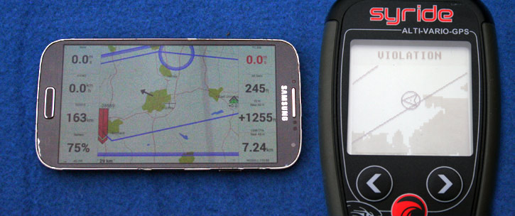
This setup works with many standalone flight instruments. Here the phone is kept in your pocket, and only pulled out if you really need it for complex long-range airspace interrogation or terrain mapping with topography (towns, valleys and rivers), which reduces the impact of the disadvantages (poor battery life, delicate, poor sensors). You might be able to get away without the extended battery case (113g). For most flying, you only need the basic info: groundspeed, nearest airspace lines-to-avoid and thermal info, visible on a flight instrument like the Syride SYS'Nav, which I've chosen due to weight, overall functionality and mapping ability with unique 'significant terrain' displayed.
UP:
+ good vario with customisable sensitivity and vario averager (1-20 sec)
+ Simple to operate
+ Frees up more screen space for XCsoar map (you can lose some info boxes)
+ Records a separate robust tracklog
+ Screen layout system well designed and easy to update
+ Riser position offers excellent visibility and clears flight deck
+ The SYS'Nav is rechargeable from the phone with an OTG adapter
DOWN:
- for complex mapping the phone will need to be used in addition
- hassle of liberating phone from pocket mid-air, then risk of delicate phone on flight deck, poor screen visibility etc.
- No thermal assistant (and XCsoar's one is using delayed phone sensors).
Alternative instruments: Many flight instruments now have the same reduced 'airspace-lines mapping'. Flymaster GPS SD and higher units add thermal core dot and a larger screen area. Flytec Track adds drag and drop file management but screen layout not as good (and presently does not offer some planned functionality, viz airspace). Aircotec XCTrainer Pro adds thermal visualisation. Digifly Air adds track and target visualisation.
IN A NUTSHELL: Flight instruments are designed for our sport and simplify your setup. The SYS'NAV is the most practical lightweight solution, great for general flying and bivi pilots. Add your phone for mapping when needed and you've got an affordable solution that covers most situations.
WEIGHT: 92g with riser mount
COST: £299
RUNTIME: 20 hours
Setup 4
Kobo
Instruments: modified Kobo running XCsoar (with extended battery and gps+vario, about £220, 260g) + Garmin (£30, 180g).
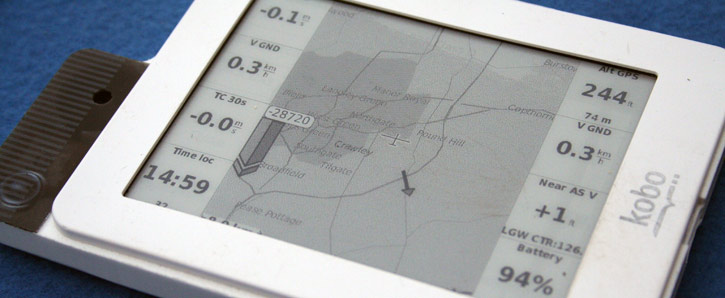
The Kobo was designed as an e-reader but some clever folk hacked the software and run XCsoar freeware on that platform. It can be a bit temperamental, depending on where you got your unit from and how the additional sensors were soldered into it. The Kobo screen area is similar to a smartphone, but it is easier to see (with some loss of detail). For useful airspace information, it must have the GPS and Vario units added. If your tracklog is important to you (or you want to take part in the UKXC League) it's not recommended as your sole instrument, but it could be used instead of the phone for your moving map with a cheap Garmin for bomb-proof tracklog. If you combine it with a standalone GPS flight instrument, you can have the benefit of a clear zoomed in map (on instrument) and overview map (on Kobo), but the combined price is nearing Setup 5.
UP:
+ easily visible, especially in sunlight
+ touch control is easy with gloves, info boxes easy to change inflight
+ improved vario over a phone (setup 1), more accurate pressure altitude and speeds
+ battery life very good
+ phone is safe
+ software update simple (drag and drop a file, either from http://www.xcsoar.org/download/ under 'kobo', or the modified release from retailer)
DOWN:
- greyscale e-ink not good for terrain display (eg. Alps) or dense info, display suffers from ghosting
- XCsoar only offers 30 second vario averager
- no screen lock (be careful on launch)
- quality varies depending on assembler, limited local technical support or warranty
- units are not as robust as flight instruments
- occasionally unstable (you might lose your tracklog)
- entering and moving turnpoints on the unit is complicated, needs a PC/phone interface
UK ONLY: XCsoar is not accepted by the UKXC League, so you'll need a Garmin tracklog as well (180g, from £30) or a standalone GPS flight instrument (see Setup 3). At a stretch you could run GPSDump on your phone: the battery life with the screen off is good, but this can be a faff (and unreliable), especially if you have multiple launch attempts.
IN A NUTSHELL: best used as a moving map, has limitations, backup unit recommended
WEIGHT: 440g (total solution)
COST: £250
RUNTIME: 30 hours
Setup 5
Oudie 3
Instruments: Naviter Oudie 3
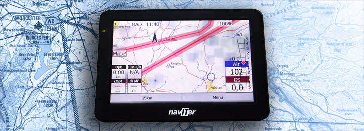
The Oudie 3 is one instrument that does everything. It is purpose-designed for XC pilots and competition flying, so it has features intended for paragliding and hang-gliding, and there are some exciting developments on the horizon. Because your phone is not needed for anything, it's safe in your pocket and using a standard battery (unless you're using the live tracking app). The instrument only weighs 345g, so for day-trips it's similar to other setups, but if you're doing self-supported trips/extended travelling, you'll need an external 250g battery reservoir for equal (20 hour) instrument life.
UP:
+ good, customisable vario
+ simple, visually superior sunlight-readable colour map
+ touch-to-make turnpoints, setting up tasks, competition features - top marks!
+ regularly updated, checks for new airspace files, developments ongoing based on pilot feedback
+ power saving livetracking via new phone app using Oudie3 sensors
+ fairly robust unit
+ screen lock prevents abuse during launch but still displays all info
DOWN:
- cost (although it's a fair price relative to other high-end instruments with this much functionality)
- limited battery life especially in cold (enough for one big XC)
- touch screen can be tricky, works better with stylus
- settings can seem complicated, takes some learning (but it does work out of the box, it's just when you try to modify things).
Bonus feature: C-records are defined as you set up your task on the device, giving you easy declared flight multipliers on UKXCL - you'll score more with this device.
IN A NUTSHELL: the most complete solution for competition and XC-league pilots
WEIGHT: 345g
COST: £585
RUNTIME: at least 10 hours
More info on the Naviter Oudie 3 >
Summary:
Decide on your priorities and address those. Do you want a beautiful moving map? Or is budget important? Instruments should be there to help your flying, not add complication. This is why I rate the Syride SYS'Nav highly (Setup 3). After testing all the setups, it has the fewest hassles for general flying. Its limited airspace display is adequate for local flying, and your phone can show larger-scale mapping occasionally. If you need maps a lot, go for the Oudie 3, which offers the best visual presentation of airspace and is a firm favourite with competition pilots. On the horizon: Flytec Connect 1 is in development, and a high-end instrument is planned on that foundation, promising airspace, feature and thermal mapping. Watch this space!
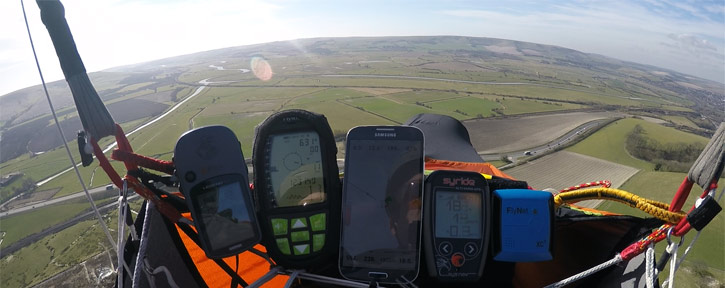
^ Test cluster. The most important part of this view is at the top.
