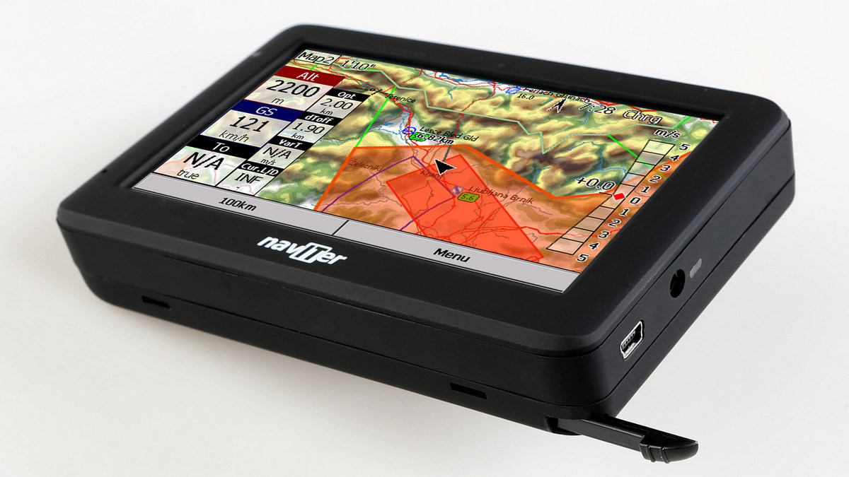
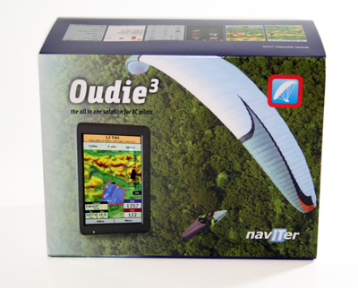
Naviter claim that the Oudie 3 is easy to use, requires no installation and works right out of the box. So for my first flights with it I did just that and, to my happy surprise, it worked just fine!
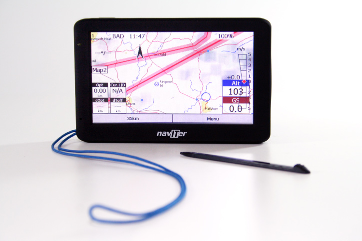
The Oudie 3 is a good size (135 x 86 x 25 mm) and not too heavy, only 345g. It has a 5" TFT LCD screen with 480 x 272 resolution and 16:9 aspect ratio.
Starting the Oudie 3 from full power off, with the software fully closed, takes about 40 seconds. There's no need to do this generally though as the instrument has a sleep mode which drains very little battery, from which the instrument and software are fully back up and running within seconds. Great!
The first thing that strikes you about the Oudie 3's screen when you turn it on is that it's VERY BRIGHT! Even in bright sunlight I found the screen relatively easy to read, one of the best full colour screens I've seen (possibly the best). Even compared to a Garmin GPSMAP 96C and a Samsung Galaxy Note 2 smartphone, I found the Oudie 3's screen is the best. The touch screen works well, even with flying gloves on.
The Oudie 3 is delivered with the latest version of Naviter's highly-rated SeeYou Mobile gliding software pre-installed. Naviter describe SeeYou Mobile as: "a complete and reliable in-flight navigation software for beginners and champions alike." and "a standalone application which helps glider pilots at all levels better understand soaring while it is happening." They also say that "SeeYou Mobile helped win World Championships numerous times already."
SeeYou Mobile features include Vector maps, Airspace warnings, Task planning, Optimization, Thermal Assistant, FAI Triangle Assistant and Multiple languages. SeeYou Mobile connects to the desktop version of SeeYou through a connection wizard so you can transfer Terrain maps, Waypoints, Tasks, Airspace and Settings through a graphical interface.
Vector maps for the whole world (topographical and ground elevation data, cities, rivers, lakes, roads, etc.) and airspace files for much of the world are also pre-installed on the Oudie 3. You just need to enable the ones you want e.g. UK. Fantastic!
The Oudie 3 is definitely a keeper for me - it's the closest thing to the perfect all-in-one freeflight instrument I've found to date! :)
I’m a minimalist. I’ve been running XCsoar on my phone for a season and have an old vario on my flight deck, because I couldn’t find a new instrument that did everything I wanted.
Once I had seen the benefits of ‘flight computer’ mapping for airspace navigation instead of zooming in and out of a small Garmin screen, I could never go back. Having a proper graphical overview really helps plan downwind.
But my phone needed extra power, so was connected to an external battery, and I couldn’t read the screen well so I had it in a sports arm band holder. The screen didn’t work reliably with my gloves on. And the phone still liked to go flat (or get damaged), so I had to fly with my Garmin strapped on a riser. Three instruments and a battery. I was frustrated.
The Oudie 3 is the answer. It does everything, in one unit: GPS, vario, flight computer. No fiddling required, it works out of the box.
OVERVIEW
Flight tests suggest that the vario responds faster than any other. It certainly seems that way when compared to my Brauniger Sonic (the most reactive vario I know of). With Filtering set to Very Fast, the Oudie 3 is fractionally faster at detecting climbs, with a much more pleasant (and customizable) tone.
If you just switch it on and fly, it will work perfectly and show you enough information. I found the operation easy, even with chunky winter gloves, except when doing fine data entry like changing sink alarm thresholds. You won’t need to touch it much when flying, except for the occasional stab at the screen to investigate airspace information, or to switch from your zoomed map/screen 1 to a gliding map/screen2. Setting up all the info boxes is best done on the ground, where you can use the stylus for accurate and fast control.
The range of information you can display is what I expected from a modern flight computer. Creating a task and adding waypoints to it was as easy as selecting named waypoints then choosing their settings. It will calculate the optimal route for you to fly, as well as display your current L/D (over last two minutes) and required L/D (compensating for wind drift, polar, and McCready). You can easily import waypoints created in SeeYou software by dropping the files in the main Oudie folder. Even the free XCplanner application supports the SeeYou format, and it took me less than 60 seconds to download some waypoints to the unit and define a task.
It records straight to the IGC format, approved by major online contests (including UKXC league). So after flying, there’s no messing around required with programs, you can just connect your Oudie3 to a PC via the USB cable, and upload your file. Naviter plans to offer an even easier upload process in future, via Bluetooth connection to your mobile phone.
The only thing missing from the unit is an airspeed indicator, which is planned for a future version (as well as some power management options).
LEARNING TO USE IT
If you test it on the ground, the vario appears unresponsive. This is because Naviter designed a silent zone to 0.4m/s while you are standing on launch. As soon as the unit detects the start of a flight, the vario begins to react to the smallest hint of lift. In the air it has a beautiful tone with a carefully designed fade in/fade out to help describe the character of the lift in an audible way.
If you personalise anything, you must tap Menu>Next>Save Settings before doing anything else. Otherwise the first time you connect the Oudie to a PC, or restart/power off, it goes back to factory settings. This procedure can be frustrating because it isn't what you expect, but once you’re accustomed to using it there’s no problem keeping it personalised.
You can customise it further by creating different profiles (nice if you’re biwingual). After going to Menu>Settings>Misc and Adding a Profile, you can set it up for another style of flying.
Adding and removing info boxes is at first a bit cumbersome. I would have expected a drag off-screen or an X to remove them, but you must have the map screen active then go Menu>Settings>Nav boxes to uncheck them. Most boxes can be slimmed down to display over 2 lines instead of 3, clearing some screen space for the map. Once you’re familiar with your display, it’s easy and fast to tweak, and you could minimise the info boxes even further.
PACKED WITH FEATURES
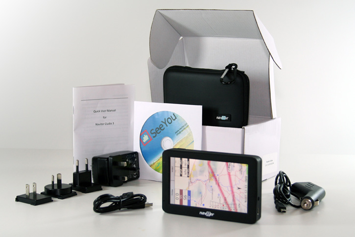
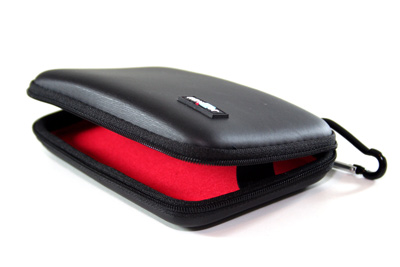
It has a sturdy integrated lanyard to secure it in flight; the rubber frame is easy to handle; it comes with a hard carry case to protect it; the charger comes with various travel adapters and the unit has a long battery life (12h30 in my tests).
An absolute winning feature for me was the airspace maps. For years I’ve flown in South Africa with only a paper map to guide me, because there is currently no OpenAir map for the main flying region around Cape Town. After copying the airspace file from the SeeYou folder to the Oudie3 unit, I had detailed accurate airspace info! Just like that. This suggests that the Naviter team are proactive and will remain a few steps ahead of the game.
IT KEEPS GETTING BETTER
There were some minor glitches which will doubtless be smoothed out, software development is ongoing. Usually it was something I did wrong, and the manual set me right. The team at Naviter were outstanding at providing technical support: when Carlo mentioned that the FAI triangle function did not cater for small triangles, they implemented the change within days. Likewise, I discovered a ‘low groundspeed blindspot’: Naviter promised to resolve it.
CONCLUSION
When I commended Andrej Kolar on Naviter’s clear and helpful support, he replied with a smile “It’s a strategic decision.” Indeed, this aspect makes it stand out head and shoulders above cheaper satnav/e-reader conversions. There are many variants emerging on the market that do part of the job, requiring external batteries, cables, DIY skills, or suffering from screen problems and requiring you to root around in the software, mostly without technical support or warranties. Naviter has six full-time staff members on the team, and they are really motivated to provide solutions that work in flight. They test the units themselves; development is ongoing. For the price you get a complete unit, all their research packed into one awesome flight computer.
On the other hand, the bright colour screen mapping capabilities and airspace display put it far ahead of the traditional GPS-altivario units, which look outdated when placed alongside on a flight deck. Maybe you’d like to keep them as a backup, but the Naviter Oudie 3 certainly wins the prime spot in my cockpit.
