Reports from Greg Hamerton and Ed Bewley, who set the pace for the Foot or Flybubble by blazing a massive hiking trail of marathon proportions...
5 July Greg (Beachy to H&O)
Report from Greg Hamerton: a great start from Beachy Head, but tragedy strikes on route to High & Over...
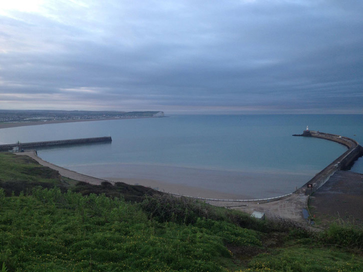
On a sunny day, there’s nothing better than lying in the grass on Beachy Head with some friends, waiting for the breeze to come in off the sea. The seagulls floated by, the tourists snapped photos ... then we were airborne!
.jpg)
Tracy and I shared half an hour of the most spectacular soaring in perfect SSE, over wispies, cliffs and a sparkling sea. Video brag to follow. I suppose I could have been racing off towards Newhaven, but the lift was just too good to leave. When the wind began to shift to the SSW, the clouds collapsed and the lift weakened. Time to go! Tracy decided for a safe toplanding. I glided along the cliffs, with weak lift yielding -0.3m/s on the vario and so extending my glide. There is no landing at high tide, except for the occasional dodgy landing channel on top behind the cliff edge, so I was glad I had judged the long glide of my Icepeak correctly and swooped over Birling Gap with just enough height to land safely amongst the curious cows.
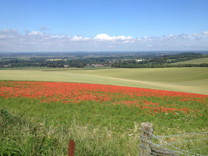
Right, the next turnpoint would be High and Over, in the hope of floating over the back to Bo Peep and Firle. I walked up the hill, and being bored with walking, started jogging. And that’s where the disaster began. A few locked gates and missed trails made my ground track a bit random, another reason why flying is faster. But it’s really scenic country, and I was enjoying the fresh air and sunshine, until I came across a particularly pretty field, and reached for my mobile phone to share the scene with you.
No phone. I knew I’d put it into the stretchy pocket on my hip-strap. My eager attack on the Foot or Flybubble course ground to a halt. Oh. Sh*t No! Fancy new smartphone, worth £200.
I looked at the sky. Really good cumulus, it should soon be popping off from High and Over (one hour ahead).
[dustdevil] Stuff the phone, you could be flying! If you turn around, you’ll lose the day.
[angel] No, it’s £200. If it takes me two hours to find it, that’s £100 an hour. That’s a good return, even for a paragliding instructor (oh, the heady salaries we command, the largesse, the luxury!)
[dustdevil] But you could come back for it later.
[angel] What, after walking till sunset? So you’ll find it in the dark?
[dustdevil] Maybe someone will pick it up, and you can call it later and they’ll return it.
[angel] Maybe someone will just pick it up.
I slowly turned around, cursing every step, threw my paraglider in a bush, and went mobile hunting. [angel] It might be somewhere close.
[dustdevil] not bloody likely
It’s interesting to note that when you walk back along the breadcrumbs of a GPS track, it can shift by 10m from the track you used. My search area went to 20m. Hello, the farmer, yes it’s me again. Hello dumb sheep. Hello stupid f**ing cows.
All the way back to Birling Gap. Of course my ‘smart’ phone had jumped ship just as soon as I started jogging. Lesson learned: everything goes in zip pockets. A 3km backtrack + 3km return I could have done without.
By the time I’d run back to my bag, and moved as fast as I could through the forest to High and Over, my legs were done for. Turnpoint bagged, darling wife with retrieve car duly praised, off to join the simple fun of paradangling with the Southern Hang Gliding Club members at Mount Caburn ... where we met Ed Bewley, who’d just beaten me by such a huge margin I thought he was pulling my (sore) leg. I’d covered just over 14km on the ground ... Ed had done about 45km (just over a marathon length) walking from Newhaven at dawn. If I’d known he was ahead of me when I was running in the forest, I would have run faster
[dustdevil] no ya wouldn’t ha, ya lying git.
[angel] you might have cried
[dustdevil] Ya woulda gone straight to the pub!
Route lessons learned: Beachy Head is a difficult flying start point. I think we had some of the nicest conditions we could have hoped for (sunny+light SSE) and we got good height (2000ft), but there was nothing we could do with it. Even if the tide was out and the wind had stayed SSE, the soaring run to Seaford, walk, then Newhaven to Brighton flight would still leave you with a massive unflyable course to complete. If you can fly from Beachy Head to the Cuckmere river mouth and move quickly to High and Over, you might just catch it in time to get up before the seabreeze hits. If you land at Birling Gap, it’s likely that the wind will blow through before you can get to High and Over. I think Beachy is best left for late in the day, after having flown there from Dyke/Truleigh. Or just walk away from it at dawn, to be at High and Over by 9 am.

But then Ed Bewley set the pace for the Foot or Flybubble by blazing a massive hiking trail of marathon proportions...
5 July Ed Bewley (Newhaven to Caburn)
Yesterday was a learning experience in many ways. The biggest lesson of all was that if you want to get a track log that will make your attempt count, you need to carry a GPS that records points when you are walking! The C-Pilot Pro does not do that. So next time it has to be the Garmin! (Lesson 1: know your equipment!) But it was a good walk, and I followed my original plan to its conclusion.
I intended to start at Newhaven at dawn, walk to Beachy Head, fly there if it was working; make some distance towards High & Over, walk on and fly from High & Over towards Bo Peep; walk the last bit and on to Firle; walk to Caburn and see how far I could get from there. I followed the Vanguard Way to Seaford, which is very overgrown, and soaked my legs with morning dew.
Arriving at the Cuckmere I decided to ford it near the sea rather than detour to Exceat bridge, and this was no problem except wet feet for a while. Next time a spare pair of socks will be carried.
At Beachy the wind was too light to soar and too early for thermic activity, so I decided to continue on foot to High & Over via East Dean and Friston forest.
At High & Over it was surprisingly strong and off to the south, but some flying had to be attempted and I spent a lumpy few minutes trying to get above the northern take-off with little success; packed up and headed for Bo Peep. Decided to cancel planned lunch in Alfriston and take the westerly route, which also meant not refilling my water bottle (not a good decision).
On familiar ground at Bo Peep, I enjoyed the trudge along the ridge to Firle and met some walkers who donated half their water to my Platypus (they were stopping in Alfriston, so my need was greater!).
The worst bit of the walk was downhill with complaining leg muscles into Firle village, where I stopped at Finn Kennedy's for a very welcome cup of tea, then on to Caburn, where I arrived after just over 11 hours' walking, just in time for the wind to die so that only a flop onto the west spur and an abortive attempt in the wake of Ghandi to sneak back round the corner to the car park were possible.
Up to the top to relaunch and down to find Greg and Tracy packing up. They very kindly transported me to the Trevor Arms for emergency rehydration with Harveys, then drove me to Newhaven to retrieve my car. Next time, more fly, less foot, but I enjoyed getting to know bits of Sussex that were previously disconnected for me and pushing myself to keep going to complete the planned route. Just a pity it won't count for the challenge :-(
More photos on http://on.fb.me/NMVmLT