Day One: Travel Day
For the full widescreen XPYRIENCE, download the PDF VERSION >
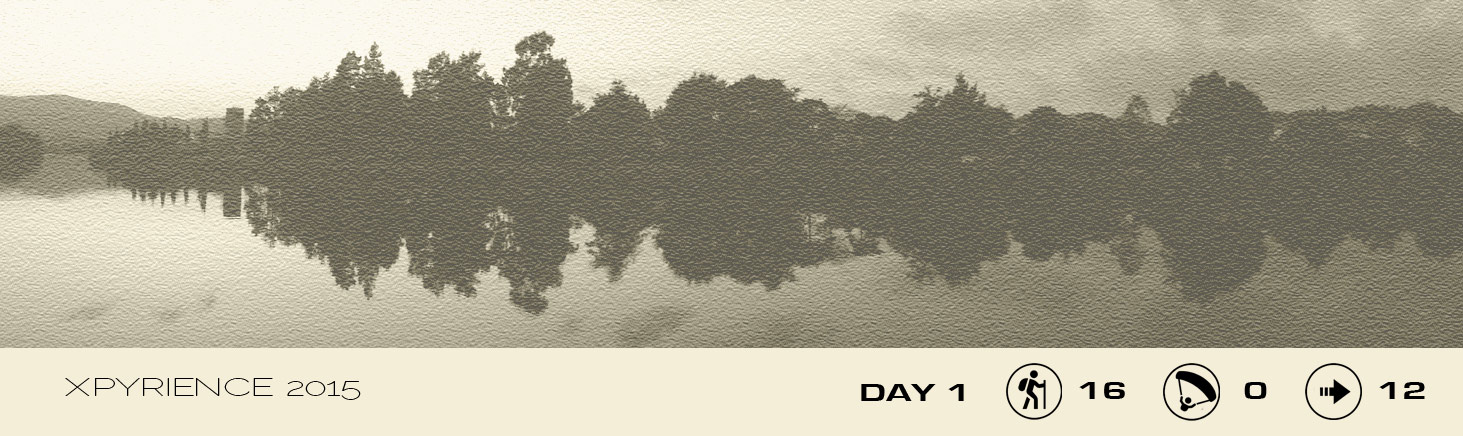
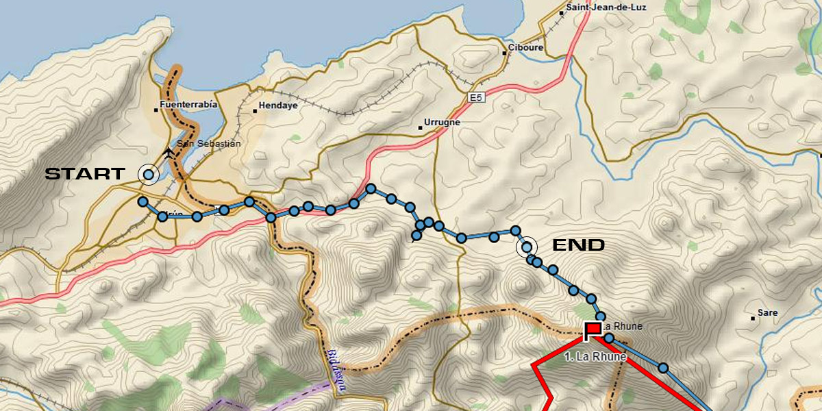
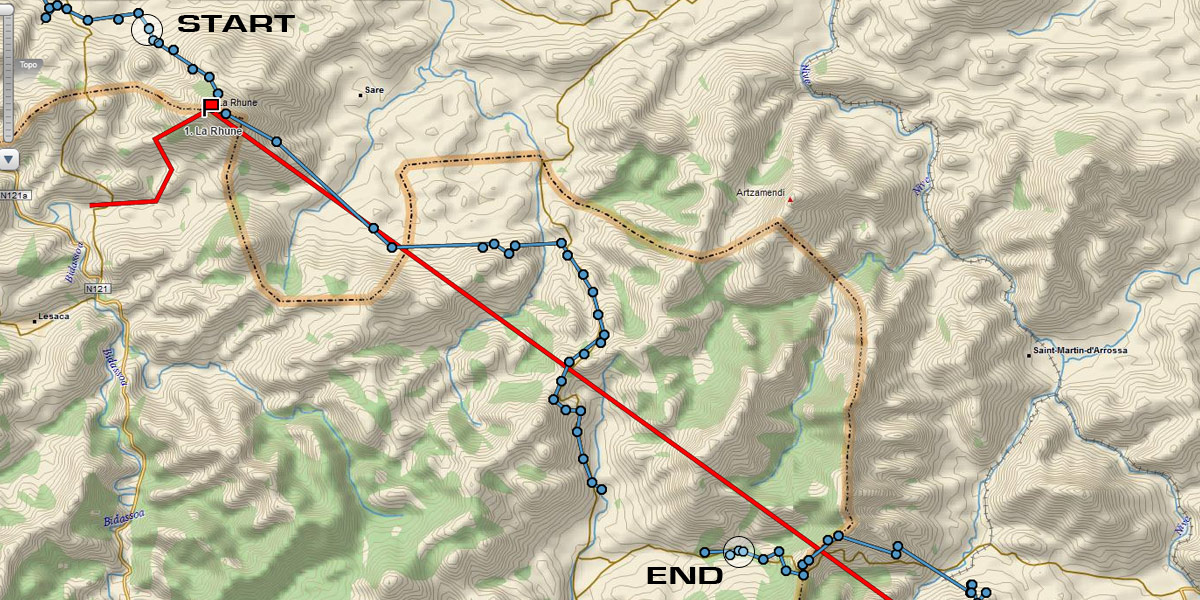
I was following the classic X-Pyr route that runs the length of the Pyrenees from coast to coast, so I flew in to Bilbao then took the obvious bus to San Sebastian. The next link to Hondarribia was a bit trickier to find but was shown on an ordinary bus shelter timetable. That's as far as I got. Without speaking any Spanish, I couldn't puzzle out how to find and book the minor bus that stops near the peak of La Rhune. The various ticket sales operators spoke no English, and nobody was willing to help. It was 9 pm and I had to start walking.
I grabbed a burger on the way and set off along the river. It's mostly an easy hike on a road through coastal farmland, but I was glad I'd brought my headtorch as darkness fell and walking on the minor tarred roads became more hazardous, particularly when the occasional car whizzed by. My toes rubbed uncomfortably in my shoes. They'd settle in, surely?
I'd dozed all day at airports and on planes, so I was happy to walk, but by 1am I'd put in almost 16 km and needed a break. I set up camp beside a stream and fell asleep at once, dreaming of flying off La Rhune in the morning.
So far things were roughly following the plan I had sketched out for my two year old daughter. We can cross off Saturday.
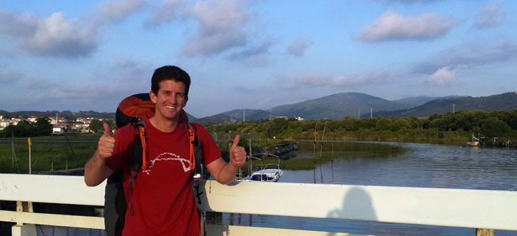
Day Two: Happy Fathers' Day
My toes were getting mashed by my tight shoes on the 2 hour ascent, but I discovered they were better without socks. I'll admit that taking bad shoes is a rookie mistake, but I really thought the Salomons fitted well enough. I usually hike with my Hanwag flying boots; I had wanted to test the difference with trail running shoes. With the heat and swelling from hours of walking, the 'minor discomfort' was now a major problem, but it was too late to fix.
Luckily, on top of La Rhune there was a Father's Day treat ... breakfast! It's never easy to anticipate where the next meal will come from, but I suppose the presence of a tourist railway to the top should have given me a clue there'd be a nice hikers' restaurant. I bought breakfast and lunch too so I was a full day ahead on rations.
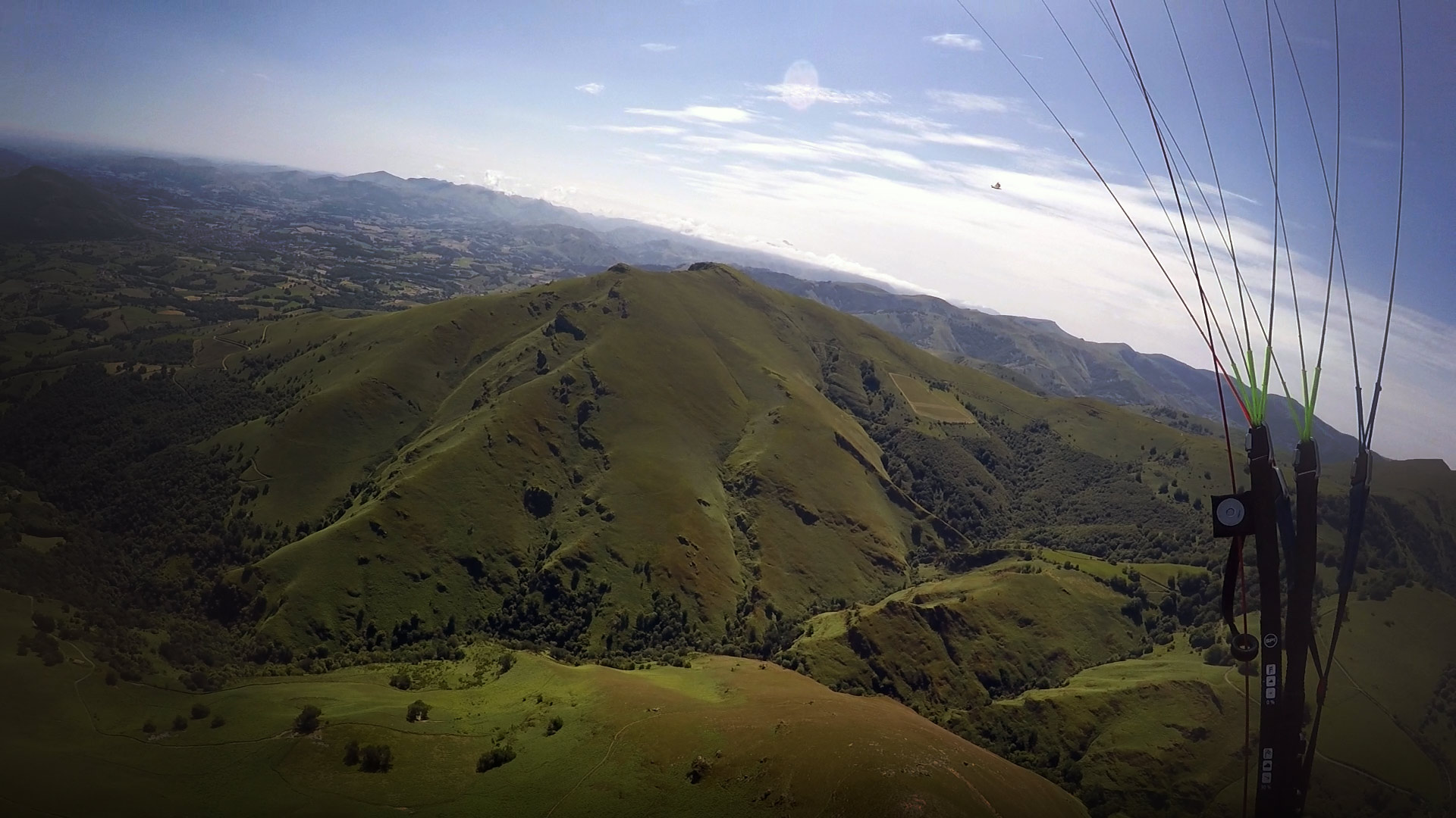
Although it was flyable at 9 am, I decided to wait for the clouds to rise above peak height. There were some big glides to pull off to avoid walking, and I wanted a chance to catch a few thermals. If I'd studied the airspace charts a bit more closely, I wouldn't have bothered.
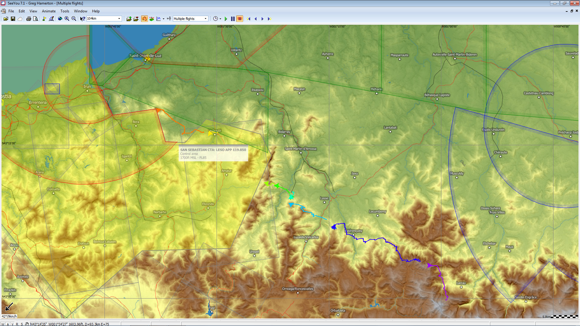
La Rhune sits right on the edge of San Sebastian CTA with a ceiling at 1700 ft. As the peak itself is at 2675 ft, and the hills I was aiming for were at 2300 ft, there was no room for freeflyers, for the first 20 km of the course. Although some pilots have a more relaxed attitude to airspace in Spain than I'm accustomed to in the UK, I prefer to avoid risking lives and messing up flying for locals by being 'that guy'.I expect that during the X-Pyr race they have some concession to go higher.
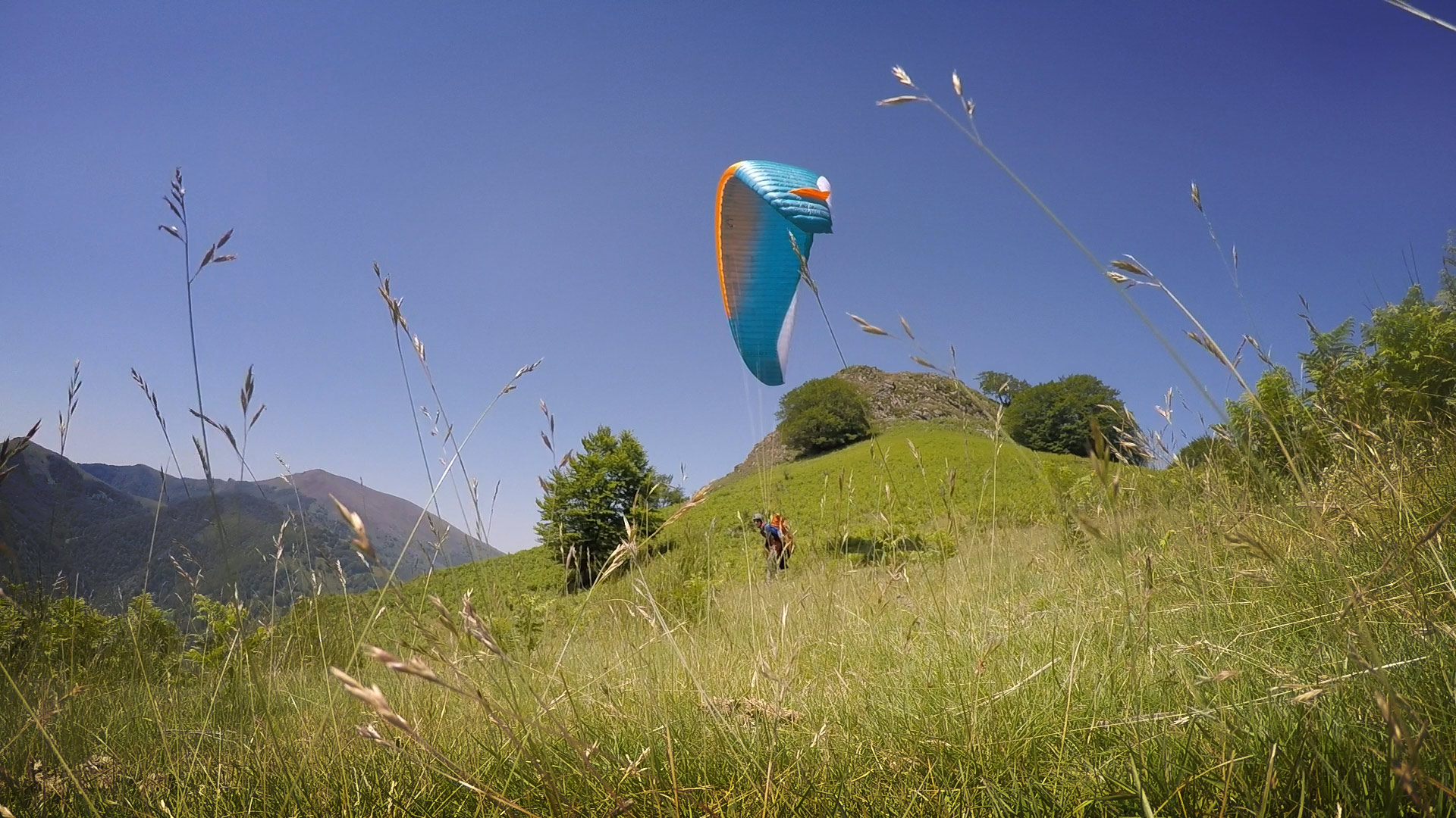
I had a short flight from La Rhune, sharing the thermals with vultures. It felt suitably spectacular. I couldn't go far because of the airspace and low coastal inversion, but I was flying! Near the hills I could see it was going to be very tricky to get high enough to have good landing options within the extensive forests.
After succumbing to the stable air, I relaunched off a hill full of miniature ponies so I could glide rather than walk up the pass. I landed near the bottom and walked all day anyway.
The tar road was boring but of an easy gradient, so I used it to go easy on my sore feet. If I came across a shoe shop I'd buy anything else and post the torture instruments back home, I joked with myself. Shoe shop. Yeah sure.
I planned to walk out of the frustrating airspace zone. 10 km further east it ended and there was a peak which might be flyable in Monday's forecast SW.
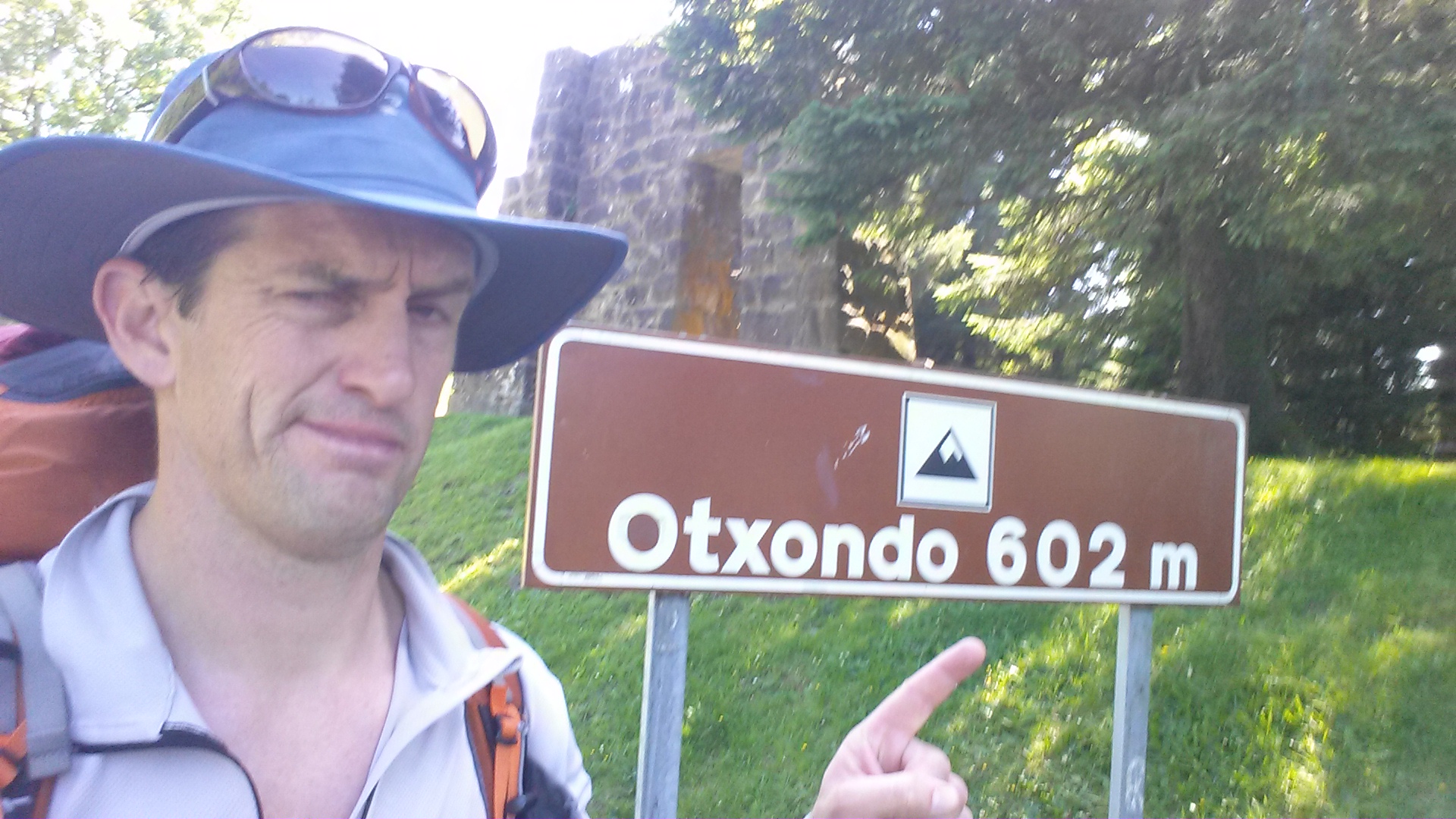
As the afternoon wore on, the sea breeze strengthened and poured over the ridge line I was hoping to relaunch from. It had taken a sweaty few hours to reach Otxondo - it seemed a lot higher than the meagre altitude suggested. I was going as hard as I could. Maybe it was the heat I wasn't accustomed to. The UK is probably not the best place to become acclimatised to the Spanish summer.
When your legs are tired and you've got a paraglider on your back, making the decision to walk down a pass is always agonising. I sat in the shade for a long while, and ate one of those 'highly nutritious' snack bars.
Time to consult the map. If I held onto my altitude, I'd have to wait until the first morning thermals, maybe 9 or 10 am. By then, I could have walked to ... another pass overlooking the St Jean Pied a Port valley. It was a much better prospect, and it was beyond the airspace.
The only snag was, it was another 18 km away, on the road.
Down I went, hot and grumpy. Little good my paraglider was doing me. I could have gone further if I'd strapped a turkey on my helmet. A frozen one.
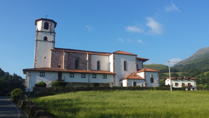
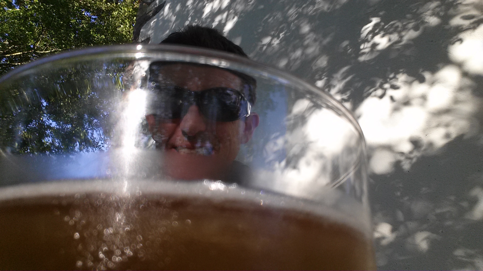
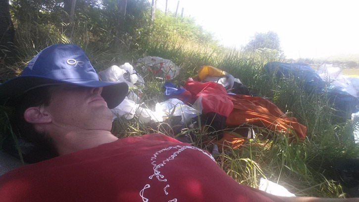
I was resigned to getting no good meal as it was Sunday - everything would be closed. Then I took a shortcut, turned the corner and stumbled upon this great little bar, with benches beside a thundering stream. The last rays of a cooling Spanish day flickered through the leaves. I ordered a tortilla, and a cerveza. Life became infinitely better.
It just goes to show, there's always something good waiting for you up ahead. You have to keep moving forward ... don't worry, be happy!
I wandered a short way into the evening, to nibble away at tomorrow's hike while I was still blessed by the good mood imparted to me by San Miguel.
Day Three: Get those boots on!
I awoke refreshed, after good sleep and wash at an idyllic riverside camp.
The tent was great. I set it up in the dark and had no bugs despite being beside a river in long grass .. which is why I have it. I like camping beside rivers. It also means you get a good wash and can rehydrate fully without trying to conserve the waterbag.
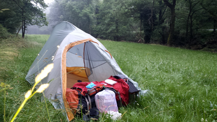
Keeping clean in a sustained bivi is impossible, but I like to try. I usually wash whatever I've been sweating in and hang it out overnight, then it goes on the back of my pack the next day.
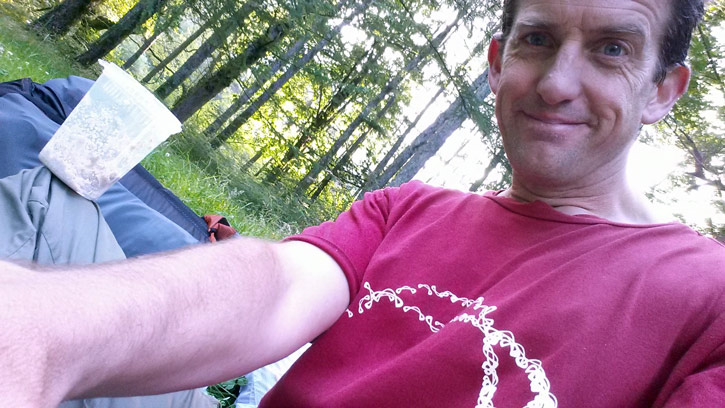
Nonetheless, when I tightened my belt after breakfast, a big black beetle crawled out of my underwear. I had embraced nature.
After a 6 km uphill march, I found a restaurant at the top of the pass. Things were looking up! It also had a shop. A shop with all sorts of things and right in the back corner ... a pair of hiking boots in size I-don't-care-they're-big.
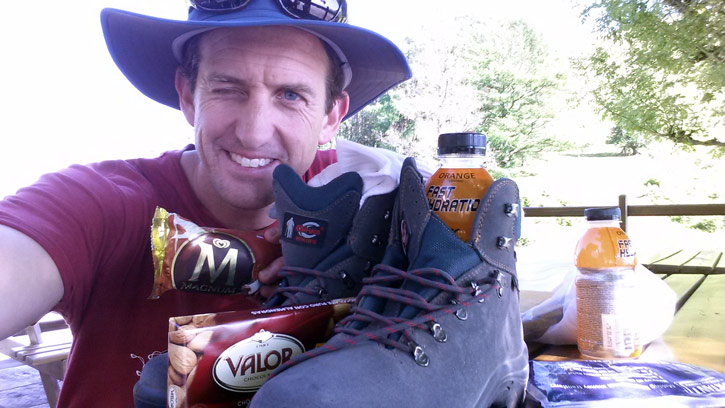
The joke was on me: I had my 740g Goretex Salomon shoes that cost £100 and I would carry them as deadweight for the remainder of the trip. They had been beaten by a €40 pair of the kind of boots your paragliding school wouldn't sell you, with lace hooks!
Bivi Pilot's Shopping List:
2 bottles isotonic drink
1 bar chocolate
1 icecream
2 apples
1 nectarine
1 banana
1 cheese and ham sandwich
1 pack socks
1 pair hiking boots
I tucked into second breakfast, and was flooded with enthusiasm (icecream) and love for the adventure (chocolate). It felt like I'd get high today (nectarine) and when I landed, I would be able to hike a long way (isotonic drink).
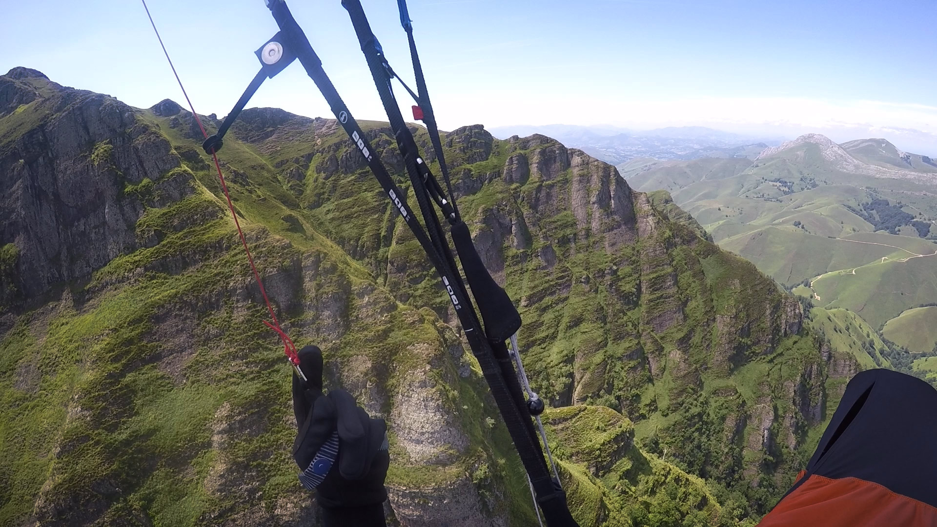
Although there was a light breeze on my back in the col I expected it would be largely sheltered from the seabreeze until at least mid-afternoon. By the low haze ahead I could see I was higher than the inversion in the next valley, so there was no big hurry. It was possible to launch from the carpark facing east, but only if I was feeling particularly brave and could ignore the tree choked ravines. Instead, I opted to try out my new boots and hiked half an hour north along the ridgetop.
A perfect grassy launch site awaited. Despite high hopes, the flying I experienced here was light leeside air that did not deliver. Even around the spur, pointing into the N wind, I could not climb, at 1 pm. I had expected more from air that theoretically had come down across French plains and not from the sea but perhaps there was too much entrainment and associated inversion. On another day, it could have been epic.
The vultures were mostly gliding around, fast. I tried the into-wind faces, failed to climb, crossed the valley to the foot of a good pyramid-shaped peak, and landed in a heap.
Friends would have noticed a distinct lack of activity on the live tracking. It bore no resemblance to any X-Pyr athlete ever seen in the region before. I decided to take on a Spanish custom: the siesta being the best thing since chocolate (had some of that before it melted) and sliced bread with bacon and cheese (had some of that too, before it turned on me).
I drank a lot of water too. It made me feel a little better about gliding like a thrown waterbag.
It was hot, and getting hotter. I knew I had to scale the peak I was on, but it looked big, and I felt small. I'd basically put in a full day of unrelenting effort to earn that flight, and it had amounted to nothing.
Eventually I summoned the will to walk up in the stinking heat. It was 28 degrees C in the shade but mid 30s as soon as I stepped out of it, and 80% humidity. Add to that a steep track with high hedges and you get a breathless hell. I thought I was carrying ample water but 2 litres got flattened fast.
So when I reached a big grassy slope half way up, with thermals caressing the trees, it was all too tempting to put the bag down. There were even vultures climbing out in light lift.
I launched and scratched for 10 minutes, then toplanded. What was going on? The whole valley should have been firing off. I should have been screaming up, hanging onto my risers. It had to be working...
I tried again. Nothing. Baa baa black sheep went the vario.
I tried out in the valley. Maybe it was out in front.
Sink. Three bags full.
So there I was, at the bottom of the hill again, with no water and a long walk to the very top. That had to be the plan, at worst I could glide down to a river. I should have walked all the way up the first time.
There are moments that can only be fixed by chocolate. That was one of them.
My little life lesson: Don't take the soft option if it's just effort you're trying to avoid. It must be a good option on its own merits it's not worth the risk.
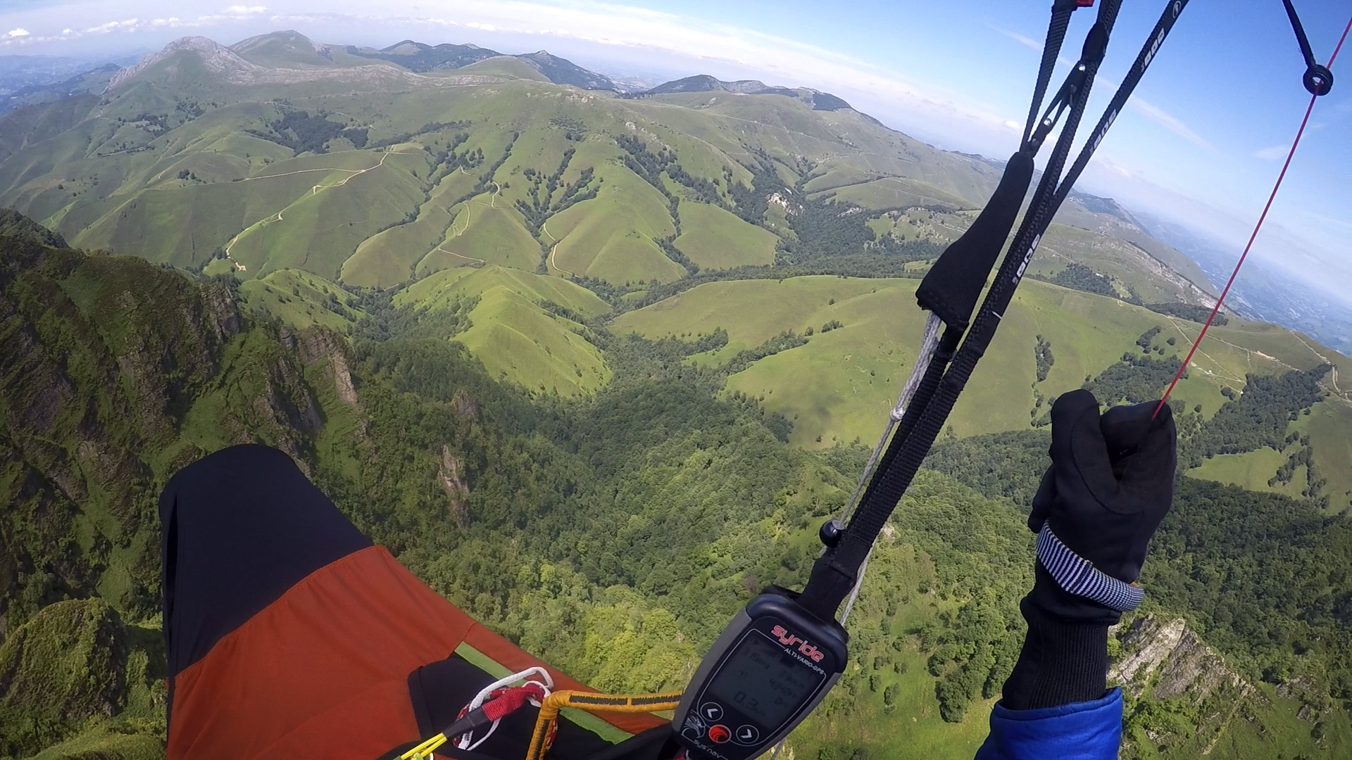
I knew I'd need more water this time, so I walked down without my pack and nicked 4 litres from the hose at the back of a farm house. Going uphill with a pack of over 20 kg in mid-afternoon was tough, but that was my closest flying option, and the day looked like it had some life left in it. 4 km of trails and 600 m ascent would be a minor foothill to most adventure racers, but as I ground my way up and poured out sweat for the amusement of the aggressive flies, I started to appreciate the difference between light racing gear and the full load required to be self-supported. That tent, almost a kilo of luxury: I didn't want it, but I knew I'd want it. If only the food bag could grow legs and walk itself up the hill. The phone batteries, almost half a kilo for days of mapping. Maybe a paper map next time? No matter how I turned the ideas over in my mind, I couldn't find a way to lose weight: I needed the things I had with me. Most of all, I needed the water.
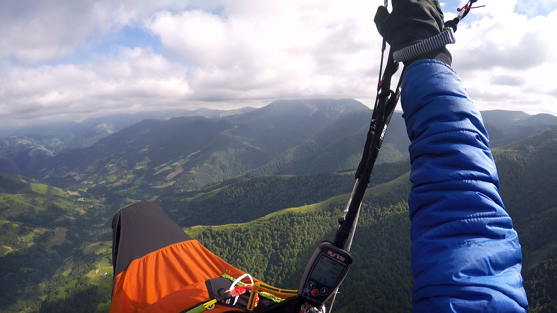
After a steep climb through a magical forest, finally, I was on top! The view was spectacular. But the day was done: there was zero wind and soon a wall of upper clouds rushed in from the west, blocking out all the sunshine.
I tried to think quickly, but I was tired.
Would the clouds stay until the next day? If it rained overnight I could be stuck on a peak in the cloud and have to walk down. I could fly down to the valley and walk or I could camp on the peak.
As I had the benefit of a data signal, I asked for some help from my Facebook friends and they scoured the internet for a forecast. It seemed there was no need to panic, it would be flyable in the morning.
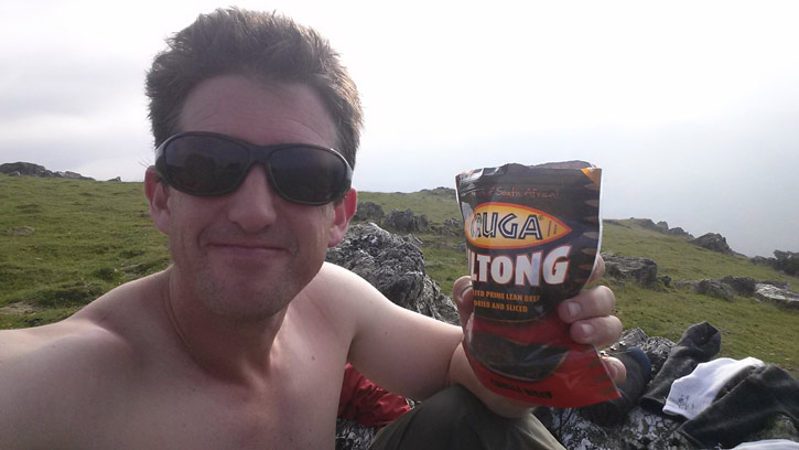
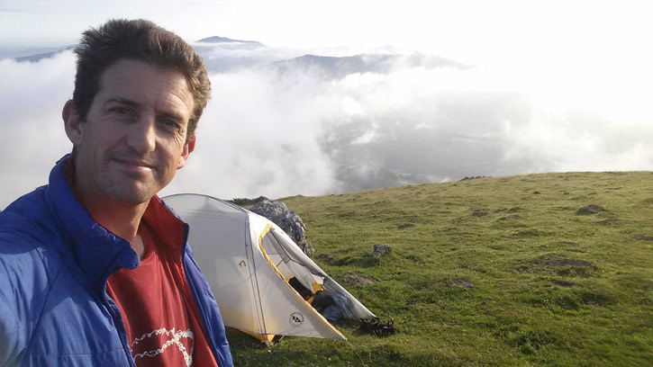
After hurrying around all day trying to get airborne, there was nothing I could do but wait. I treated myself to half an hour of music (battery power being a limited resource). I had a good wash, tucked into some biltong then set up the tent for a restful overnight on the peak.
Day Four: The vultures are soaring
The vultures are soaring. In any normal person's story, a sign of dread. But for me, joy!
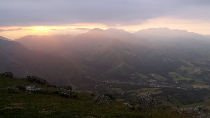
I had gambled on it being flyable by not gliding down to the valley for a morning of drudgery on the road. There was a lot of cloud overnight and it was misty at 8 but then the sun broke through and the birds began to swoop through the wisps.
I waited as long as I could bear, because I had some big transitions between ridges which could put me on the ground early. Cloudbase ahead (at end of valley) was below me and there were no decent cumulus clouds yet either.
Although my clothes were all washed and I smelt like a fairy (albeit the Hairy Scary Fairy) I regretted using my drinking water to do it as I only had my 500ml flying bottle remaining so I had to land near water that afternoon. In future I would only wash clothes at streams, I decided.
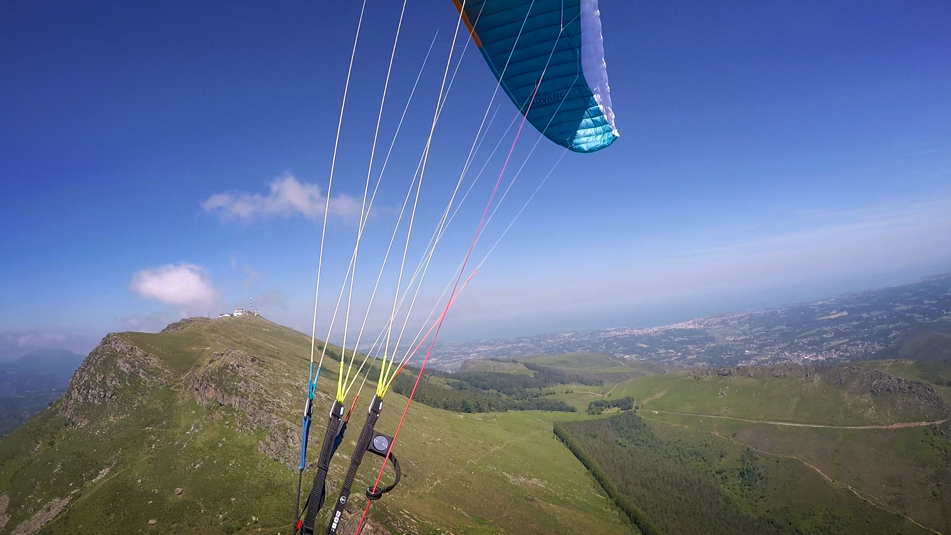
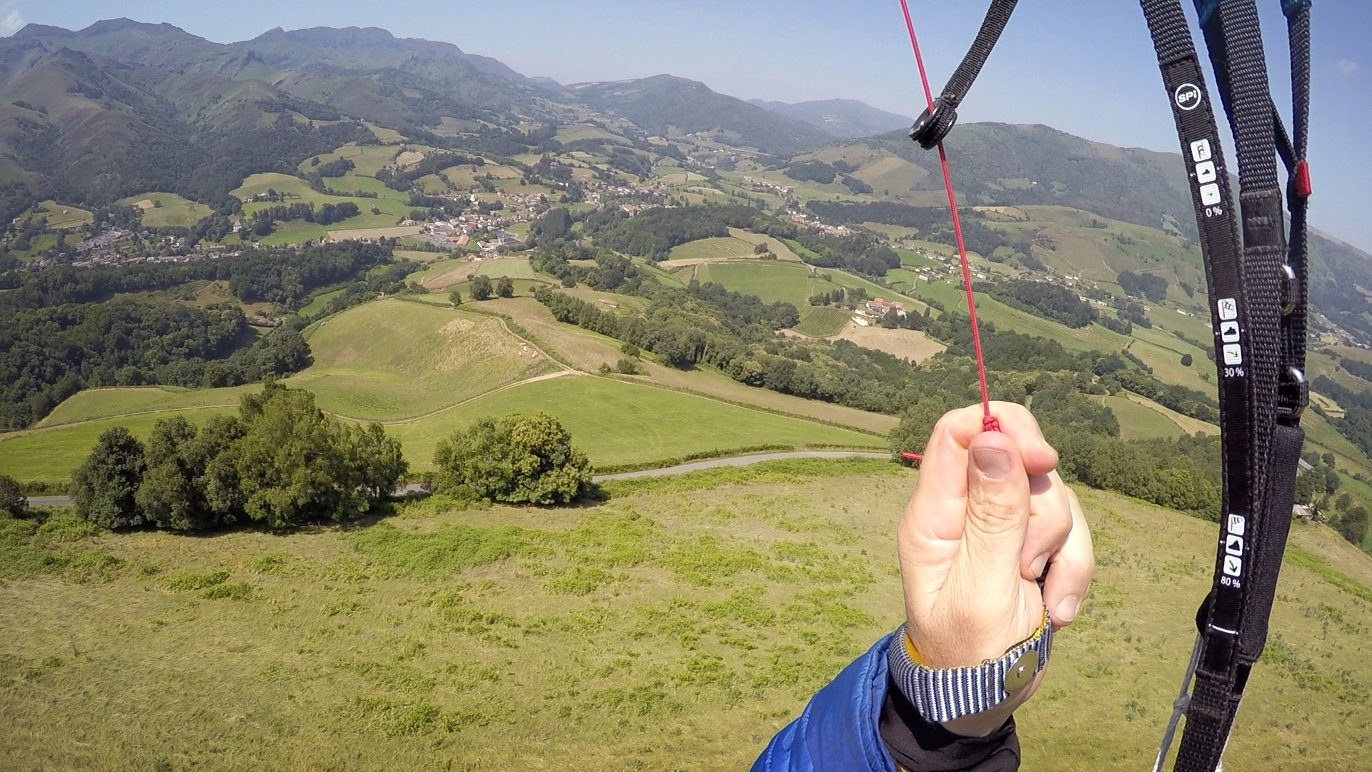
When the vultures were showing clear signs of thermals, I joined them and was rewarded with a climb and a commanding view of the route ahead. I felt liberated.
I made the first big crossing, climbed again slowly, and glided ... to the deck.
This time I knew I had to ignore gravity and the heat, and get up to the nearest hilltop, fast. It still took almost two hours to get airborne again, what with all the packing, hiking, and waiting for fickle thermic breezes.
As luck would have it, I almost bombed out again; I was low when I encountered a messy little 0.5m/s climb with a lot of drift. I didn't want to walk. I held onto it.
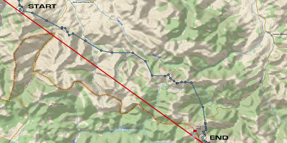
The mountains began to draw in air from the plains in earnest, and rather than lose the thermal, I went with the flow. It wasn't the ideal line to the pass over to Ohri, but I was able to reconnect with the front ridge after traversing the sheltered hills in the lee and building (just enough) altitude.
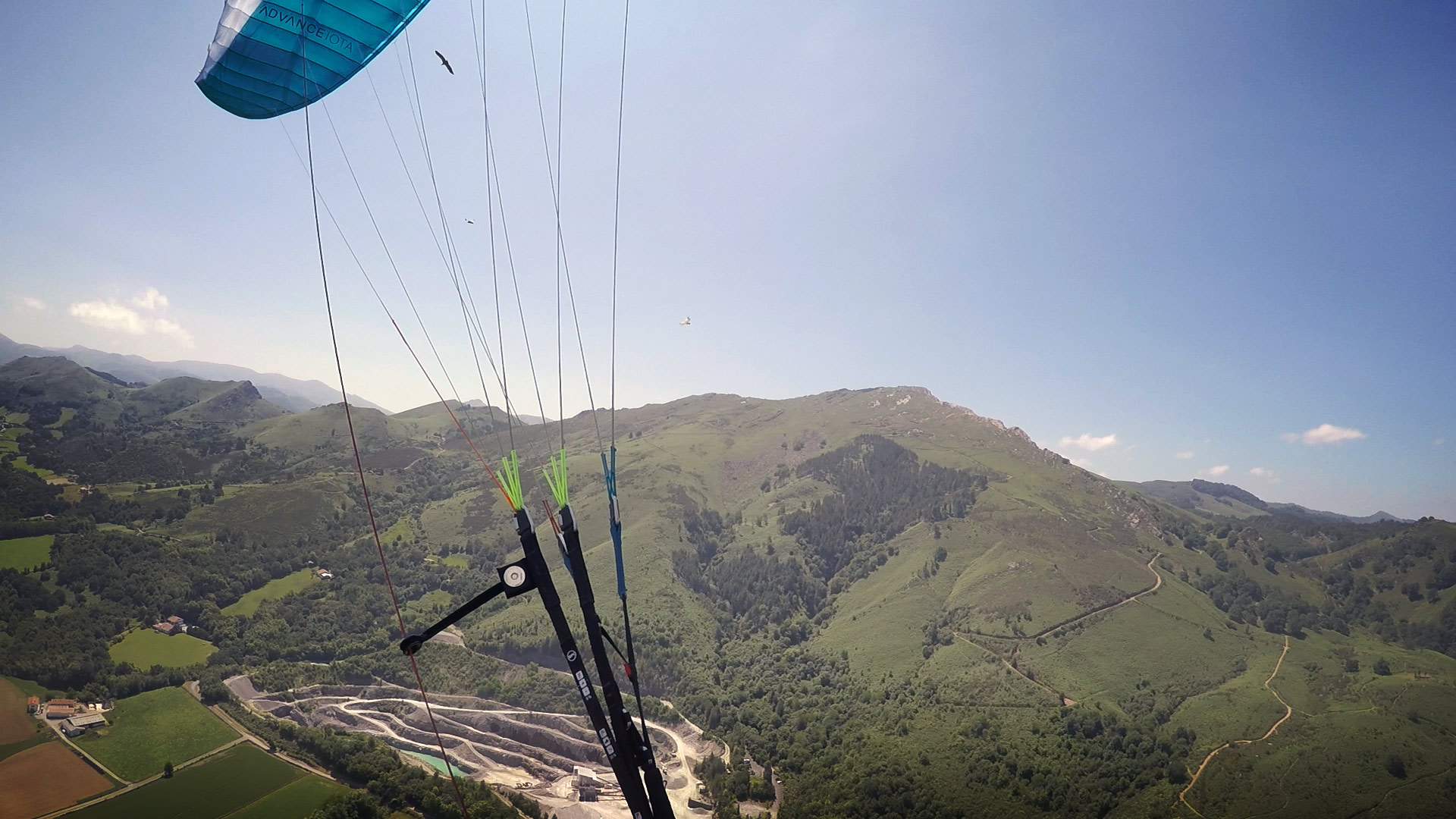
Stepping up the pass over to Larrau is tricky in anything but light wind because you're working up a narrow spine that merrily leads you into various unlandable treed ravines. I kept a beady eye on the strips of grass beside the winding pass. At the top of the pass, the rocÄ·y walls become very steep and serrated. The only sensible way is up.
Some vultures led me away from a doomed glide over to the plateau valley. Come this way, they said, look where we play. So I followed, into a spectacular bowl that became progressively more nerve-wracking. I really didn't want to go down there, it was awfully tight and steep.
Then my grounspeed slowed, and the clouds ahead were starting to look slightly orographic, as if some strong NE wind was pushing over the two ridge lines upwind of me. Then I started losing altitude and sank below the cliff tops ...
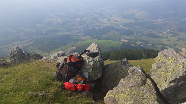
I retreated to my previous climb, then toplanded. I needed time see what the wind was doing. A short hike along the skyline would do no harm.
There is no such thing as a short hike for me. Landing always involves some kind of resting and recharging as I process the intensity of flying new terrain and come back to earth. I have a snack, a drink, and go through the laborious process of packing all the many elements of bivi kit into the correct comfortable shape. Then the mostly flat trail morphs into the real up and down workout that creatures on the ground must deal with. By the time I reached the launchsite the sky had mostly clouded over and the wind was weakening.
Luckily, there was still enough life left in the day to climb in some lazy turns and glide over to the Orhi pass where a little half-up made the difference between another sweaty pass ascent and a gleeful soaring over the trees watching trucks grind up in first gearbefore toplanding over the back in the mild rotor wash.
I was buzzing. I was beside Ohri, the second turnpoint, and I'd done it without much walking. Total hiking for the day: 6 km. I used my enthusiasm to put in another 3 km on the scenic road, trying to find water and a good campsite.
Brought to you by Flybubble

Want to see more? There’s no better way to support our efforts than buying from us. We’ll ensure you get great service! Choose from our great range AND enable us to produce more content to benefit the freeflight community.