We invite you to take part in the second Foot or Flybubble challenge! Using only your feet or your wing, link the selected launch sites in the closed circuit. Any day in May, June or July counts, between sunrise and sunset. The best attempt wins (longest then fastest around the course).
Using only your feet or your wing, link the selected launch sites in the closed circuit. Any day in May, June or July counts, between sunrise and sunset. The best attempt wins (longest then fastest around the course). So watch the weather and pick the best days.
It's a circular route: you may choose any start site and direction. Your GPS tracklog must show you within 200m (horizontally) of each turnpoint. You are aiming to return to your start point, which means the route is 64.8 km for everyone (in a straight line, as the paraglider flies).
And, new for this year, you can combine tracks from various days: your fastest legs will be used to give a total course track. So come back and add to your distance, or improve your time! However, this incurs a one hour penalty per extra day included in your tracklog (so if you complete the course using five different days, you have a 4 hour penalty).
A supporter may bring you sustenance if you want (or you can pop in to the pub), but you must carry your active GPS and all your flying gear all the time. No motors, wheels or transport allowed. Minimum required equipment: helmet, harness, glider.
Your distance on any unfinished leg is calculated by subtracting how far you are from the next turnpoint in sequence from the leg distance, so you may deviate from the course but distance flown away from the course line adds no extra score. If more than one pilot completes the course, the fastest time wins.
We’ll try to help you fly the whole course, but you may have to walk some of the sections to get to a suitable relaunch point. We will be arranging on-site guidance and briefings, so everyone can safely take part. It doesn't matter if your attempt is a drift from the Dyke, a float along the cliffs from Newhaven, or a glide out from Firle followed by a walk to the Trevor Arms and on to Mount Caburn. Any attempt counts.
There will be a range of awards, including prizes for the best video clip, image, or story, so get creative and tell your story.
Come to the launch event on Saturday 13 April where we'll present an exclusive cross country flying seminar while we feed our enthusiasm with good pizza.
It's a great opportunity to learn about the sites, to discuss the route choices, share tips, speculate and of course attempt your own inspiring flights and applaud your friends! All hang gliders and paragliders are welcome.
Info
How to enter
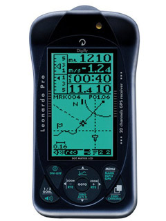
Scoring will be via our own Leonardo server thanks to Manolis from Livetrack24.com. Livetracking will be available for those with GPs-enabled smartphones or tracker devices. Otherwise use your normal GPS and upload your tracklog to xc.flybubble.co.uk.
Then try to capture the spirit of the challenge and post your story, image or video on the event page on facebook.
If you're not already a member of the SHGC, please join the club or make sure you pay your daily site fee. We can only accept entries from current BHPA licenced pilots following the usual flying rules. Club Pilots should buddy up with any rated Pilot on site to get a briefing and companionship on the route. You may fly any footlaunched glider you want. Yes, we welcome hangies; give it a try!
Even if you don't take part, you can learn a lot about the great SHGC sites, the personalities, the champions, the gliders and the ups-and-downs of cross country flying just by watching the event on facebook.
JOIN US on Facebook > FOOT OR FLYBUBBLE 2013
1 High & Over (50°47.464'N 0°8.532'E)
2 Bo Peep (50°49.226'N 0°7.712'E)
3 Firle (50°50.061'N 0°5.179'E)
4 Mount Caburn (50°51.686'N 0°3.049'E)
5 Ditchling (50°54.174'N 0°7.010'W)
6 Devil’s Dyke (50°53.132'N 0°12.746'W)
7 Truleigh (50°53.048'N 0°15.648'W)
8 Newhaven (50°46.926'N 0°3.002'E)
Leg distances
3.3km Truleigh - Dyke
7.0km Dyke - Ditchling
12.7km Ditchling - Caburn
3.9km Caburn - Firle
3.3km Firle - Bo Peep
3.4km Bo Peep - High and Over
6.6km High and Over - Newhaven
24.6km Newhaven - Truleigh
64.8km TOTAL by air (approx. 80km by foot)
Adding the route and waypoints to your flight instrument
The simplest way is to turn on your GPS, make sure it's recording a track, and visit each site - if you're on the launch site you are in the 200m radius. No programming required.
Important Note Regarding GPS Tracklogs: Most freeflight instruments are set up to only record flights, not walking. They automatically start to record a flight when you launch, then automatically stop recording once you land. This means you're GPS tracklog won't show any of the non-flying bits you do, so your efforts might not count for the Foot or Flybubble! You need to double-check whether your instrument(s) can be set to record the whole time, whether walking or flying. Most Garmin GPS' can be set to record continuously. You should also check that your GPS won't run out of tracklog points when recording for potentially 16 hours plus! At the end of the day it is up to the pilot to ensure that they have a valid tracklog.
How to download the route to your Garmin GPS
1. Download the GPX file from XCPLANNER
2. Switch on your Garmin GPS. Then connect it to your PC.
3. Open http://www.takitwithme.com/gpx.html and follow instructions.
4. On your Routes page on the GPS, find the new route, rename it to FoF-2012 and activate it.
Mac users: See section "Foot or Flybubble for Mac users" below.
How to add the waypoints to your Flymaster flight instrument
1. Download this wpt file and place it in a folder on your computer.
2. Download GpsDump from Stein Sorensen's website.
3. Run GPSDump and open the .wpt file. Connect your Flymaster flight instrument to your PC.
4. Choose the "Send to Flymaster (ID & Name)" option fro the "Wpts" menu.
Foot or Flybubble for Mac users
HOW TO DOWNLOAD THE ROUTE TO YOUR GARMIN (MAC).
Crispin Rose-Innes kindly gave us the following helpful tip for Mac users:
"Garmins have never easily synchronised with Apple Macs. However here's a way which works for us:
1. Download the old version of Firefox 10.0.2 from the web (search for "Firefox 10.0.2 download"). Once downloaded you'll be asked if you'd like to install the latest version - DON’T! You have to use Firefox 10.0.2 as later (or earlier) versions of Firefox don't support GiPSy Flight Manager, the Firefox add-on which talks to Garmin.
2. In Firefox 10.0.2, go to TOOLS in the header bar > WEB SEARCH and type "GiPSy Flight Manager". This should then automatically install and embed itself within Firefox below TOOLS, and appear as a selectable option.
3. Turn on your Garmin GPS and connect it to your Apple Mac computer.
4. Select GiYPsy FM from the menu in Firefox 10.0.2. Once GiPSy Flight Manager is launched it should recognise which Garmin GPS unit is running, and remember it for future use. You should now be able to upload routes with way points.
5. Open the route on XCPLANNER.
6. Click Download (right hand side) then Format>GPX.
7. Open http://www.takitwithme.com/gpx.html and follow instructions.
8. On the Routes page on your Garmin GPS, find the new route and activate it.
Easy! Not! Patience is required BUT it does work beautifully once you know how!"
Thanks Crispin!
Advice
To help you make the most of the fun!
To take a tour of the route
To take a tour of the route in Google Earth, and follow the suggested walking trails:
- Right-click and Save Link As to a folder on your computer: this KMZ file.
- Open it in Google Earth, select it in 'Places' panel and open the dropdown subsection called (by foot)
- Click 'Play Tour'. To increase the touring speed, go to Tools>Options>Touring>Speed.
This will help you to know where you're aiming for when landing, so you can shorten the distance to the next site. Most of the route is on bridlepaths or friendly farmlands. Have fun exploring the wonderful South Downs Way and surrounding countryside.
For more suggestions and route advice, browse through the Advice section for the 2012 event, and scroll through the 2012 event page on Facebook.
Southern Hang Gliding Club (SHGC) Flying Sites
Info regarding flying at Southern Hang Gliding Club (SHGC) sites can be found on the SHGC website, where there's a wealth of information including info for visiting pilots and an online siteguide.
We'll be running a Foot or Flybubble Launch Evening on Saturday 13 April 2013, which will be a great opportunity to learn about the SHGC sites and to find out how the Foot or Flybubble 2013 event will run.
GPS tracklogs
How to get your FoF track log off your GPS without breaking it:
- Switch on GPS, then connect USB cable to GPS, then connect to PC
- Open GPSDUMP (free download from http://www.gethome.no/stein.sorensen/body_gpsdump.htm Latest version)
- Click Garmin (USB) or whatever unit you use. If there are multiple track files for the day, select all of them
- In the data dump area, scroll down and left click once on the first data point you want (look at date and time)
- Scroll to the last data point of your continuous track log (hike and fly), SHIFT + left click to highlight the whole track.
- Select File>’Save in IGC format’ and fill in boxes. Add something memorable at the end of the file name, like ‘bewley-bopeep-footfly’
- Log in to your account on the scoring server (xc.flybubble.co.uk) and under Main Menu>Submit Flight!
- (Optional step for submitting FLIGHTS to other XC leagues:) In the data area (step 4), now isolate any flights you want to use for XC leagues. Your launches/landings are where your speed drops to zero. Save an IGC flight file (this is best for UKXC league/leonardo/xcontest) and for SHGC league, use KML format by clicking 'Save log' (top right button).
- Clear your track log on your GPS, ready for tomorrow.
Live Tracking
Livetracking for Foot and Flybubble
Thanks to Livetrack24, live tracking is available for the event! Livetracking is not necessary to take part in the competition, but if you want to play with it (and appal your friends/competitors) there are three options:
Use your smartphone: if it has a GPS, you can download the free Gaggle software from the Google Play store. This offers easy setting of the ‘flight’ filters to begin live tracking when you move only 1m forward, so the walking bit is included in the live track. The free alternative XCSoar unfortunately only offers live tracking during your flying time and no obvious way to change the flight filters. But beware! Using your GPS, data networks and livetracking on your phone will drain the battery in an hour or two, so unless you have an extra powerpack it’s not worth doing. Keep your Garmin GPS running as well.
Use a Flymaster LIVE: just set your start speed low so it begins tracking when you walk
Buy a live tracking unit from livetrack24.com which you switch on at the beginning of the day and just leave running. This is what is used in modern paragliding competitions. It has enough power to last 8 hours, which is probably enough, although if you’re going to march until sunset to complete the course in one day, it will go flat, so you’ll still need to keep your Garmin GPS running.
In all cases, you need to set up an account on livetrack24.com (simple, free). Then configure your unit to log into livetrack24.com with your username and password when it is tracking.
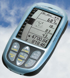
Or just use your GPS: no live tracking, but simply submit your flight at the end of the day. If you don’t have a GPS, use either XCSoar or Gaggle which will save an IGC file on your phone, which you can copy to your PC and upload to the scoring server. XCSoar still works for this, it records the entire track (including walking) it just won’t send out the live track information unless you’re flying. Note that GPS enabled flight instruments like the Flytec and Brauniger probably won't record walking sections at all, so keep your other GPS unit running.
Getting started
Even before the face starts, the Foot or fly course is officially open for practice!
We recommend testing out your equipment, uploading a tracklog and learning about the scoring system before 1 May. You’ll be amazed how different things are out on the course to when you’re sitting comfortably behind your PC. You think everything’s sorted, but ... [insert tale of woe here]
So here’s a very simple flight to kick things off. http://xc.flybubble.co.uk/flight/7
Yesterday was cold and grim at Bo Peep, and very windy. I launched and searched up and down the ridge to find the best lift, which finally presented itself somewhere near the carpark. This is a safe place to drift back, with landing options all the way along, and you get the added bonus of a curving ridge line that leads to ... High and Over!
The leg is timed from the last moment I was in the turnpoint cylinder at Bo Peep to the first moment I enter the one at High and Over. So I can dither about on the ridge for hours, it doesn’t matter, but if I’d been a bit more precise I would have clipped the cylinder just before setting off over the back. As it stands, my last trackpoint in cylinder is 12:11. I can see this by moving my mouse over the altitude trace in the flight stats, having checked ‘follow glider’.
If you’re worried about rotor and the sky falling on your head, I can assure you that the airflow is benign here. This is because the descent is very gradual on the lee side, and you’ll quickly be far enough downwind for any ridge turbulence to have dissipated. The wind was as strong as you’ll ever possibly fly at Bo Peep, and it was cold, so the potential for rotor was elevated, and I went over low at 100m/330ft. Yet I could safely soar along the back ridge, there were gulls and other birds milling about. It got a bit lumpy and too side-on near High and Over, making soaring close to the bushes a bad idea here. If you land short, the bridlepath runs along the ridge top.
So with just a bit of ridge lift I almost reached the edge of the turnpoint cylinder (200m short). I landed, felt relieved, got a bit more relieved, then faffed about folding and packing. Then walked the last 200m to close the leg. Anyone spot the tactical error?
Last year I had my packing time down to 7min. This year I am shocked to discover that it took me almost half an hour to get my sh*t sorted. Which doubled my time for the leg, to 59 min.
Top tip: if you’re within 500m of the turpoint when you land, bunch and walk straight away. It’s by far the fastest way to close the leg.
You can pack or eat lunch at the turnpoints, they are rest points this year! Your time for the next leg only begins as you leave the cylinder for the last time. But if you fly only part way of a leg then go home, you lose the achievement, you must close a leg to score it. It becomes too complicated for the scoring to stitch together wiggly tracks from multiple attempts.
Returning to Bo Peep, walking, it took me about 1h10 (assuming I’d taken the fork to the turnpoint instead of the cars). With a bit more pace I would have beaten the flier! Because the flier was being a birdbrain.
For an idea of how charming the Easter weather was, click on the Photos tab above the map. Add a few of your own when you submit a flight, we want to see the manic grin, and the mud!
So get out on the course, get some practice and post your attempts to xc.flybubble.co.uk.
Scorer’s Note: If I have to squint to work out if you’re in or out of sector, you’re out. Make sure you’re clearly in the circle for long enough to lay obvious track points. And I work in minutes, not seconds, as per the flight stats visible above.
The airspace violation warning is part of the scoring system. The turnpoints are defined as prohibited airspace cylinders. So you need to bust this airspace! It doesn’t show London TMA but the scorer knows where it is, so stay below 5500ft or you’ll be deleted. There’s some 4500ft airspace too, see http://bit.ly/UEdNul
The scores you see on the tracklogs page are based on the Leonardo system, not the special rules of the Foot or Flybubble. We will score each flight manually before posting them to the RESULTS page; you can disregard the classes and XC scores.
Phil Clark's FOF Top Tips
Tips from a not-shot, as cherry picked from last year's entries to the page feed.
Tip 1- my personal no1 top tip for attempting this is 'try not to dither - it's better if you can work out where you're going next before you get to the point where you need to make a choice'
Tip 2- You can also use Google Chrome for looking at the waypoints in Tom Payne's excellent Waypoint Planner on found on pgforum and then you can see exactly where the cylinders are. If you have windows8 you might be better with Google Chrome as your browser for this... Certainly much better for me! Although, after this year I'm changing 'Google Chrome' to 'Mozilla Firefox'!!!
Tip 3- for the Flymaster users (although this may work on others)
when you set the task in your gps device enter 2x laps of the course and repeat the turnpoints... this way when you clear (enter) a turn point en route the circle still remains drawn on your task map. This allows you to see if you are 'in' and able to rest or 'out' and against the clock. Also makes it easier for you to duck back in and 'reset the timer' after getting some height prior to attempting the run to the next one
Tip 4- don't forget the sunblock, it's been so long since I had to think about it I completely forgot yesterday (now I have a red and painful nose)
Tip 5- 'do or do not - there is no try' Master Yoda
you'll be amazed how far you can go when you don't care about getting back, just get some height and head for the next point on the list, it'll be fun, it'll be hard, you'll have a tale to tell and if it's one of the first or one of the best you'll remember forever, if you don't go then you'll never know and you'll always ask what might of been...
- Summary of Phil's FOF top tips:
1 indecision is as bad as walking - don't do it
2 sort your tech out, now!!! - get prepared
3 know your rest points and what's in or out
4 sunblock or hat - melanoma / carcanoma way worse than walking
5 have a crack at it - & don't forget to share your 'so, there I was...' tales of derring do
Prizes
It's an unforgettable adventure. The main reward is completing the challenge. In addition, there are lots of great prizes to acknowledge outstanding achievements.
Seriously Fun Trophy
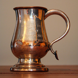
The winner of the event will be awarded this Rare Georgian 18th Century Baluster Form Silvered Copper Tankard. It has lots of stories to tell, just like you after completing the challenge! If you're brave enough, we'll even fill it with beer!
Champion Award
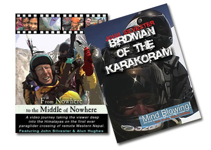
For any pilot who completes the circuit and links all the sites in one day. Prizes: The first ten to do so will win a 'mind-blowing' DVD from John Silvester! Everyone else will get a £10 Flybubble Gift Voucher*.
Finisher's Award
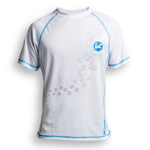
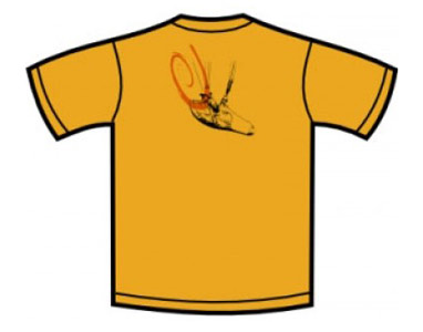
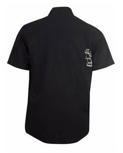
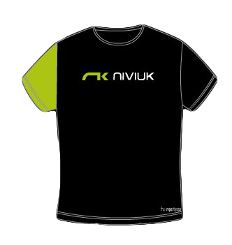
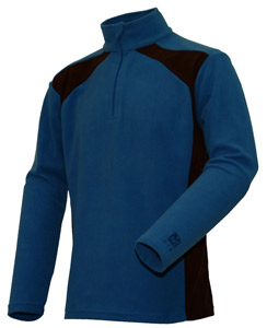
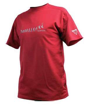
For any pilot who completes the circuit and links all the sites over more than one day. Prizes: The first fourteen to do so will win a choice of one T-shirt from the selection displayed, supplied by Kortel, Niviuk and Supair. Everyone else will get a £10 Flybubble Gift Voucher*.
10 km Award
We know it's a challenge: actually making it away from the hill. Even if it's just a short flight and a stroll on the south downs, 10km is an achievement you can be proud of. Prizes: a BIG round of applause! And a choice of one DVD from the selection of award winning adventure sports documentaries by the Fresh Air Crew.
Flight token
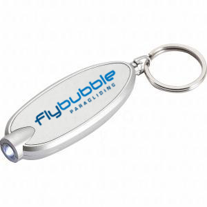
Your feet have to leave the ground, and you must close at least one leg on the course (turnpoint to turnpoint). You get the amazing Flybubble keyring with built in flashlight (to help you find the turnpoint in the dark, of course). Most people don't know this, but it can control the weather, send messages to the moon, and even hold your keys.
Category Prizes
The pilot who makes the best attempt (longest, then fastest around the course) will be the winner in each category.
NOVICE = Pilots who had not done a valid 10km XC flight, anywhere, before 1 May 2013
XCPILOT = Pilots who had not done a valid 100km XC flight, anywhere, before 1 May 2013
HOTSHOT = The remaining pilots, and any pilots flying non-kingposted hanggliders
Prizes for 1,2,3 position in each category, allocated from this fantastic prize pool:
Best media entries
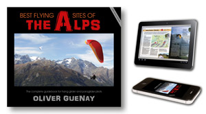
We're looking for the best image, story or video that captures the spirit of the challenge. Post them on the Foot or Flybubble page on Facebook. The winning entries will be chosen from the final cut by a pilot's poll. For each category (IMAGE, STORY, VIDEO) you will win a £10 Flybubble Gift Card and a copy of the Best Flying Sites of the Alps book.
Flytec feat
For a pilot who hasn't won a main category prize but really blows us away with an inspiring feat given their experience. If you've never flown xc, this might just be getting away from the hill. For dusty old skydogs, you'll have to work harder. The prize: a Flytec cap, T shirt and £20 Flybubble Gift Voucher.
Flybubble Gift Card
Flybubble Gift Cards can be used towards purchasing gear from Flybubble. They cannot be redeemed for cash and will be valid for 12 months from the date of the prize giving.
Flybubble crew (owners Carlo and Nancy, and staff members Greg and Simon) are not in the running for prizes but we will be competing for honour. :~)
Sponsors
Foot or Flybubble 2013 is proudly sponsored by

.jpg)

