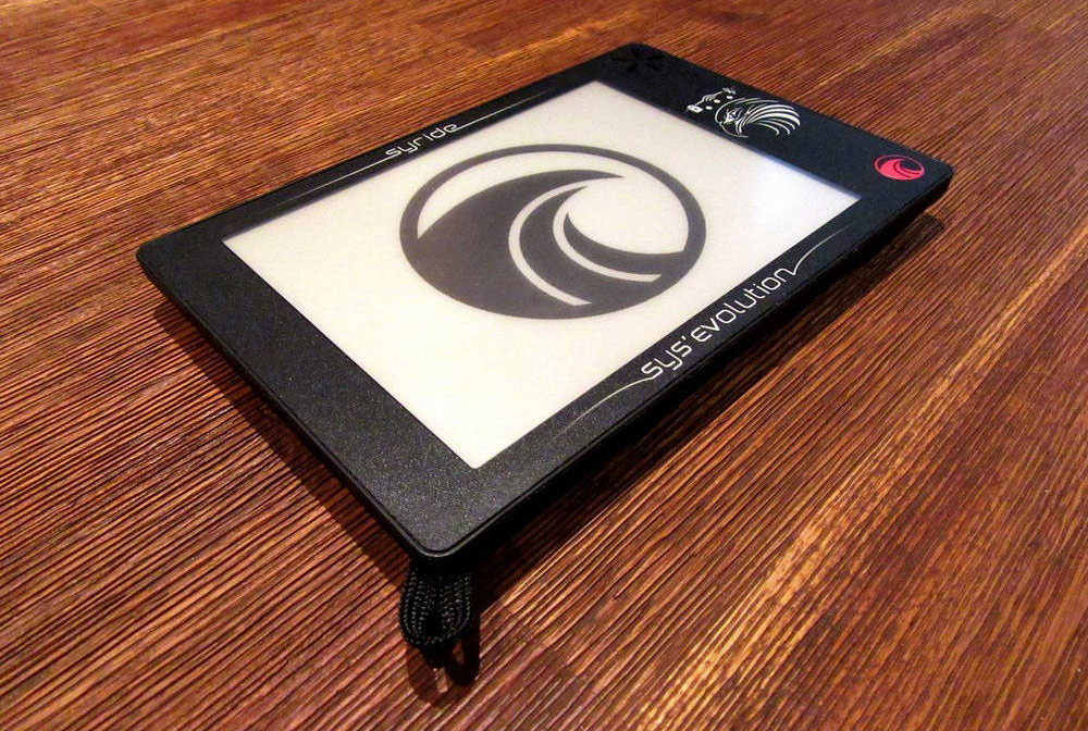
A technical review by Steve Uzochukwu
This ultralight instrument has three main functions: it's a vario/altimeter; a moving map display/navigational tool; and complete flight computer for competitions. The Syride SYS'Evolution was announced at St Hilaire in 2016, and was available to buy in early 2017, but with software in a mostly alpha state of readiness. Since then, the instrument has evolved via beta level releases to a finished product (a stable release in software terms). If you looked at this instrument more than 3 months ago then you'll need to look again as there have been big changes, including a world first: a combined 3D airspace and terrain map.
SYS’Evolution: Wide screen e-ink
Dedicated ‘all in one’ paragliding instruments have been around for a while now. Most of them use high contrast black and white (greyscale) LCD displays which are easy to read in strong sunlight, or they use colour LCDs, which are harder to read but higher resolution. With the advent of e-readers, e-ink was introduced, which produces a black and white display with levels of grey in between. The display is very much like paper, and gets easier to read the more strongly it's illuminated. This in marked contrast to colour LCD, especially when backlit, which is harder to read the more incident light there is, and also requires more backlight to display in strong daylight, thus dramatically increasing power use. E-ink ‘always on’ displays only use power when their contents are changed, and can retain a static screen for a long time.
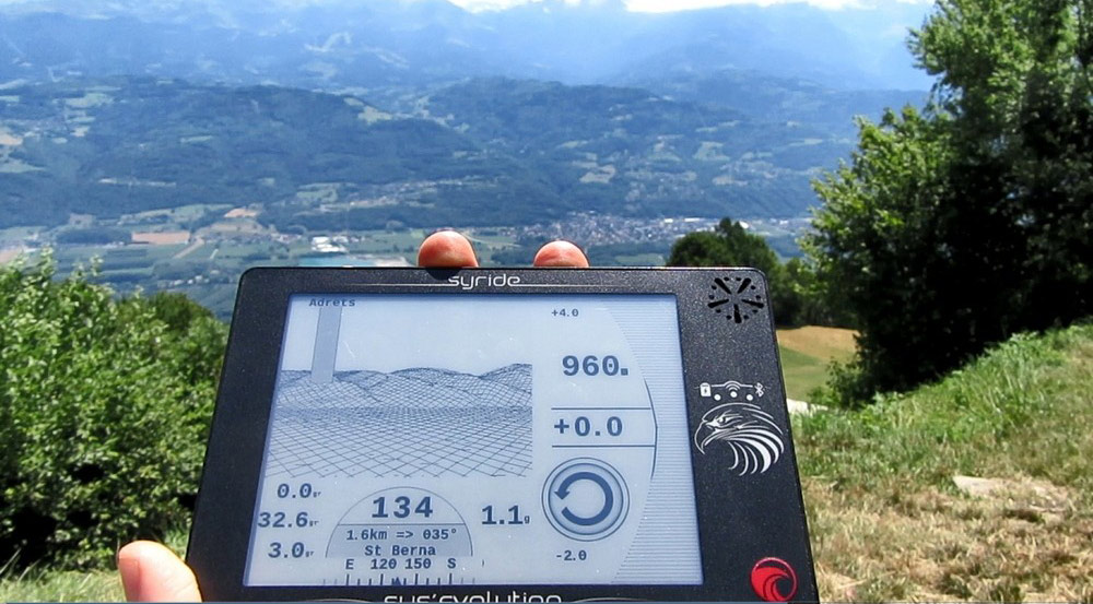
The downside of such displays is that they do not support the high refresh rates the other types of screen do, and can suffer from ghosting and some image retention or ‘stickiness’. A number of attempts have been made in the past to make e-ink display based instruments for paragliding, some commercial, some DIY. They have met with varying degrees of success. The Syride SYS'Evolution, with a large e-ink display measuring 90mm x 123mm, offers a display with excellent sunlight readability. Beside the screen are a speaker for the vario, power/Wi-Fi/Bluetooth indicator lights and a power switch on the right hand side of the device.
SYS’Evolution: What do you want to see?
The SYS'Evo has three different screen pages out of the box, and the change between them is done by a swipe action with a finger. The instrument comes with 3 screens already set up, and there is also the option to build your own with an on-line tool (http://www.syride.com//en/ssctool/Evolution) or to modify the standard set up. (You can have up to ten screens, and those screens are built by selecting widgets in the SSC tool.)
When you have finished making up your set of screens, SSC tool gives you a file to download to your PC which you then upload to the SYS'Evo. This means you can make as many files as you want, but you can only have one set up in the device itself. The tool gives you such a good representation of the screen (it's WYSIWYG) whilst you are building the file that there will be no surprises after your upload.
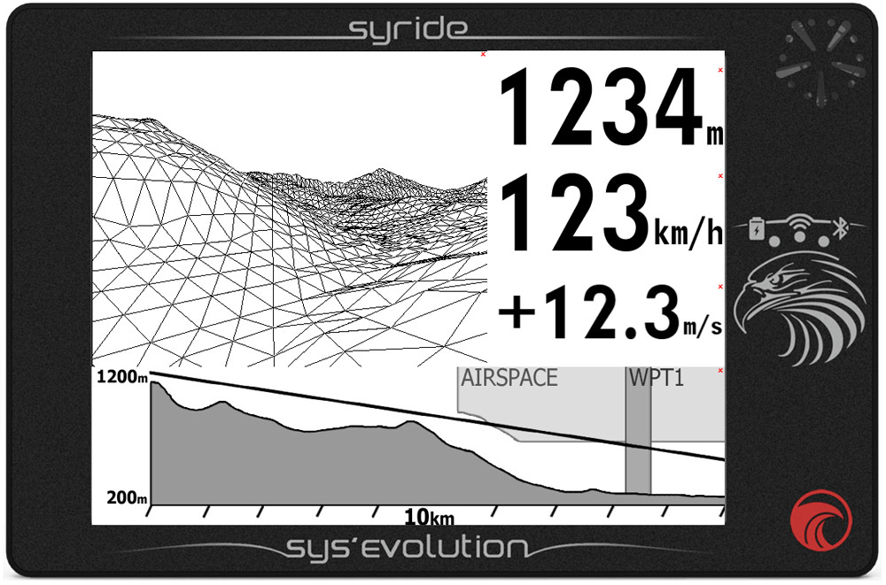
The first screen you see when the instrument powers up has a wire frame 3D model of the landscape and airspace top left hand side, and the transition tool, which is a vertical cross-section of the airspace at the bottom of the screen. Waypoints from tasks will be shown in both these displays. Height, speed and climb rate appear as numbers in a box on the right hand side. However, this and everything in the next three screens can be altered.
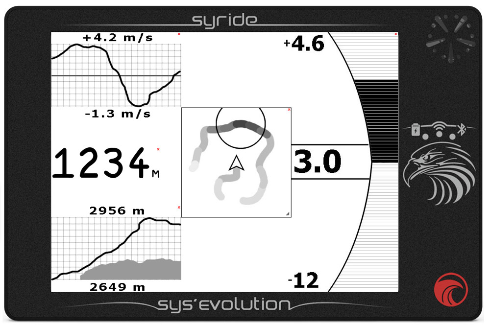
Numbers in boxes, vario climb and sink as gauges, maps of the terrain with airspace viewed from above and a vertical section through turnpoints and airspace can all be selected and placed on the screen in scalable boxes or in different sizes of fonts. You can even make the 2D map showing basemap, terrain and airspace full screen size, which is particularly effective on the SYS'Evolution's large e-ink screen.
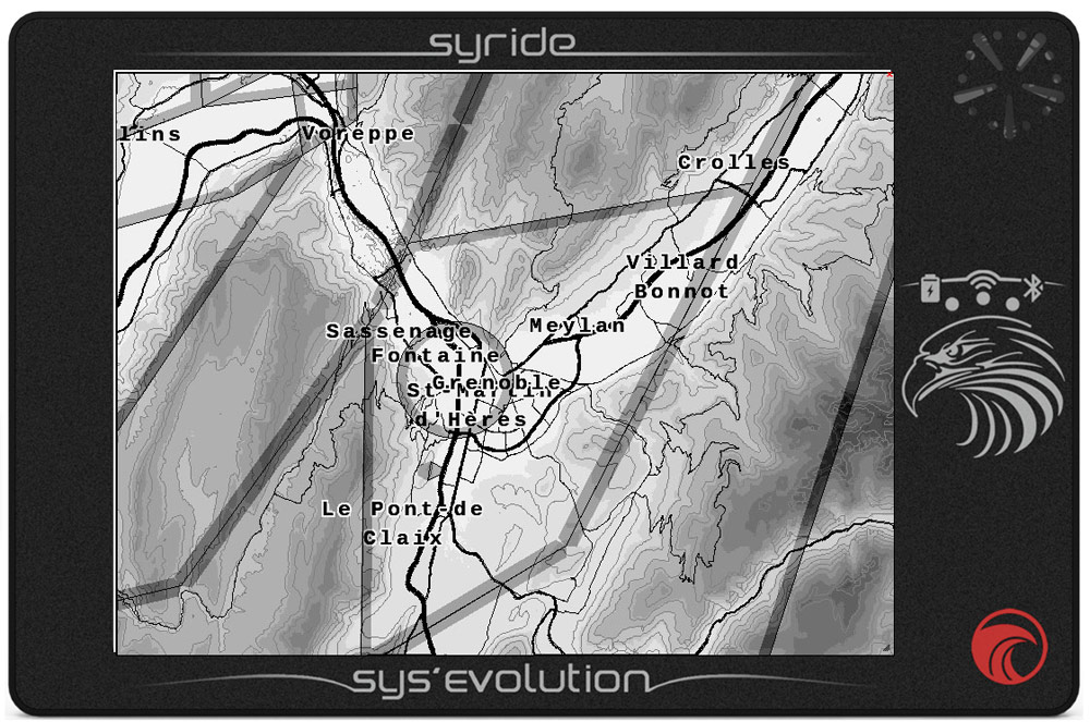
After the third screen there are a number of blank screens which can be configured, but won't appear in the cycle of screens until they have populated by the configuration SYS PC Tool on a computer. There is also a weather screen, which gives you local weather when the instrument is off, as well as showing local time and battery state. As e-ink screens only take power when refreshed, and the screen is refreshed once a minute (minute hand on the clock) power drain is minimal.
SYS’Evolution: How do you set it?
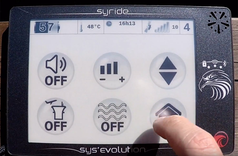
Basic settings for the device itself, audible warnings and navigation can be pulled up by swiping up vertically from the bottom of the and then individually chosen by touching on the relevant symbol. Basic information for the device like battery level, number of GPS satellites locked to, local time, temperature and which screen of the five you are on can be seen with a vertical swipe down from the top of the screen. The screen works with gloves, and was adjusted for slightly better touch sensitivity towards the end of 2017. I've tested cloth and leather gloves and as claimed by the manufacturer, the screen responds well.
SYS’Evolution: Vario and altimeters
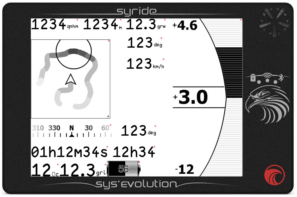
The vario has the usual thresholds for audio tones on up and down, and a third tone for a “close to a thermal” alert, also with its own adjustable levels. The volume of the vario sound has four discrete levels, and can be heard via an earphone if desired, as the instrument has an earphone jack. Damping can also be set.
The more advanced parameters can only be set from within the configuration tool which runs on a PC, but all platforms are covered, with a configuration tool available for Mac, Windows PC and Linux. The default settings for the vario are very good, and this is therefore an instrument where you can just turn it on and fly. However, the more technical might choose to change the way the vario tone modulates as the climb rate increases, and this can be done from the PC configuration tool with a number of other settings like thresholds and damping.
There are three altitude values, GPS, QNH & QNE. QNE is incorrectly named, and is your pressure altitude with sea level assumed to be 1013.25 HPa for flight level based airspace above the transition level, and QNH is your height above sea level. QNH is not manually set, but is referenced from the GPS altitude once the instrument is able to obtain a lock that gives the accuracy as better than 5 metres. Accuracy is very high, as at least 3 separate satellite systems (GPS, GLONASS. Galileo) are available and are used. There is no setting for a height above take off, or what general aviation calls QFE, although the instrument will log the height you take off at and give you a height difference figure. The height above sea level is very quickly set automatically. At switch on time a GPS booster engages to ensure lock happens quickly and accurately. Altitudes can be displayed in metres and feet simultaneously, as can distances and ascent rates. You can also choose if the altitude displayed is a pressure or GPS one.
SYS’Evolution: Wifi and Bluetooth
The SYS'Evo has WiFi built in, to allow you to upload your flights to your Syride account and to install firmware updates over a wireless network. When it is not in use, the manual recommends you turn it off if you need the maximum battery life. Once connected wirelessly the instrument will tell you about any updates available. Updates are not yet 100% reliable over wireless yet and the update itself may need to be done over the USB connection to the PC. The Bluetooth menu is unfinished and apart of from interaction with a phone (SMS reading, for example) it's unclear what else might be on offer from this menu.
SYS’Evolution: What’s it like in the air?
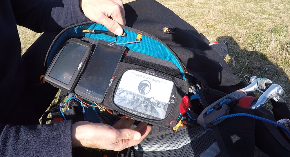
I flew with the SYS'Evo mounted on a flight deck, held in place by its own neoprene case. It has an easy to use lanyard as does the neoprene case. To protect the screen it was easy to take the instrument out of the case, turn it over then replace it in the case and store it that way.
Holding the red Syride symbol button down for three seconds, the screen comes on, the instrument self checks, then the GPS Booster legend is displayed whilst the instrument acquires a location.
I customised the screens after a couple of day's flying as I didn't really gel with the wire framed 3D terrain representation, preferring a 2D airspace map, a vario display pinned to the right hand side of the screen and some fields with my altitude and ground speed. Since then the 3D airspace representation has been added, which makes this part of the display much more attractive. I also added some task parameters.
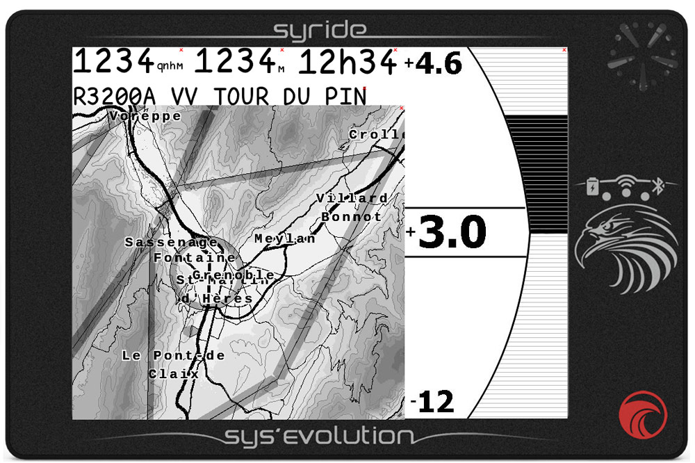
The second screen became the thermal map with more or less the same numbers as the previous one. This is easy to do and my first screen configuration session was over after about 20 minutes, the layouts uploaded and tested straight afterwards. There's a default layout to go back to if you're not happy.
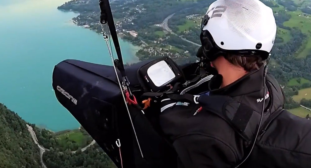
In the air the two things that stick out most are the vario audio - it can be made quite loud, and the e-ink screen, which just gets easier to read as the sun gets brighter. Your main interaction with the instrument will be the swipe to the left to change screens, although if flying XC rather than in a competition I think I'd be OK with just one or two screens. Airspace warnings are easy to read and pop up as soon as you hit the proximity you set. You get a warning until you exit the airspace and the proximity area. Screens are drawn quickly when changed but not at the same speed as an LCD. It pays to have the screens configured how you want them and to invest time in this on the ground, as they can only be changed whilst at a PC.
SYS’Evolution: Competition functions
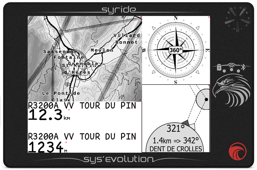
The competition flight computer allows you to build tasks, and you can set all the flavours of cylinder around waypoint, as well as In/Out cylinders for starts and global lines or cylinders. It's in the navigation menu that you create, edit and delete waypoints, and the same goes for tasks, with the additional aspect of activating them. The waypoints menu is very basic. Any waypoint created on the instrument will require manual input of Lat/Long.
Unfortunately deleting waypoints is only possible one by one, there is no way for selecting a number. Managing waypoints using SYS PC Tool is also quite basic, there is no easy way to remove large numbers of waypoints. SYS PC Tool can't present you with a list of loaded waypoints either, nor offer bulk deletion of them unless you upload other waypoints. Uploading a new waypoint file, even one with just one waypoint over-writes all the previously loaded ones. However, the latest version of GPSDump will now manage waypoints in the device or convert them prior to upload. Direct and optimised routes via waypoints are implemented. Waypoints uploaded must be in the Ozi .wpt format.
The GoTo function works very slowly with a large waypoint file and only shows the ten closest waypoints. There is no way of entering the first letter or digit of a waypoint then being offered a short list of matching ones. There is no “Mark/Enter” function to save a location or an “MOB” point in case of an accident.
At the end of the day simply plugging the SYS'Evo into a PC with the SYS PC Tool loaded will ensure your flights are downloaded to a designated directory on that PC, with all possible formats of those flights in folder with the day's date on it. Keeping a log was never this easy, and if you have a Syride account the flights can be uploaded to that over WiFi.
Syride SYS’Evolution: In summary
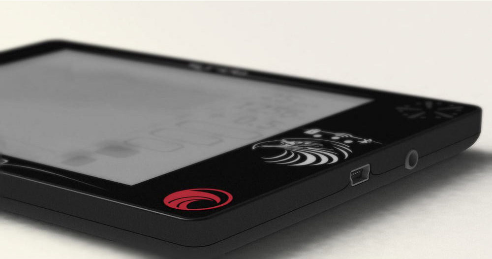
The Syride SYS'Evolution creates new standards for sunlight visibility in an instrument that is a good size for a moving map, and with a configuration that is flexible in an almost unheard of way, but still very easy to use straight out of the box.
In flight the audio from the vario and readouts that can be almost any size (and in any position) mean that little attention can be paid to the instrument whilst getting the maximum information from it. The competition side of it is still in development, with the larger, more detailed waypoint display not yet available.
The drawbacks include the need for a PC for detailed configuration, a screen that's only black and white, and fairly basic GoTo and competition programming to date. For some the lack of colour is a deal breaker and if high contrast colour is a priority, then look at the Naviter Oudie and Skytraxx 3.0 series of flight instruments.
The big plus points for the SYS'Evo are the exceptionally readable screen, the top quality audio vario, the amount of customisation available, the intuitive nature of use, and the automation when it's plugged into the PC for downloading your flights and uploading firmware changes. Roads, terrain and airspace are already in the unit, but airspace will need updating periodically.
Charge it overnight, then go fly without needing to do anything else. This is a superb all round instrument with lots of flexibility that requires very little housekeeping.
Find out more about the Syride SYS’Evolution
Syride SYS'Evolution: Video review
We recorded an impromptu video review of the Syride SYS'Evolution on the hill. Sorry we don't show the instrument more in this, hopefully it's still helpful for you!
Brought to you by Flybubble
Like what we do? The best way to thank and support us is to buy gear from us and recommend us to others. Review our service on Trustpilot and our products on Flybubble Shop. You can also subscribe to Flybubble Patreon. Thank you!

