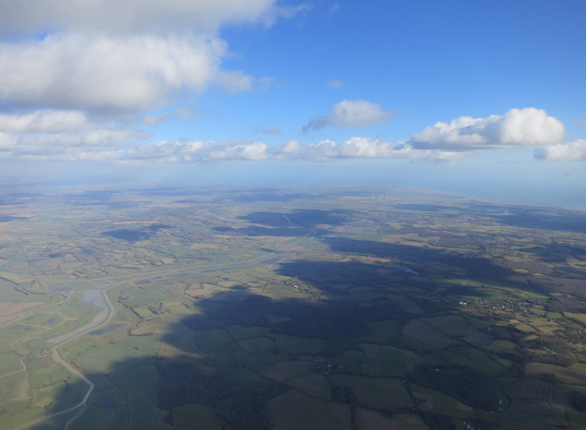
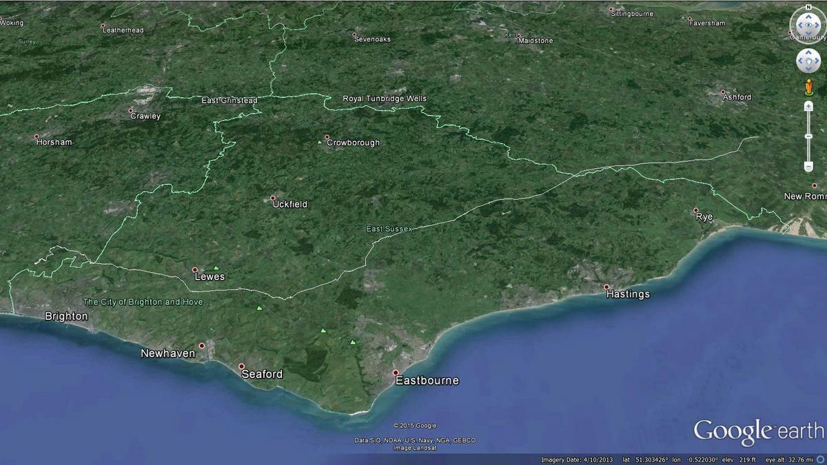
Flybubble's Carlo Borsattino recounts his February flight by paraglider from Devils Dyke in East Sussex to near Ashford in Kent and gives insights into how this exceptional flight was achieved starting, as it often does, with checking the paragliding soaring weather forecasts.
Checking various weather forecasts, Friday 27th February 2015 was looking very good for free flying in the south of England with some potential for cross country (XC) but the risk of it being a bit breezy for paragliding.
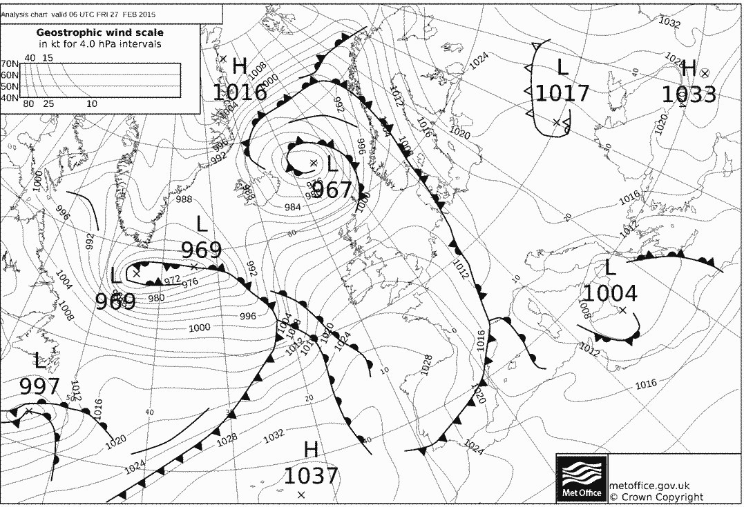
The synoptic charts showed a post cold front air mass with a well-timed ridge of high pressure sliding through before the next low pressure system with associated fronts and high winds arriving the next day.
Weather charts
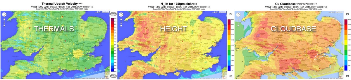
RASP* forecast showed some reasonable thermic activity with climbs getting to over 3000 feet Above Sea Level (ASL), an active sea breeze front and cloud base getting to over four grand in some places!
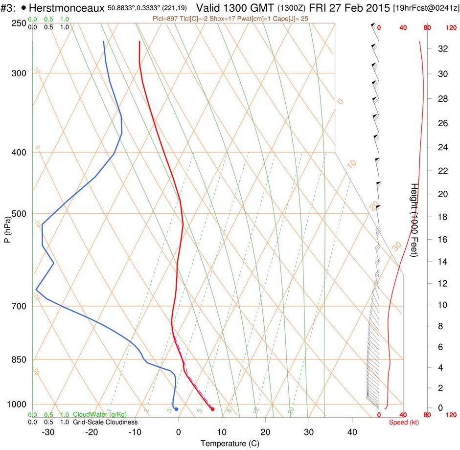
The RASP forecast sounding for Herstmonceaux (in East Sussex) looked good too, showing weak thermals rising to around 4000 ft ASL and cumulus cloud tops to nearly 5000 ft ASL. This also showed the temperature at cloudbase being around -3 degrees Celsius (°C), before taking into account the wind chill factor (which would make it feel like -11°C).
Schoolboy error #1
In February in the UK? Really!? An over-optimistic blip in the meteo data system, surely?!
And so, doubting Thomas that I was, I made the first of my schoolboy errors by not preparing properly for a long XC flight and not fully charging my flight instruments. I would pay for this later!
If lucky we might get to Bexhill...
The plan was to head to Devils Dyke around 10 AM, get flying around 11 AM, hang about until climbs were good so we could push a bit cross wind to avoid drifting towards the coast, and aim for the train line from Eastbourne along the coast whilst keeping an eye on where the Sea Breeze Front was. If lucky we might get to Bexhill, about 45 km cross-downwind. Others agreed. I'm glad we were proved wrong!
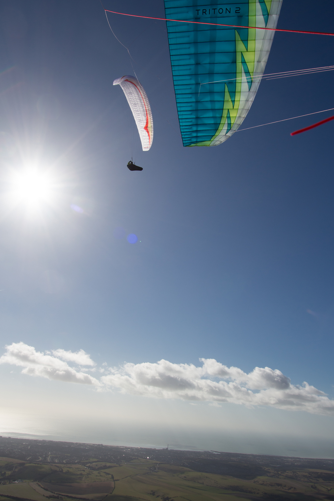
I had to get a few jobs done before leaving the hill. Then Cross Country magazine's Hugh Miller, an ex- British paragliding champion who lives locally, gave me a new Gin GTO 2 to compare against the Nova Triton 2 he was testing. Further delays meant I didn't manage to launch much before 11:30. By this time Hugh was already up high, thermaling with British team pilot Mark Watts, also an ex- British paragliding champion who lives locally. Time to try and catch up!
Until just a few minutes before I was ready to launch there was a good breeze and lots of pilots were getting up high easily all over the sky. Then the wind dropped to below soarable (somewhat ironic considering we were concerned that it might be still blown out at this time!) and conditions changed to light thermic cycles with variable lifty and sinky periods. I launched and struggled to maintain for a couple of minutes, deciding to top land before sinking out. Several pilots ended up slope landing or going to the bottom, as seems to be common in these fickle conditions.
I made sure I was ready to launch if conditions improved and waited watchfully. A few minutes later I felt a wind change hinting at possible thermic activity upwind, saw that some of pilots who were already high were now thermaling over a wide area under some newly forming wispies** upwind of my position and then, the clincher, spotted some birds climbing out front possibly within reach.
Launch!
I went for it and was blessed with a buoyant glide out, climbing all the way. Amazing just how much difference a few minutes can make to the conditions! When the lift slowed, I turned and did one 360 in the thermal. Vincent, the famously full-mouthed French flying baker, had launched just after me and followed me out; Nancy had too.
Looking at all the visual clues, and going on my gut feeling, I left this climb, even though it was going up OK and I wasn't high, and pushed further out towards the newly forming wispies. It worked and I found better climbs, getting me up faster. Eagle-eyed Nancy had spotted this too and promptly did the same thing. Vincent didn't, choosing to stick with what he had, which meant that he climbed slower than we did for a while and later lost out on the best climbs to come - the ones that got us up high enough to leave the hill. Easy to say now, but hard to judge - and impossible to be sure - at the time!
Nancy and I worked this lift and pretty soon others came to join us, as it was the best climb to be found. The thermals were disorganised and multi-cored - and so were circling paragliders and hang gliders within them - but thankfully everything became more consolidated as we rose.
Stay or go?
We were steadily drifting downwind in the climb, over the back of the hill and fast approaching the point of no return i.e. we probably wouldn't be able to make it back to the hill if we carried on drifting much longer. I was by now 'top of the stack' in our gaggle with Hugh and Mark gliding back upwind from Brighton direction to join me, having topped out in another climb they'd taken earlier. At around 2100 ft ASL I decided to leave this climb and push cross-upwind towards Poynings where I could see Mark, Franco and Finn on their paragliders and Luke Nicol on his class 5 'rigid' hang glider working some lift. Most pilots followed me, leaving the climb to push back upwind, whilst a few others continued climbing and drifting downwind.
My plan at this stage (for I had now formulated something resembling a plan!) was to first try and get myself into a better position more cross-upwind to the NE of the Dyke, around Newtimber hill area, before heading off XC cross-downwind. The idea being that I'd work a bit harder now to hopefully make it easier later. However on this occasion my 'cunning plan' didn't really pay off and my hard work was not rewarded!
I lost some of my height pushing upwind and was then only greeted by weak, broken climbs. Franco, Finn, Hugh and Mark clearly weren't impressed with the conditions and, having scrabbled about for a while, all headed off back towards launch one by one, leaving just Luke and I scrabbling some more in weak bitty lift. [As it happens, both Luke and I had independently declared fairly ambitious goals for the day. This undoubtedly motivated us to first leave the hill, even though it was only February and others had predicted that we were wasting our time and wouldn't get far, and then to keep going even when the conditions got tricky.]
Drifting away, XC!
Meanwhile some of the pilots who were lower than me in the good climb we'd left to push upwind had simply continued drifting over the back in that climb, and gotten up nice and high downwind of the Dyke before then heading off XC towards Falmer. Their tactic had worked much better, this time. Luke and I watched them enviously whilst searching our area for good lift, scrabbled only in rubbish lift, and cursed. After about 15 minutes of pratting around in this twaddle with me, Luke hit warp factor 9 on his rigid and zoomed off to catch up with the lead paragliders, who by now were already a few kilometres ahead. This only took him a few short minutes, leaving me scrabbling well behind. He must have around double the glide angle and fifty percent more speed than a top performing paraglider on that rigid, I thought. There really is no comparison between them!
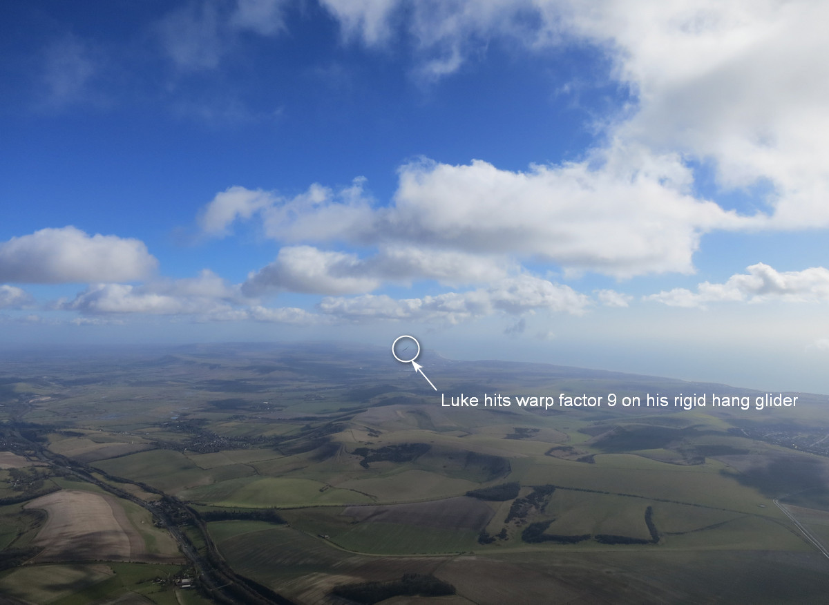
From here I did my best to try and catch up with the leaders, by climbing as fast as I could and pushing on as soon as it felt right to do so, as it would be nice and advantageous to fly with them. However, try as I might, I failed to do so. The paragliders ahead always seemed to find better climbs than me and so kept pushing on, maintaining their lead. Luke took advantage of his huge performance and glided north upwind, finding a good climb over Lewes. The last I saw of him was gliding off towards Flybubble HQ in Ringmer, disappearing into the distance.
I could only see one paraglider ahead of me now, Rob Simpson on his green Nova Mentor 3 Light, near Firle. To the south and SE a marked sea breeze front was forming and marching steadily inland toward us. Inland the sky was looking really good and so I started to have bigger ideas than just reaching the coast at Bexhill. I decided to try and push inland, so as to avoid running out of land and escape the oncoming sea breeze, and see how far I could make it heading NE. Ashford perhaps? But first I needed to get up and high, so that I could glide cross-upwind to regain some of the ground I'd lost so far!
Finally, good climbs!
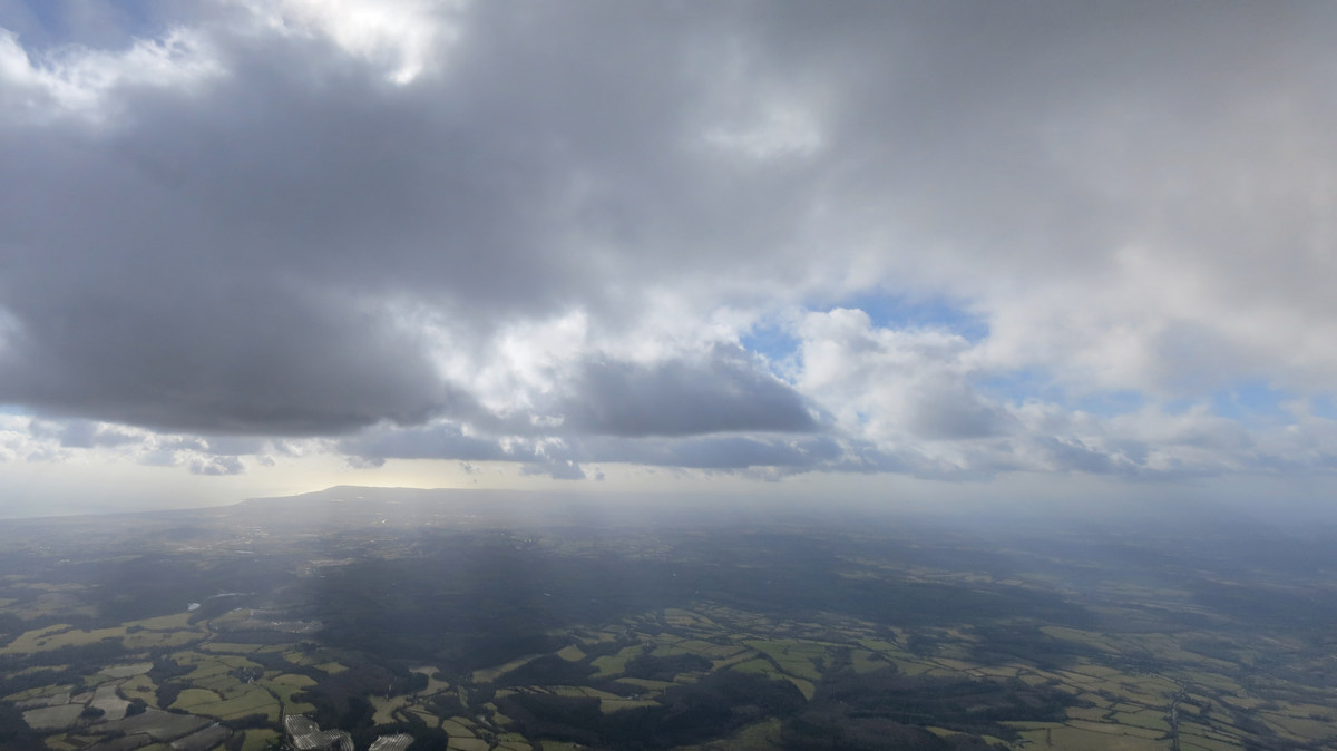
After much scrabbling, I finally managed to connect with some good climbs between Firle Beacon and Arlington Reservoir, as the sea breeze front spilled over the Downs and pushed up some of the air in front of it. This convergence lift was a bit better, but also much choppier, than the thermals I'd been working until now, which allowed me to get to know how the GTO 2 behaved in sportier air! I reached 'base at around 3200ft, and just kissed the wispies as I headed NE towards the north end of Hailsham, where I could see a small cumulus forming. Meanwhile I could see Rob getting low and eventually landing to the south of Hailsham. A shame we never got to fly together in the end!
Schoolboy error #2
By now I was starting to suffer from another of my schoolboy errors: I'd neglected to wear adequate gloves (heated and/or inners) or bring my disposable hand warmers so my hands were a bit frozen and my fingertips numb. I helped pump some warmer blood into them whilst gliding by dangling my arms down, rotating my shoulders and jiggling my arms around whilst opening and closing my hands. That worked a treat... and so my fingers started to sting - ouch! My first taste of hot aches*** for this year, but certainly not the last!
Schoolboy error #3
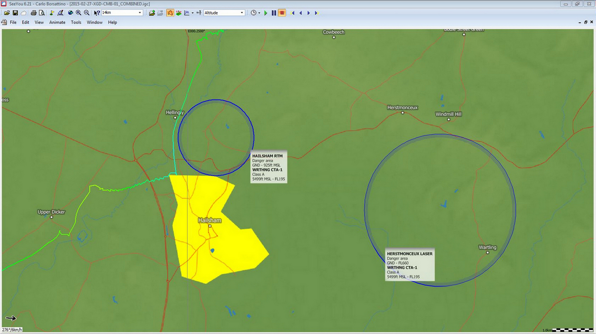
Perhaps my brain had also become slightly frozen, and I was distracted by the hot aches in my fingers, as I then made my next schoolboy error: Having found another climb to the W of Hailsham, I was now drifting towards Hailsham RTM (Radio Telecommunications Mast?) which is listed as being a Danger area in digital air charts (it's not shown on printed CAA VFR air charts) and sits just to the N of the town. Not thinking straight, I became uncertain about whether I was allowed to fly through this (despite flying XC in this area for many years this small bit of airspace has rarely been an issue) so of course I had to assume I wasn't. Therefore I left my climb at 3000ft, still climbing nicely, and glided N around the supposed airspace over Hellingly and towards some well formed cumulus clouds. Later on I remembered that Hailsham RTM is only from GND to 925ft AMSL, as my Oudie 3 was clearly showing me, so even if I wasn't allowed to fly into it I was well above it anyway. Silly schoolboy, me!
Freezing flat
The extreme cold was also starting to have some other undesirable effects on my flight. Within minutes of each other both of my inadequately charged flight instruments (Naviter Oudie 3 as main, Garmin 96C as backup) were giving low battery warnings. To conserve battery I turned off the vario sound on my Oudie 3 and relied solely on the Flytec Sonic I carry as a backup audio-only vario. Whilst fiddling with my electronics on glide I also took the opportunity to activate a great live position sharing app, Glympse on my Android phone and sent Nancy a quick text to let her know how I was getting on and to activate Glympse on her phone as well so we could track each other.
Cooking flying, frozen fingers!
Luckily for me my glide wasn't too sinky and the next clouds worked really well, so I only lost around 1000ft before reaching the next climbs which got me back up to 3200ft ASL near Cowbeech. From here the flight got much easier for the next 40 km or so with regular cumulus clouds marking regular climbs and 'base rising to 4300 ft ASL as I went along, making it much easier to push crosswind! The only downside was that since I spent more time higher up it was even colder than before; my body was fine in my superb Advance Loft jacket but I got the hot aches in my fingers twice more. Ow! Ow! Ow! That'll teach me for not being properly prepared!
About three-quarters of the way into the flight both of my instruments went flat within minutes of each other. So I activated the LiveTrack24 app on my phone, which would at least give me a tracklog, and resorted to using one of the many phone flying apps for navigation. Whenever I do this it always reminds of just how much I prefer using the Oudie 3, as it's just so much more intuitive to use and see! Fortunately I know the area well so can navigate my way around using ye olde mark one eyeballs anyway.
Into Kent
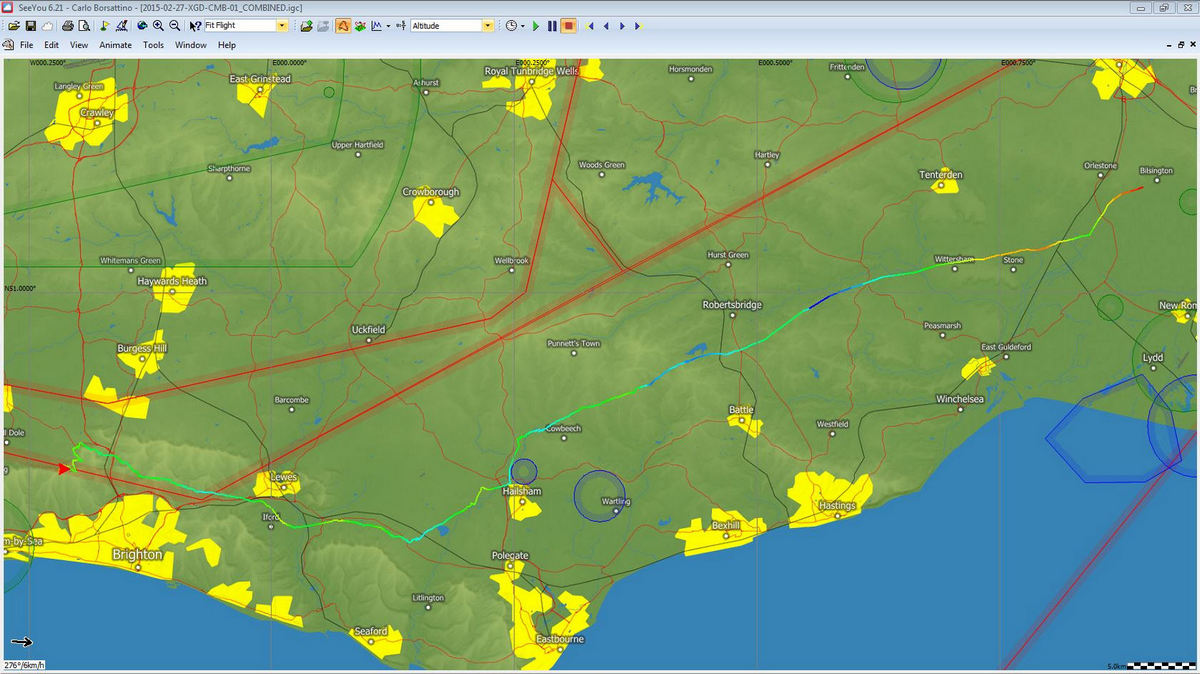
My track took me over Darwell Reservoir, NW of Battle, between Newenden and Northiam, past Wittersham and then straight over Appledore where I got a rather broken low-ish save. I got back up to 2000ft ASL from this climb before losing it. I found some more broken bits of lift but nothing good enough to get me back up and finally landed in a nice big field next to a farm between Ruckinge and Bilsington in Kent.
Getting back
Luckily for me, Nancy had first thought I'd landed just N of Hailsham when I sent my text so decided to retrieve me as I wasn't too far. On the way she realised that Glympse showed that I was still flying so she decided to drive after me as she didn't expect me to get all that far. It was February in England, after all! So in the end she very kindly picked me up from where I landed and we stopped for a celebratory late lunch in Tenterden on the way back. Lovely!
Looking back
The flight distance was around 81 km straight line, 87 km with 3 turnpoints. Over 100 km was feasible by paraglider on this day, with Margate (128km) not out of the question... but who cares about the distance, it's the experience that counts - and stays with you! I'm glad I took the gamble and left the hill. Of course I might have bombed out but that's always the chance you have to take if you want to fly XC. It wouldn't be an adventure, or half as much fun, if the outcome was predictable!
Fantastic! What a great start to the 2015 cross-country flying season, woohoo! :~D
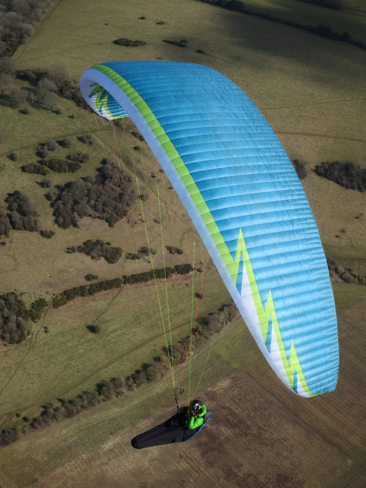
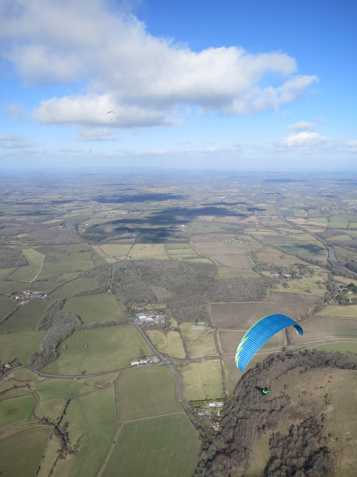
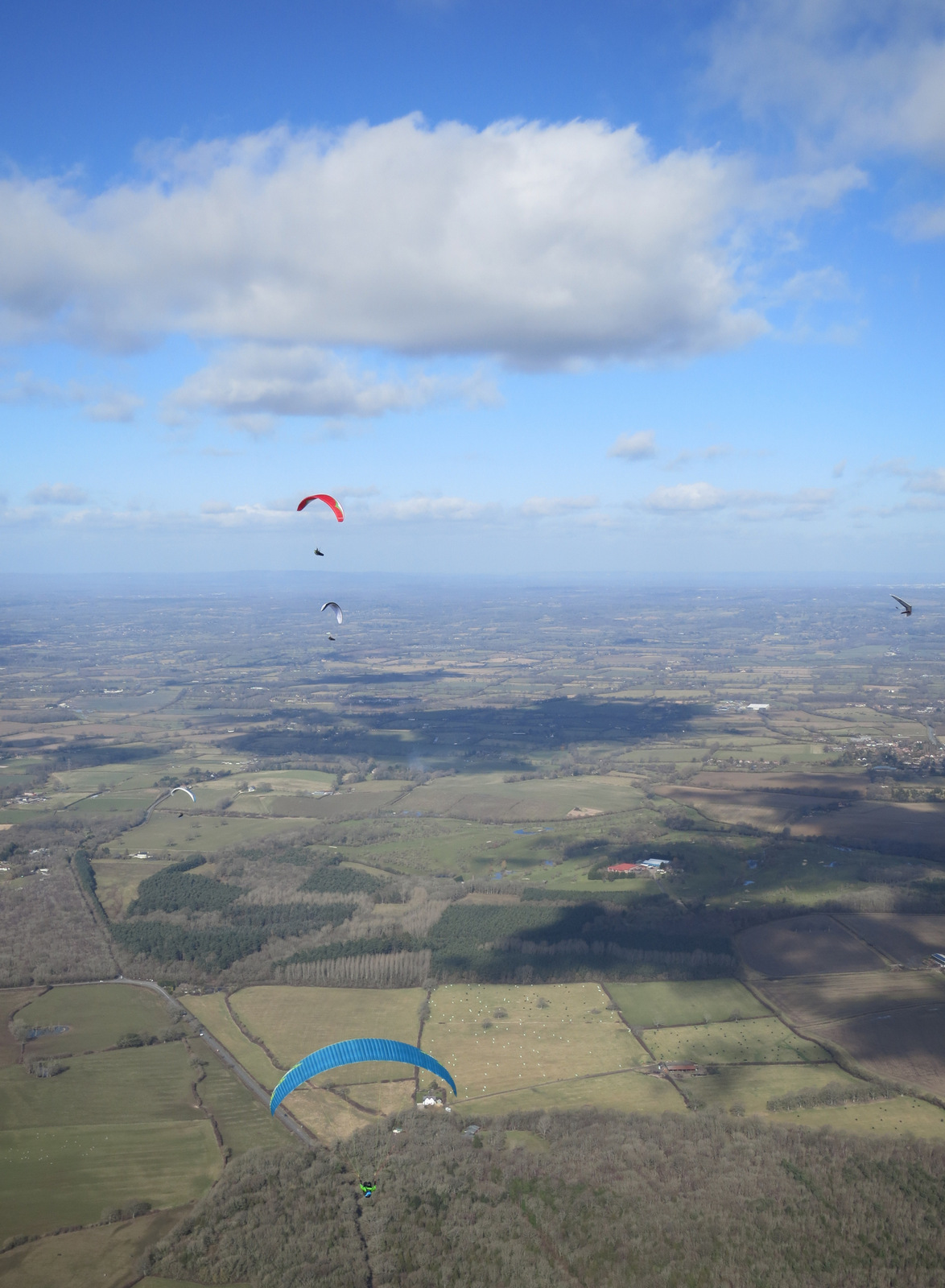
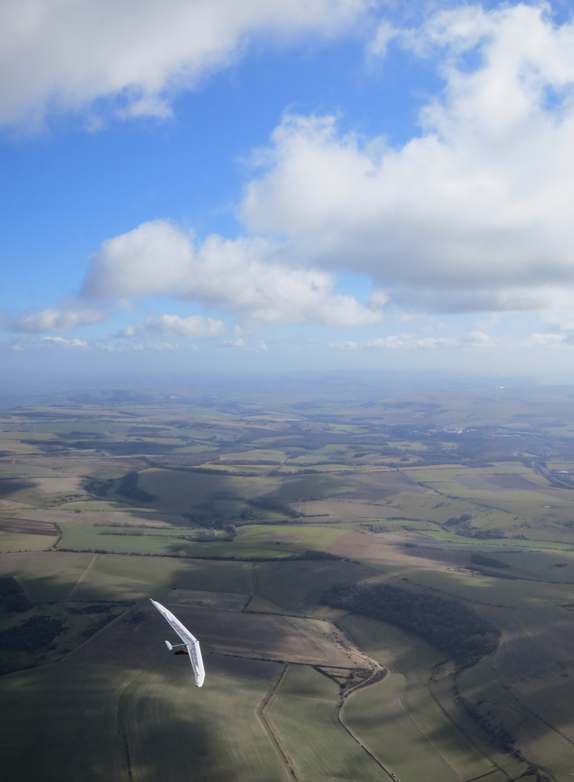
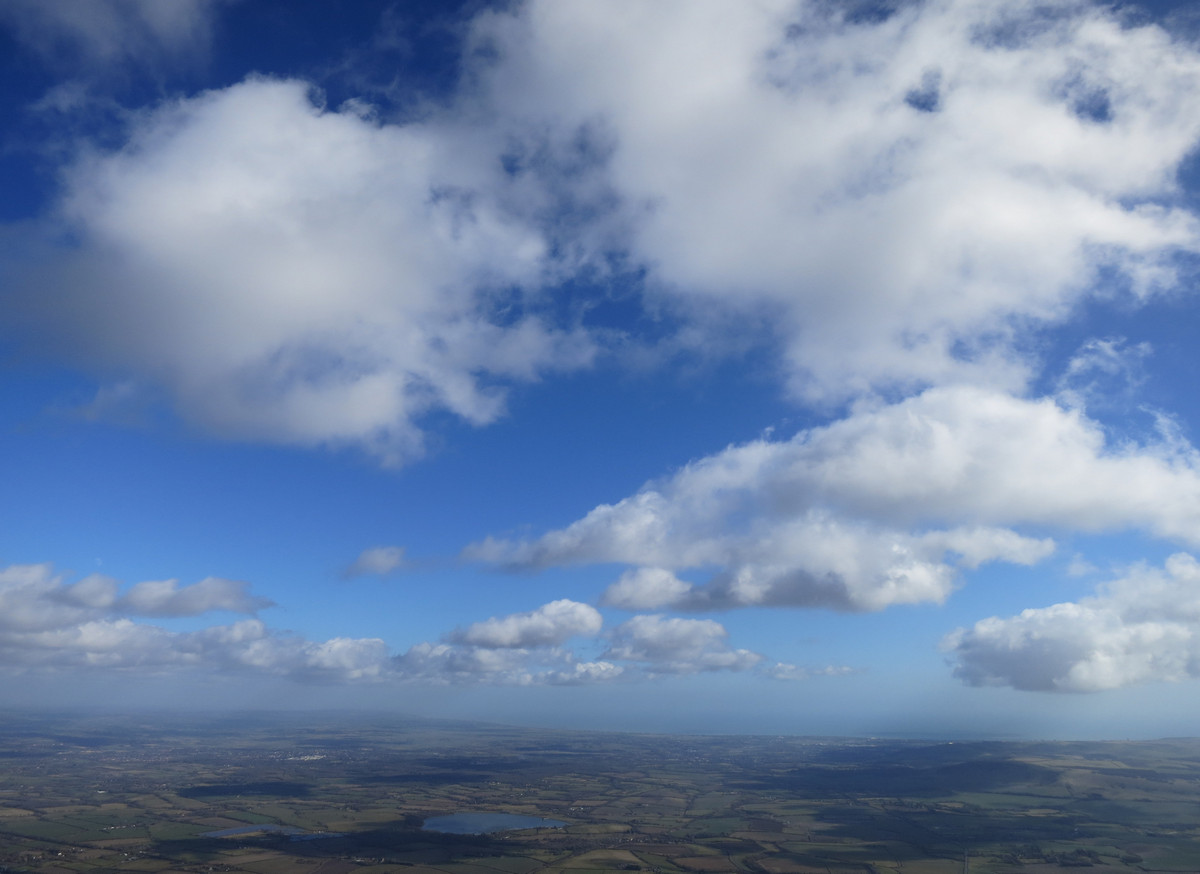
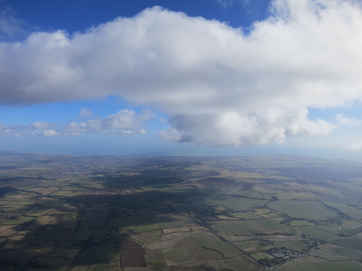
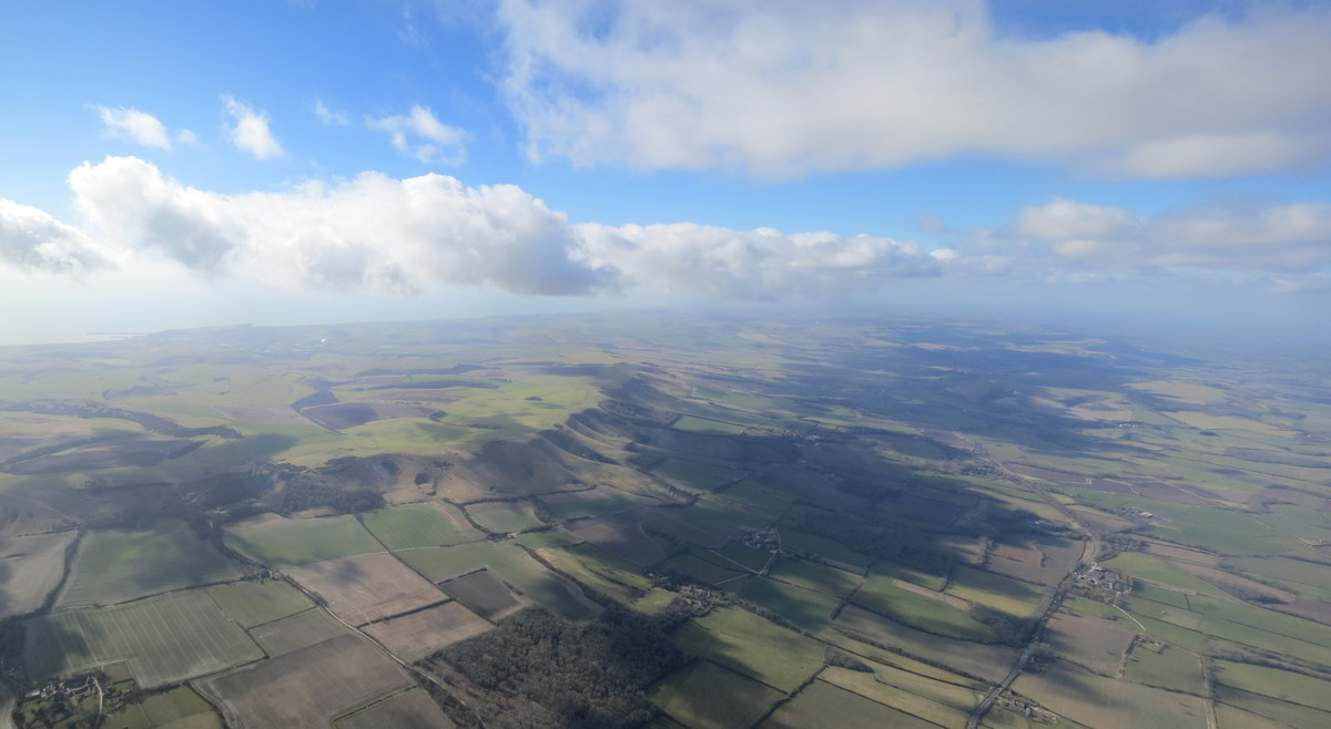
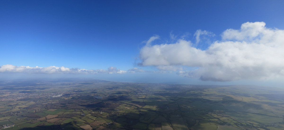
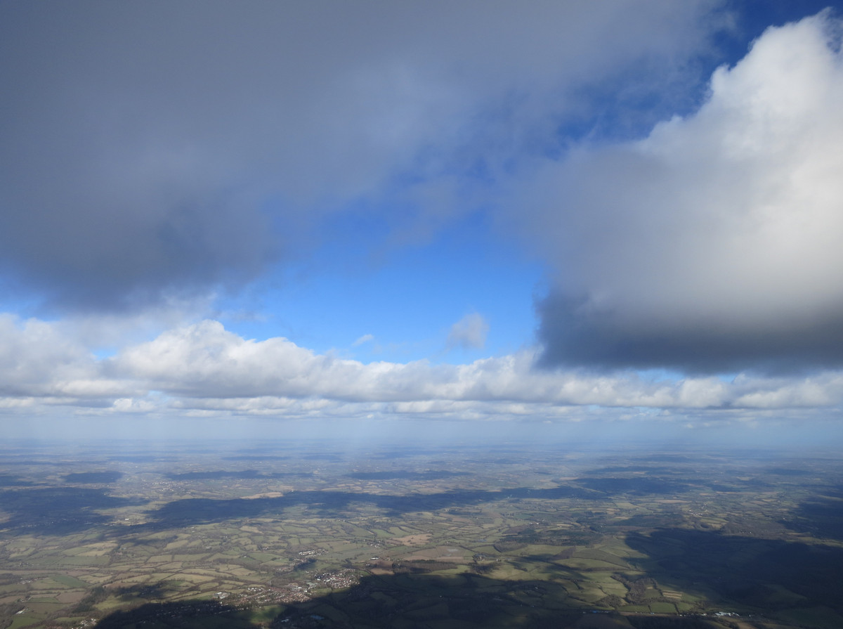
Photos
Check out some of Carlo's photos from this fabulous flight below (click to open 'lightbox' viewer):
[justified_image_grid rml_id=741]
You can see Carlo's tracklog for this flight in "the global flight database" Leonardo.
Other pilot's flights
Some other paraglider pilots also managed some notable XCs on the same day. Amongst them were Richard Chambers, Nick Warren and RJ Macaulay who all managed to get away from Butser Hill near Petersfield, heading east towards Devils Dyke: Richard: "A great day at Butser West, test flying the lovely Niviuk Artik 4. Managed to fly 44 km with Nick Warren, including a play with the clouds in the sea breeze front. I didn't even take off until 3 pm. Are we sure it's February? More like this please. But less cold; my fingers still hurt!!" RJ got to Dial Post: "Not a 'typical' XC, if there is such a thing... I had to spiral to avoid cloud while my airspace alarm went off under the 4500 ft airspace! It was extremely cold. Base was at 4 to 4500ft! It helps when a cloud street sets up over take-off!"
Enjoy Richard's fantastic video from his fabulous XC:
Read Carlo's summary of the 2015 UK Paragliding XC Season
* RASP: Regional Atmospheric Soaring Predictions. This has a useful archive, so you can check previous days. http://rasp.inn.leedsmet.ac.uk/
** Wispies: Wispy cumulus clouds, or the wispy bits you get around the edges of clouds.
*** Hot aches: A rather painful physical reaction to the cold, most often felt in the hands or feet. When exposed to the cold, blood stops flowing normally to the extremities. Later once you warm up, the blood begins to flow again; this causes the pain known as the hot aches.
Brought to you by Flybubble

Like what we do? Want us to keep doing it? The best way to thank and support us is to buy gear from us and recommend us to others. You can also review our service and our products and become a patron. Thank you!