
Flybubble's Carlo Borsattino has been flying cross country (XC) by paraglider since the early nineties, and has a reputation for his ability to stay aloft for hours even in the weakest conditions. But it takes more than patience to fly over 200 km in the UK. He analyses the technical challenges, tactical moves and saved mistakes that helped him to achieve his personal best distance to date.
Soaring weather forecasts
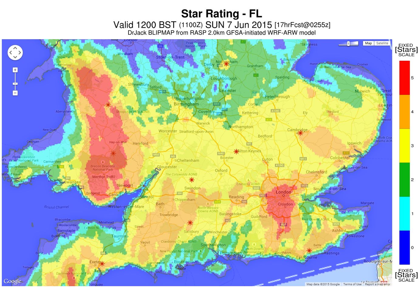
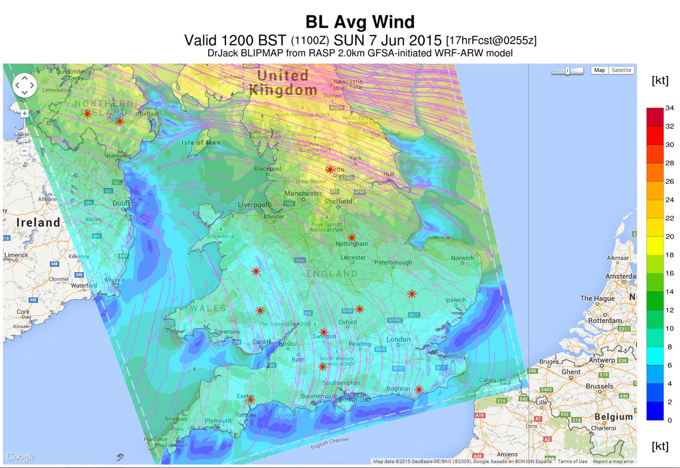
The weather forecasts for 7th June 2015 were looking epic in the west of England and Wales so Nancy and I decided to travel from East Sussex to somewhere in the West Midlands the evening before so we could get a good night's sleep and be on site early.
Our friends Crispin, Grita and Ed decided to join us so we all travelled in the Flybubble van to the best value accommodation we could find, which turned out to be in Redditch. We stopped for a dinner at a country pub which Ed found on the 'good pub guide' online, and were tucked up in bed by 11 pm.
Which flying site?
There were various sites to choose from, but there was also a risk of it being blown out in places. But which site to go to? A big part of XC flying is about being in the right place, at the right time.
After scanning the forecasts and the many messages on the XC chat groups I thought that The Lawley in Shropshire was looking like the best option. We arrived first on site at around 10 am. I posted to one of the chat groups that it was looking good at The Lawley.
Hugh Miller reported that it was "blowy but doable" at The Wrekin (near Telford) about 15 km to our NE. A few minutes later he updated: "Blown out here. Heading to Lawley!" The word quickly got around and soon the XC hounds began to join us.
What goal?
I'd already decided to aim just south of Dorchester for 210 km. The furthest goal I'd managed to reach before was Devils Dyke to Margate for 128 km the year before. Barney and I exchanged plans; he and several others had a goal NW of Dorchester, near Sherborne, for around 181 km - which seemed ambitious enough!
I nearly changed my goal to theirs but in the end decided to stick with my original declaration as I thought the day was looking exceptionally good and I really wanted to beat my previous PB of 199.9 km done in 1999 in Quixada, Brazil. The closest I'd come since then was 197.7 km in the UK, from Leckhampton near Cheltenham in Gloucestershire to near Okehampton in West Devon (but that's another story). Little did we know that our differing goal declarations were to have unexpected consequences!
The first 100 km
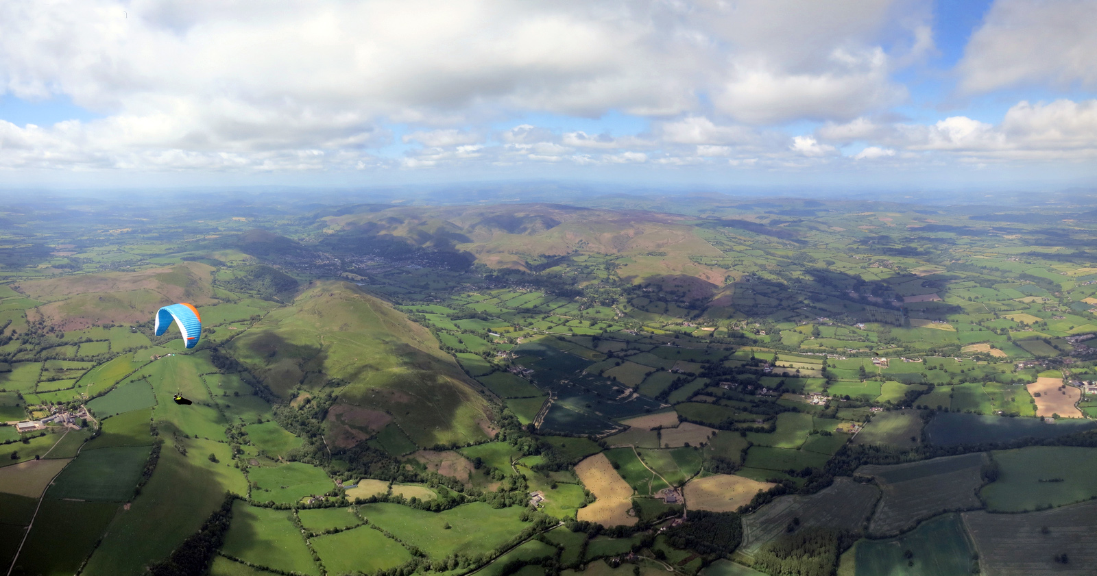
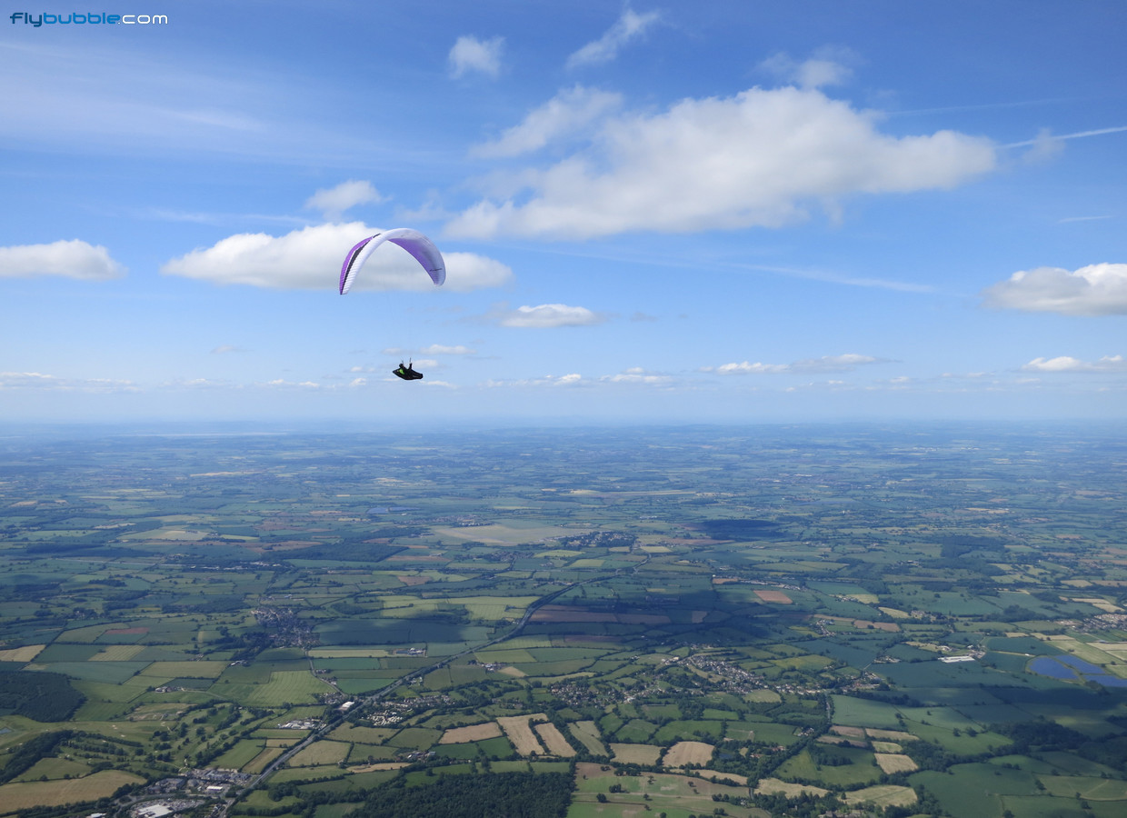
I launched first at 10:55 closely followed by Nancy who soon found a good climb along the ridge so I joined her and we thermaled up to around 3000 ft together, grinning from ear to ear as we marvelled at the stunning views all around us. Crispin, Grita and Ed launched a few minutes after us and worked the ridge. In retrospect it was fortuitous for them that they missed our first climb as conditions proved particularly tricky for the first half an hour and the day seemed to quickly improve thereafter.
Our first climb petered out so Nancy and I pushed back to the ridge, looking for another climb to take us up to 'base. We were also waiting for more pilots to launch so we could fly as a gaggle, but the rest of the pilots who flew the top distances of the day only launched between 11:21 and 11:38, so we left the hill on our own.
Our plan was to take it easy for the first part of the flight, try to stay high, and let the top pilots on their EN D and CCC wings catch us up so we could fly together with them for a while before they inevitably shot off ahead of us on their hot ships.
I got to around 4200 ft before my second climb fizzled out, whilst Nancy didn't quite connect with the core and so lost the lift a few hundred feet lower. We went on glide SE towards the Clee Hills, and got some weak broken climbs.
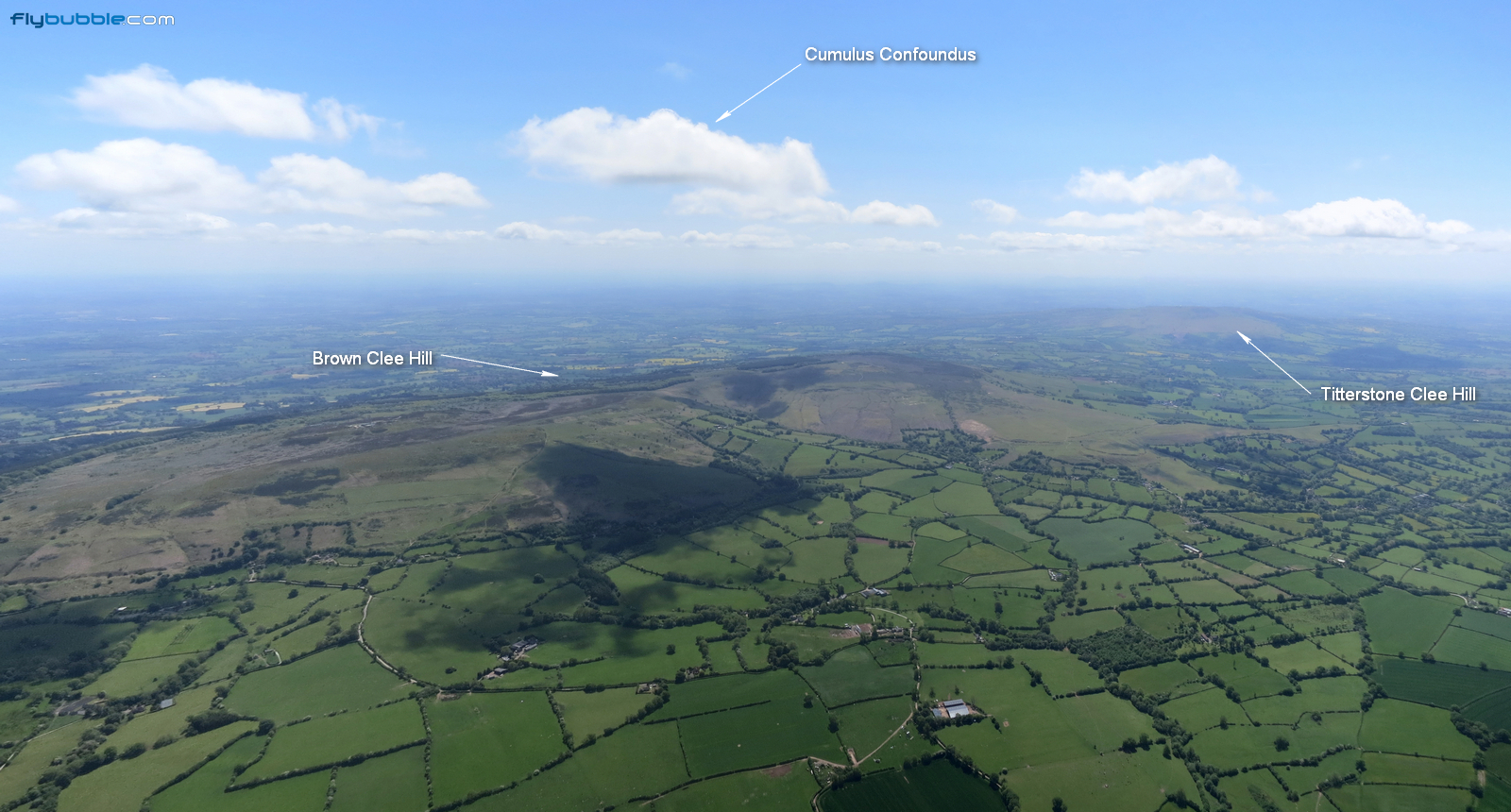
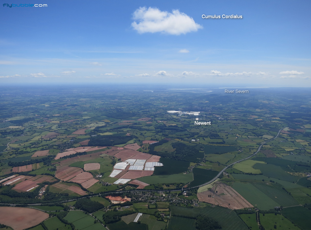
There was a good looking cumulus cloud ahead. Unfortunately our timing was not good and the cloud (Cumulus Confoundus!) collapsed just before we got to it, leaving an area of sinky air. All we could do now was glide on and hope. Nancy hit more sink than I along the way so she got very low over the hills and was forced to soar on the shallow slopes in a strong Venturi caused by the air rushing through the col between the two hilltops.
Meanwhile I got a weak climb above Nancy which I drifted along in, willing her up. Nancy hooked a thermal from what looked like nearly ground level and took it up and over the back, drifting fast. It was looking like she might get up but then she lost the climb and had to run downwind, finally landing in a field near Wheathill. Darn!
My climb had broken up so I was forced to run too, finding heavy sink (up to 3.9 m/s) downwind of the hills. I picked up a good climb over Cleeton village which took me up just short of cloudbase.
I could now see 3 gliders several km behind me (Phil Colbert, Phil Wallbank and Mark Wilson) and 2 more (Barney Woodhead and Pat Dower) at around 10 km. I couldn't see anyone near me, I was at base and it was looking good ahead; time to push on! My cunning plan of waiting for the others to catch up wasn't working...
The section from the Clee Hills past the Malvern Hills to just before Gloucester went very well for me with regular good climbs up to a gradually rising cloudbase, staying above 2000 ft on glides, and not having to mince around in weak stuff too much. I can only guess that the pilots following must've had a harder time of it because, despite them flying as a 'super gaggle' on higher performance wings and me flying slower to let them catch me up, they didn't get level with me until I was past Stroud, over 100 km from The Lawley.
Decisions and mistakes
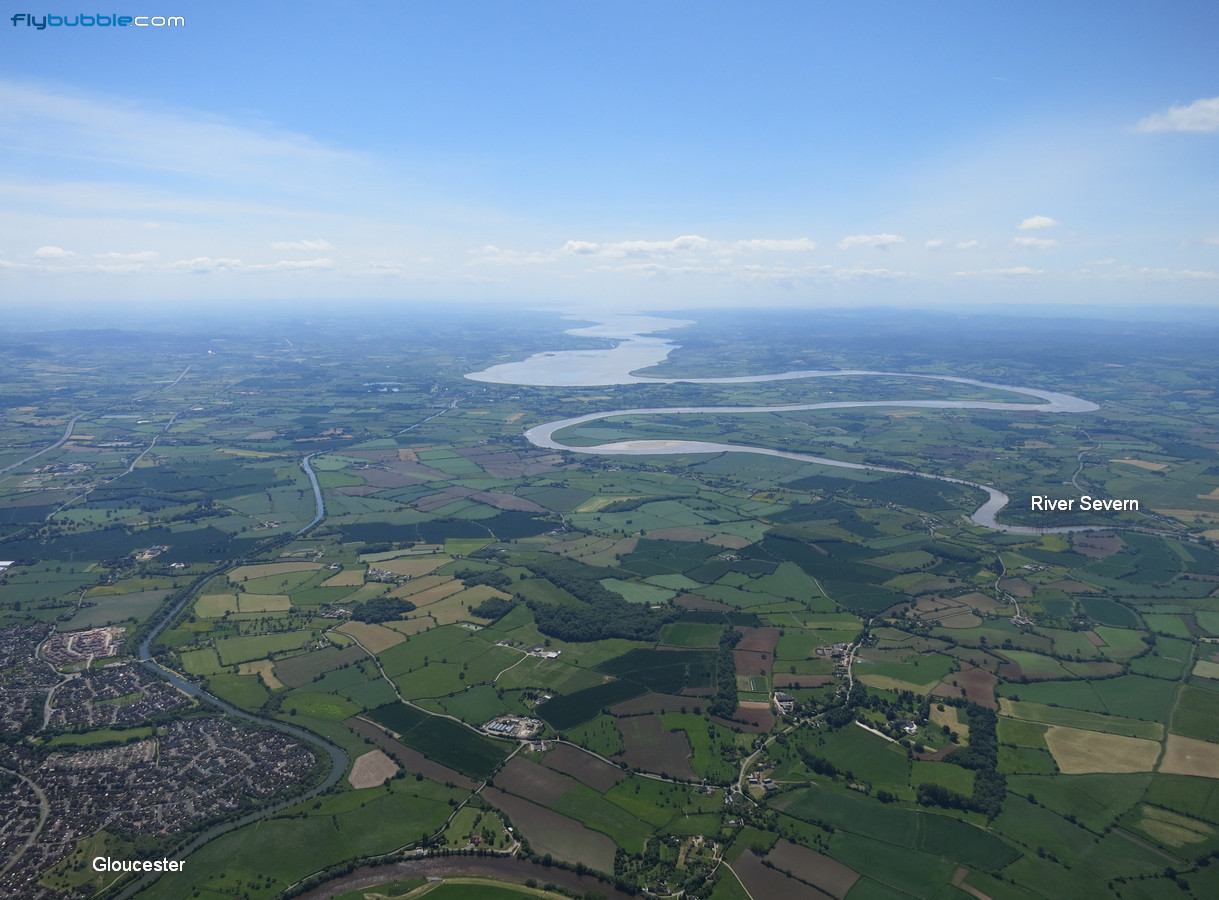
I found a rather spunky climb (perhaps caused by 'river breeze convergence' from the Severn?) just south of Gloucester. The Baker's Dirty Dozen were circling with intent just behind me. I had to decide whether to go west of Colerne ATZ (through the Bath Gap) or east of it. Although I'd requested for the Bath Gap to be opened from 12-6, I hadn't had confirmation of this before I launched.
I checked the SW Airspace Telegram group on my phone, whilst enjoying a moderate aerial rodeo ride, but found conflicting information. So I posted a message to ask if someone could please extend the Batch Gap airspace permission and Peggy Williams kindly confirmed that it was open until 1800 - thanks Peggy! As it turned out, we didn't go through the Bath Gap anyway, but we needed the option to be kept open in advance, in case that turned out to be the best way to go. Having gleaned this information, I then made some very bad decisions which nearly ended my flight.
First bad decision
I left the climb I was in (at 5400 ft)when I should've waited for the others to catch me up; I've no idea why I did this as that was my plan all along and it would've been very easy to have done so at this point.
Second bad decision
I headed straight downwind rather than diverting to the west under some wispy cumulus clouds, which meant that I took a long sinky glide all the way down to 1200 ft. This wouldn't have been so bad if I wasn't sinking like a stone and the ground below me wasn't at 600 ft.
I bumped into a very broken climb (it felt like I was in the cooler, more stable air from the Severn) which I quickly lost. And then another, which again disappeared. I ran cross-downwind and located another, better climb and latched on to it. I wasn't letting go! Meanwhile the Dirty Dozen were circling a k or two behind me, in orbit.
Back in the game!
The climb I'd found turned out to be a good 'un, and the mob pounced on top of me like hungry bears after a fat trout. By the time the first one came overhead (Phil Colbert, at just shy of 6,000ft) I was back up to 3,900ft and still climbing nicely. Since most of them were at least 1,000ft higher than I they carried on without me. Hang on a minute; that wasn't my plan at all! The only one who joined me was Andy Wallis, who was at a similar altitude. But even he left after a few turns. Was it something I said?
I decided to let them go, and enjoyed the climb. It topped out at over 5,800ft. Woohoo! Time to chase after the XC hounds, who now seemed to be in somewhat of a hurry - heading straight for danger area D145 near Hullavington (see note below) which goes up to 2,000ft.
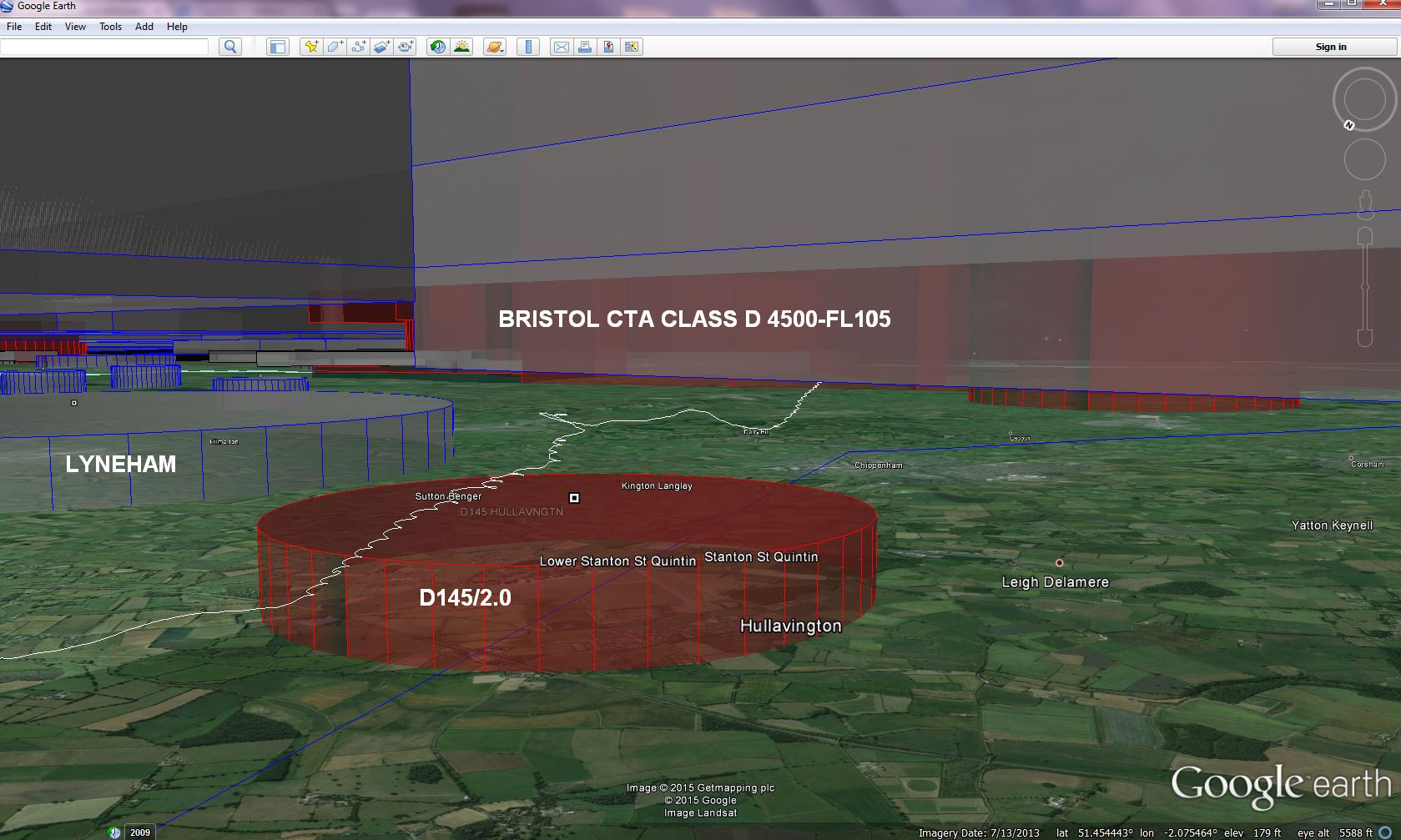
I hit upon a climb just before the danger area so went clean over the top of it. Ahead I could see that some pilots hadn't properly accounted for the wedge of restricted airspace ahead at 4500 ft, and were having to either spiral down or divert eastwards to avoid infringing it, wasting time. This allowed me to catch up a bit.
I ferreted out a good climb just north of Chippenham, which allowed me to join up with Andy Wallis again. We flew as a pair until Trowbridge where we caught up with Phil Wallbank and then flew as a trio for a short while. Most of the rest were a few Ks ahead of us, with Mark and Hugh a few Ks ahead of them having put on a spurt of speed. 5 hours into my flight, 158 km from launch, I needed another 52 km to reach goal. Although late in the day (4 pm) this now seemed feasible!
Whilst Barney & Co were now getting close to their 181 km declared goal, further west, I wanted to carry on towards my declared goal just south of Dorchester. I didn't know where Hugh and Mark's goal was but it looked like they were heading a bit further west than my goal too. So I was back on my own again!
Closing moves
I detoured SE under some good looking cumulus clouds, which took me up to over 6000 ft. This allowed me to take a long glide across a big blue gap (no clouds) to the next line of cumulus, which looked very good. This cloud street was working really well but unfortunately heading in the wrong direction. So with 30 km to go I decided to leave it and head across another blue gap for the next cumulus, about 10 km away. Fingers crossed for at least one more climb!
About 20 km from my goal, now 7 hours into my flight, I ran into a disorganised climb just north of Mappowder village. Ahead of me the sky was completely blue, so it seemed likely I wouldn't get another climb. To my west I could see that the sky was looking better and all of the pilots who'd taken a more westerly route were doing much better than I, finding more climbs. It was too late to crosswind to them so I just had to make the most out of what I had!
I worked the lift for around 15 minutes, resisting the urge to press on, eventually topping out at just over 5200 ft before it died completely. Still 16 km to go. My Oudie's glide calculator showed that at my current glide I wasn't going to make it - I'd be 1 km short! I forced myself to relax and enjoy the views. No point getting stressed; either I was going to make it or I wasn't.
I passed the 200 km mark for the first time. "WAHOO!!" 😀
As I kept gliding I could see that my glide calculator was putting me closer and closer to goal, but still short. I optimised my glide as best I could, thought lifty thoughts and hoped for buoyant air. As I went over Dorchester my sink rate reduced giving me just the boost I needed to make it, with about 400 ft to spare. YEEEEEEEEEEEEHA!! 😁
I landed in a big grassy field. The Artik 4 fell down beside me and breathed a gentle sigh. Its job was done. We had crossed six counties, been airborne for almost 7 and a half hours, and spent exactly half the time thermaling. We'd achieved over 55000 ft of ascent or almost twice the height of Everest. And now, we were near the English south coast.
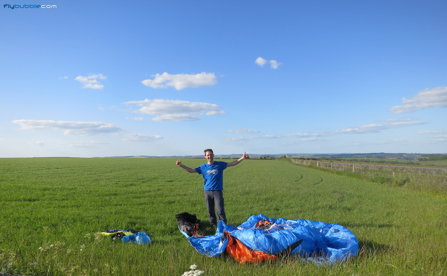
A nice lady drove me to Weymouth quay where I met up with the rest of the gang, who'd driven down after me. Crispin and Grita had also both beaten their global PBs, and Ed had almost bested his. We celebrated with a meal of fish and chips. It had never tasted so good!
Post Flight Analysis
An unforgettable day
Sunday 7th June 2015 turned out to be a record day for XC flying in the UK: 134 pilots flew a total of 12,261 km. Surprisingly, my flight turned out to be the highest scoring of the day (and the year so far) at 284 points, as I'd declared the most ambitious goal at 210 km, and made it! Other new entrants to the '200 K club' for the day included Richard Butterworth, Andy Wallis, Patrick Dower, Phil Colbert, and Phil Wallbank.
As well as all of the amazing flights and experiences had by many, Wayne Seeley pointed out something that made the day even more special: "It looks like we all celebrated Richard Westgate's birthday in style. What an epic banging day. Congratulations to everyone who flew new PBs." To which Chris Harland responded: "Let's call it Richard Westgate day!" And so it was.
NOTAMs
There are generally some relevant NOTAMs to be aware of - and sometimes avoid - on every flying day. I check NOTAMs as part of my XC weather check. Sometimes NOTAMs are advisory in nature i.e. we're allowed to fly through them (but it's generally wise to avoid them anyway if you can); other times they are prohibited. As always, it is the responsibility of the individual pilot to ensure that they do not fly into prohibited airspace. The mantra I follow is: "If in doubt, KEEP OUT!"
On this day one NOTAM in particular seemed to be of relevance, H2033-15 near Hullavington in Wiltshire. As far as I could tell this NOTAM was only advisory in nature i.e. it was a navigation warning which we were legally allowed to fly through. However I know that the UKPGXCL may disallow a flight if a pilot flies through an area which has a navigation warning such as this if their bad airmanship causes a hazard to others and they receive a complaint.
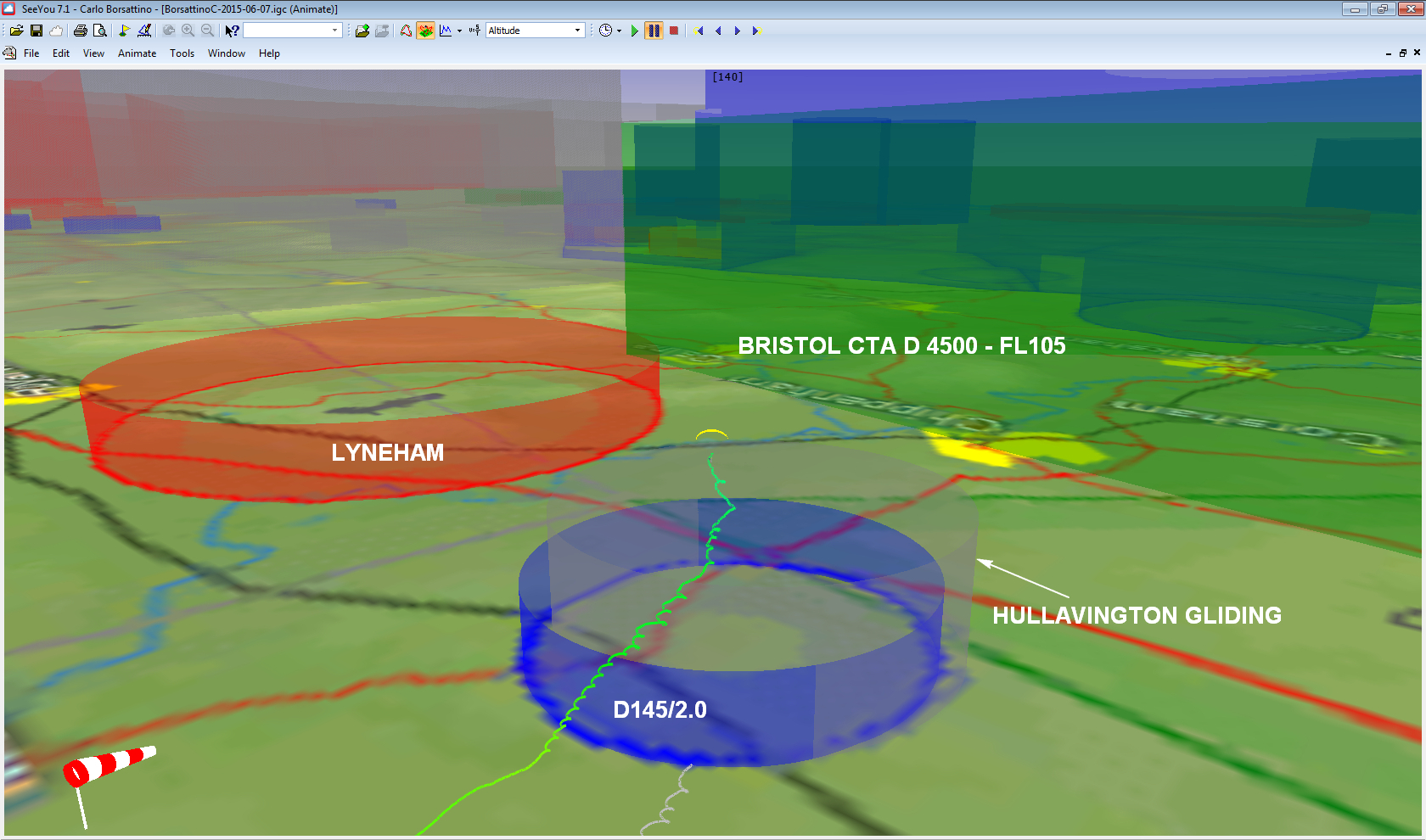
On this day NOTAM H2033-15 turned out to be very relevant for a number of pilots, including me, as we all flew right over it! The NOTAM was centred on danger area D145/2.0, which is easy to miss on the air charts as it overlaps Hullavington gliding site. D145 is only activated by NOTAM i.e. you're allowed to fly through if it hasn't been activated by NOTAM, similar to other areas of airspace e.g. RAF Lyneham, a few kilometres to the east of D145.
I very nearly landed early during one of my best ever XCs due to leaving a climb and gliding crosswind to avoid RAF Lyneham; I later found out that it wasn't active that day so I could've flown through it! Although I managed to carry on this cost me at least half an hour, which turned out to be the difference between getting to goal or not, as turned out to be the case for me that day. Lesson learned!
Tracklogs
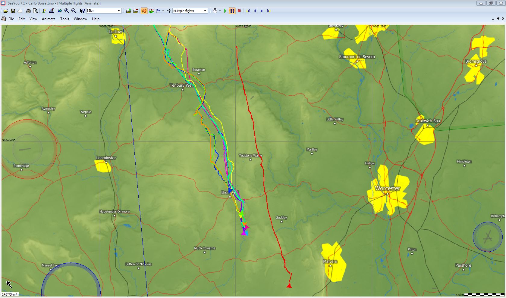
You can learn a lot from analysing your and others' tracklogs. I prefer to do this using Naviter's excellent SeeYou flight planning and analysis software, which also allows you to load multiple tracklogs at once, but you can also do it with free software such as Google Earth and online services such as ayvri.com (was doarama.com). I find it particularly useful to see the routes and tactics different pilots used when compared to mine and others at the same time. Check out Phil Clark's series for tips on how to do this.
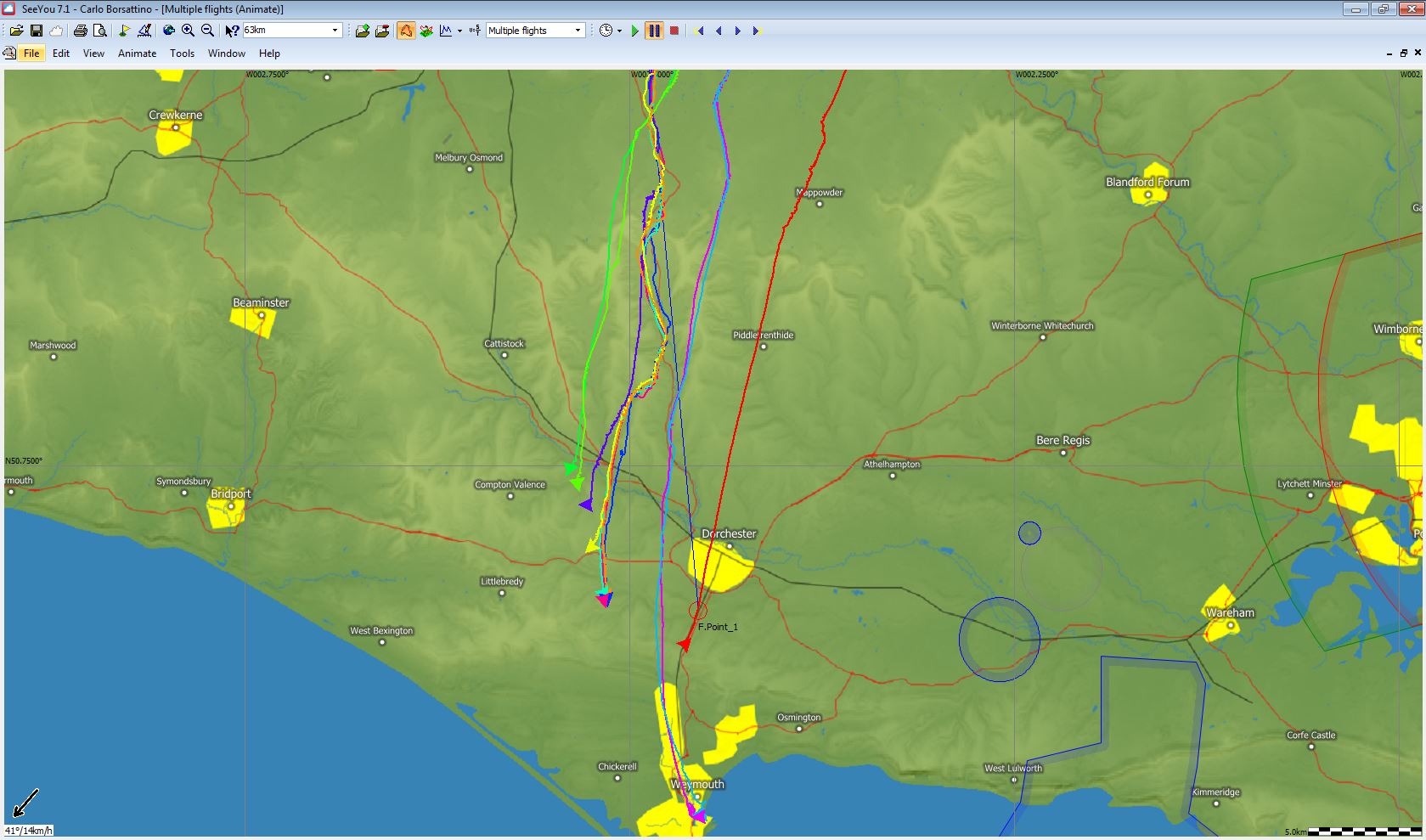
See all the flights from the day in the UKPGXCL
Brought to you by Flybubble

Want to see more? There’s no better way to support our efforts than buying from us. We’ll ensure you get great service! Choose from our great range AND enable us to produce more videos and articles to benefit the freeflight community.