
There is a bewildering choice of flight instrument options available to free flight pilots—even just within the range of flight instruments which Flybubble chooses to offer—each with their own features, screen design, sensors and technical capabilities. Especially with flight instruments, what’s right and best for one pilot at a particular stage in their flying progression may well not be right for another pilot, or even for the same pilot at different times or stages in their pilot progression. Let’s examine how to choose the right flight instrument option for you, at this time.
Instruments can help you stay up for longer, climb better, glide further and make better decisions. An altimeter might seem simple: it can tell you how high you are and whether you are climbing or sinking. But is that in metres or feet? QNH or QFE? Barometric or GPS altitude? For new pilots, things can rapidly become complicated. The simpler the instrument, the fewer choices you will have to make and the less it will demand from you. The key to getting the right instrument is to have all the features you really need on display, and no more.
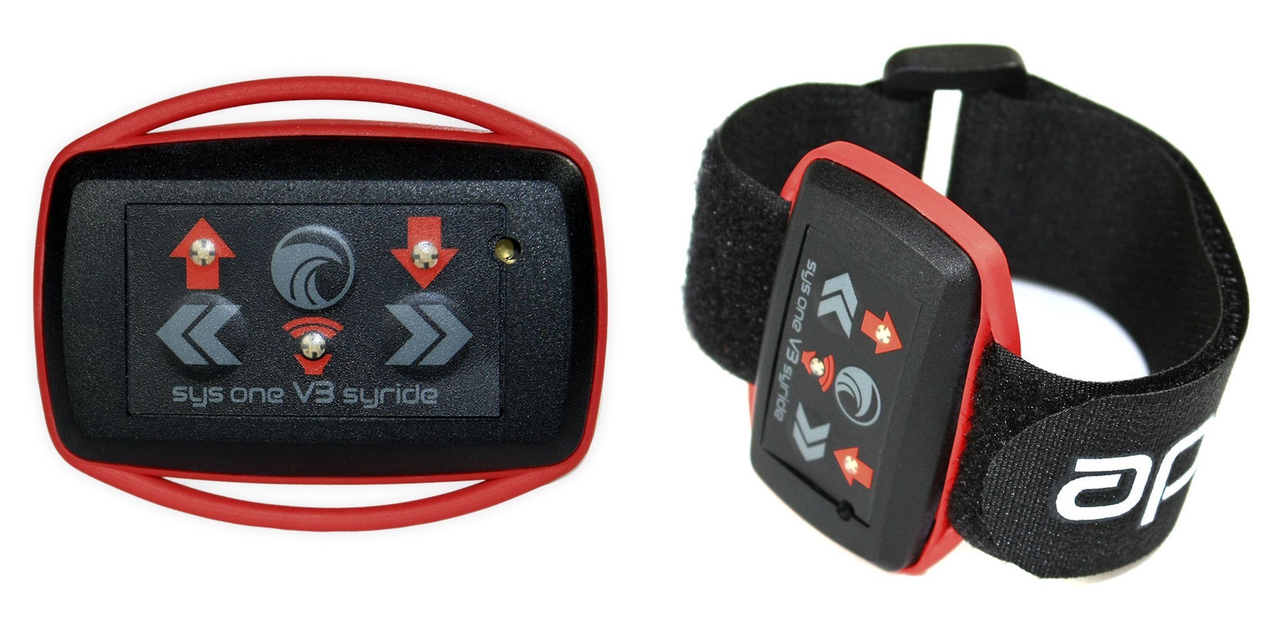
Vario only
If you don't need an altimeter where you fly (no airspace nearby) then you can use a simple vario-only instrument to help you identify climbs and sink. These can also be handy to have as a backup. The information these instruments produce typically comes from a pressure sensor, but the limited processing power in these ultralight units means they are basic.
Alti-varios
For effective thermaling, what you need is something that beeps when you lift it but sensitivity is not everything: what you want is some intelligent filtering that describes a true thermal and eliminates the gusts and bumps that waste your attention. This intelligence comes with the slightly larger units. They also provide the crucial 'averager' function which calculates the average climb you have experienced over a set interval (usually 10-15 seconds), which makes a big difference when trying to work broken lift.
Altitude can be determined in two ways, either by ambient air pressure or by three dimensional GPS position. All entry level alti-varios have pressure sensors and calculate pressure altitude, but because the air pressure changes every day you'll have to correct the displayed launch altitude to get accurate figures for real altitudes, or leave them at standard sea level setting (i.e. don't correct the launch altitude) to give consistent flight levels.
Which method you choose depends on what airspace you're commonly avoiding. Airspace boundaries are often depicted in altitudes (low down, most UK airspace, in feet above mean sea level) or as flight levels (up high, in hundreds of feet above the 1013.2hPa surface). The other aircraft will be using instruments that calculate their altitude using air pressure, so it's best to have something similar and not be flying on GPS altitude, especially the one provided by your phone.
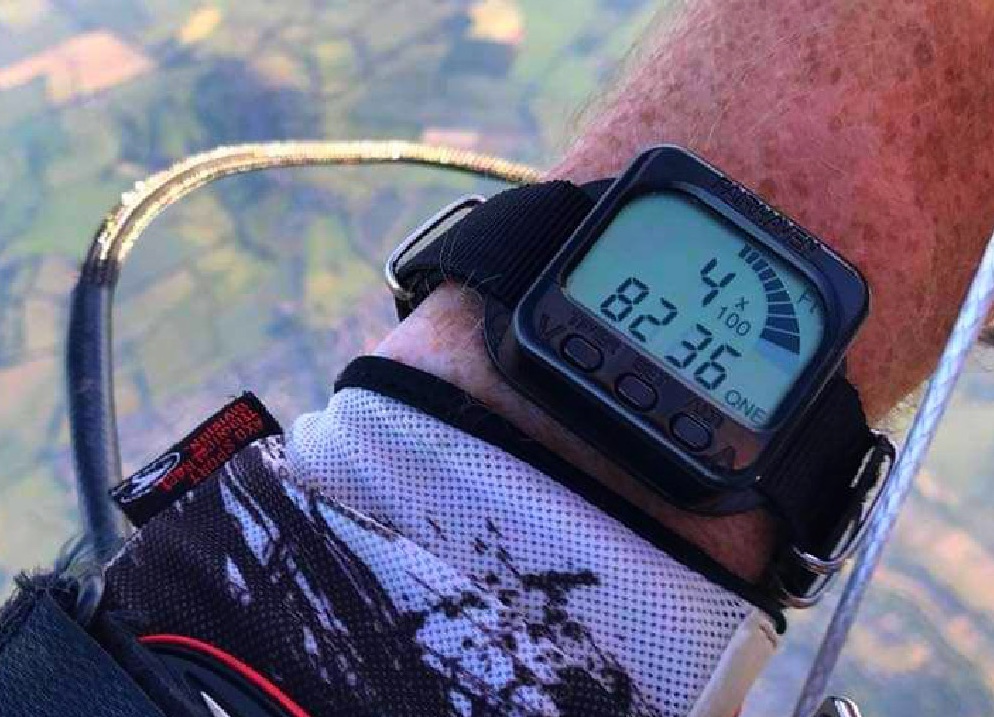
Alti-vario-GPS
These units use the satellite network to determine where you are, display your ground speed and heading and often record your track. Knowing your ground speed can be a big help as you ascend, it can flag up the potential safety problem if you've encountered stronger winds aloft. It also helps you identify the wind direction (you're pointing into wind when your ground speed is lowest). Some GPS units will calculate the wind direction using your drift during steady circles. Knowing this helps you to identify the best places to find lift (upwind of obstacles) and the places to avoid (downwind of obstacles).
The more advanced models offer the ability to put in turnpoints or goals, which helps you follow a planned route. Do bear in mind that they don't replace a compass and have been known to fail so don't rely on your GPS if you're playing near clouds.
Even if you don't need navigation features, some find having a tracklog to review your flight to be useful for your development.

Navigation
With the GPS on board and some additional data it is then possible to enter the world of the moving map. If you are serious about XC flying, this is the way to go. Being able to see your airspace challenges and route options relative to your position is brilliant! Looking ahead on the map allows you to make strategic glides to avoid no go zones. Seeing that you are still clear of the airspace boundary gives you the freedom to climb and maximise your chances on the next glide. Looking at the snail trail of your track can help you centre that elusive core in weak conditions. You can even load up points of interest like house thermals and train stations.
The more complicated and sustained your challenges are likely to be, the more the type of screen and size of display becomes important.
Smartphones vs purpose-designed flying instruments
Although smartphones running flight apps can help bridge the gap, they are delicate, power hungry and not ideally suited to being operated with gloves or being viewed in bright sunlight. Some purpose-designed flying instruments offer robust mapping solutions in a package of hardware and software that is designed specifically for paraglider pilots and is continually evolving. Some others offer a simpler airspace wireframe solution.
Competition flying
For competition flying, a good instrument is vital. The shortest path through a series of cylinders changes with your position, so having an instrument that can recalculate this as you move through the air offers you an advantage in the competition tasks. Easy waypoint management is an important feature too. Consider if you would like to have live tracking (or will you only use your tracklog to review your flights afterwards)? Ease of use and computing power wins for most, although large events like the Red Bull Xalps and Paragliding World Cups often favour live tracking capabilities.

Other sensors
There are instruments can link to airspeed probes, G force measurement and even heart rate monitors! Some instruments now allow you to see, in real time, not only where others are but how they are getting on too. Some allow you to show up on aeronautical collision avoidance networks. It all depends on what you need.
User friendliness
The simpler units offer no choices, beyond setting the altimeter before launch. The more complex instruments offer a myriad of options. If you have a flexible display, bear in mind that it must be really easy to see the most vital info. Make your numbers nice and big and don't clutter the screen.
Consider how easy it is to set up away from the computer. How do you get airspace and waypoint info into it? Is it a straightforward process to enter a turn point for an out and return? If you fly that route will it count as ‘declared' for the XC league? Will the charger work if you're abroad for a week? Will the battery last if you're away for a week? There are many aspects that add up to provide you real value for money.

Features to consider
For altimeters, if you reset at the top of a climb then on the next climb the altimeter will easily show you if you got higher than last time because you only have to beat the zero, not remember the previous number (this was a game I used to play when ‘boring soaring' at the coast). Having a second setting means you can see height gains above take off as well as height above sea level.
Is it possible to adjust the vario tones? Being able to set when the sink tones kick in can give you some peace and quiet when soaring. Adjusting the volume and frequencies can also help you get the most from the vario. Initially I really hated the one instrument I tried until I changed the sound profile; it's amazing just how much difference it can make (to some).
Having a vario unit with a display opens up averages and other options: on my Flymaster I use an 'instant' dial and an 'average' number. The extremes of the dial are set quite low at +/- 3m/s, this makes the dial quite sensitive and useful for light lift, in strong lift I rely much more by harness feel and the noise without looking at the instruments. I only want to confirm the climb isn't tailing off and so a nice big easy to read average climb rate number is what I want there.
If you have a moving map, choosing Track Up instead of North Up can affect how the unit has to redraw elements when you move and it's worth trying out both options. Being able to add or remove details from the map can also be a useful function. Do you really need to be repeatedly reminded of that radio mast when you're doing some local soaring?

Making the choice
Give some thought to the type of flying you will do. Most instruments will display altitude as a number, when you are choosing your instrument try to see if that number is easy to read at a glance. A screen that is jam packed with info may be harder to use in flight. Can the screen be customised to your preference? Is that customisation easy for you to do?
Discussing your needs is always a good start. Chat with the pilots who actually do the flying you're interested in. Flybubble offers a MATCH service, available for free to any customers after placing a purchase deposit. Being able to see a range of instruments in one place and at the same time is a very good way to narrow it down. Weigh the pros and cons, get a shortlist and pick the one with the nicest beep... you'll hear that noise in your sleep so make sure it's one you can really love!
For more inspiration, check out the range of instruments on our website.
Related
Free flight Instruments FAQ — Flybubble
Instrument Reviews — Flybubble
Brought to you by Flybubble
Like what we do? The best way to support us is to buy gear from us and recommend us to others, thank you!
