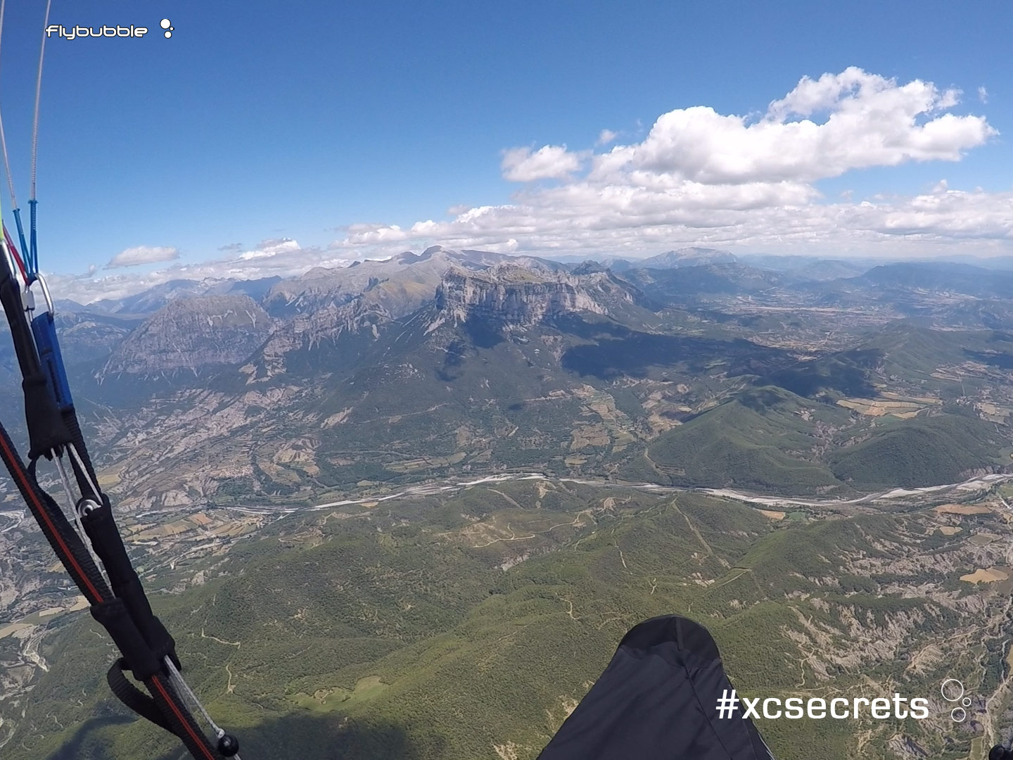
What do you see? Analyze the snapshot above yourself, before scrolling down for the answers.

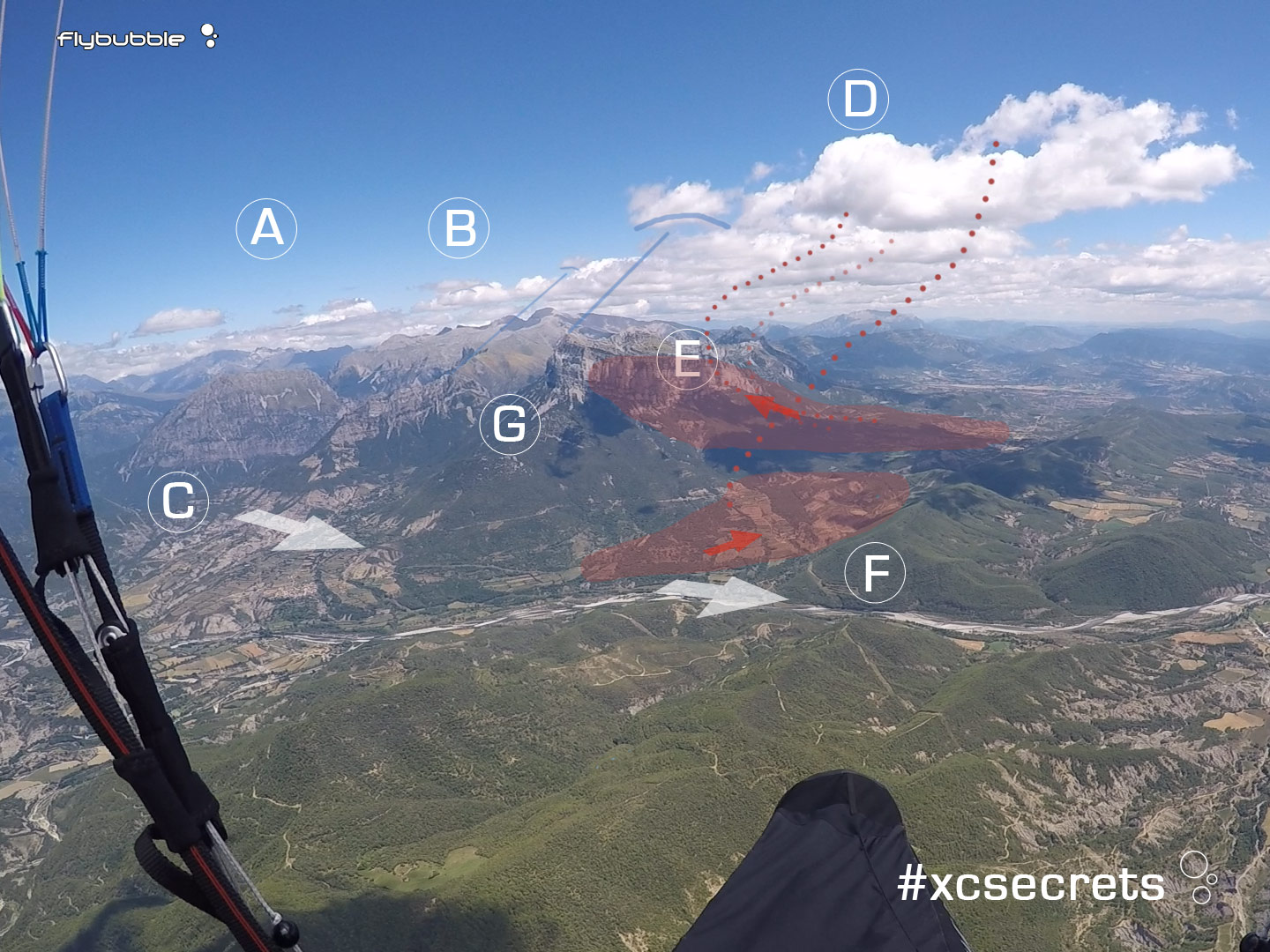
5. Spanish Pyrenees, midsummer, midday. From the cloud shadows we can estimate the sun is shining from the right, and from the cloud shapes the wind is strong, and coming from the left.
A. the large blue area indicates that this is where the air is descending after pouring over the mountains from the left. There are more clouds beyond E, where the air isn’t sinking so much due to more high ground. So we really don’t want to try and go towards A. Guess where the next turnpoint is? That would be A.
B. The curved base of these little clouds suggests strong wind, which is reinforced by the offset between likely peak triggers and the other small clouds to the right. Time to take care!
C. The wind direction aligns with this valley and so this is where the worst descending air will spill out (turbulent) before being focused at the venturi beside the small ridge at F where I would expect the strongest landing conditions.
D. The best thermic cloud in view, most likely being fed by the sunny cliffs at E which creates a local sheltered area and leeside heat pump. There’s a strong inversion limiting climbs and causing clouds to flatten out, so we can expect climbs to be fairly rough, narrow and sink to be strong. Unfortunately the cloud is shading its own thermal source, so it’s not as good as it could be.
The stepped cloudbase indicates that two thermals have produced it – one from the cooler, moister vegetated area, and one that has been heated further on the cliffs, producing a higher cloudbase, with the best climb. To get this climb, you’d need to be tight in on the cliffs: very high risk!
E. The top of this leeside cliff is potentially a zone of chaos. The strong wind will continue to pour over the ridge from the cooler shaded upwind side, and the inversion above means the airmass will be compressed – the venturi effect will be extreme. When there’s a big thermal releasing in the lee it can resist this force, but not entirely: there’ll be wild rough turbulence as the winds mix. When there’s no thermal releasing the sharp edge and steep drop will cause a strong rotor. So you can expect to be smashed up, or smashed down. For experts only; perhaps only for madmen.
It’s a risky move, given the strength of the wind, and the presence of the cooling shadow in the region, because if you don’t find the protecting thermal you will be in the rotor area of a large mountain. Don’t expect the slope below E to be soarable, it will be changeable.
F. This ridge will split the wind, and the fields nearby create a good heat source which will further encourage the wind to bend left to the thermal release point. The small cumulus top right indicates the top of this thermal. If we can find this one, it simplifies our decision and is our ticket out of here, enabling us to link up to the clouds and stay high. Take care! If we don’t find this thermal and sink into the red area, we have limited safe landing in a channel that might be windy.
G. The spine here might catch the wind slightly and enable soaring up to peak height, but only if you come in high enough. With the wind direction and strength it is exposed to wicked turbulence from the ridge upwind of it. Most of the airflow below G will be diverted downhill, worsening the sink. You’d need to be really committed inside this terrain to benefit from the lift, which would also put you in a high risk area should the turbulence be severe. Best to avoid G altogether.
This is a tricky valley crossing. The pilot is not at cloudbase (you can see the cloud shadow bottom left) and looking at the bases ahead I’d estimate 1,000ft or more climb would be possible. Maybe stop and climb more?
Uncomfortable with the risk here? Turning right affords you the safest route, out into the plains, where you’ll glide a really long way from these valley constrictions and turbulence.