
By Carlo Borsattino
On Wednesday 21st May the weather forecasts were looking potentially very good for a paragliding cross country flight (or two!) the next day from High & Over, with light winds, good thermals, high cloudbase and possible convergence lines (concentrated lift areas) predicted in southeast England.
Paul 'Tefal' Andon sent a text saying he thought it was "looking like a good one". Matt texted asking to bring his new Garmin GPSMAP 96C to the hill for him if I was planning on going flying; I most certainly was!
I wanted to get to the hill nice and early, hoping to leave home in Ringmer by 9am, but in the end didn't manage to leave until around 9:30. Fortunately the traffic wasn't too bad on the way there but by the time I arrived at High and Over it was about 10 past 10 and people were already flying, climbing out and getting fairly high.
As I walked (quickly) to launch I watched as a small gaggle climbed up in a nice-looking thermal with Dave 'Gandhi' Newns, Tefal, Dave Massie, Owen Latham, and some others lower down. Tefal and Gandhi, on a Gradient Avax XC2 and Axis Vega II respectively, seemed to be top of the stack with Dave chasing them from below on his Sky Ares; Owen, also flying a Sky Ares, and the others seemed to either leave the thermal, or lose it, and came back to the hill.
As I was getting my glider out and getting ready, I sensed that the wind was already starting to go off to the south; Tefal and Gandhi later told me that they felt the same thing as they were climbing out, which is why they decided to leave the hill so early, at only about 10:20. The thermal cycle died on the hill and the wind went off to the south so, with neither any thermal or decent ridge lift left, everybody landed. Finally, I was ready to launch - just as the good flying conditions ended. Doh!
"You should've been here earlier; it was really good." a somewhat smarmy pilot said rather smugly.
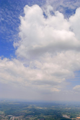
Photo: Carlo paragliding over the South Downs hills in Sussex, England.
Missed it?
Seemingly unperturbed by the crap conditions, Trevor Hurt launched and did a very good job of just about maintaining in the scrappy, crappy-looking lift whilst Gandhi, Tefal and Dave dribbled along in weak lift over the back of the hill, drifting downwind towards Firle. Dave seemed to be struggling a lot more in the lift they were in and was getting low over the hills near Firle Beacon, whilst Tefal and Gandhi floated high above him. I stood on launch watching "the three amigos". |
Squeaking away from the hill
|
Planning ahead
Finally, the patience and concentration of the past half hour had paid off and I could now relax a little? |


Passing over Lewes and heading West

By the time I passed over Lewes and reached Mount Harry on the other side I was down to 1500ft before I found a broken bit of lift over Cuckoo Bottom which I drifted in, taking me right over Blackcap, slowly sinking. The wind here was stronger, around 15-18mph, and more southerly (SSE).
The thermal I was in was wind-blown and very broken, surging up briefly in one small spot at around 0.2 to 0.4 m/s, then sinking the rest of the way round at around -0.1 to -0.5 m/s, averaging 0.1 to -0.2 m/s. I lost the 'climb' and ran off downwind, all the while sinking at around 1.6 m/s, hoping to clear the crappy air that would most likely be in the lee of the hills, and hopefully find another climb. There is always hope!
I went over Plumpton at around 900ft, with Plumpton Racecourse not far to the north of me, hoping to get something off the agricultural college or Wales Farm where I found: nothing; nada; nichts; rien; and then zilch. It was sadly looking like a glide to the ground...
To see a map (by kind permission of Memory Map ) showing my track (solid red line) taken from my Flytec 5020 from High & Over to Plumpton, click here (opens in a new browser window, 340 KB).
Photos by Carlo Borsattino: Gliding from above Mount Caburn over Lewes towards Mount Harry and Cuckoo Bottom.
Scrabbling along, trying to push cross wind
Then I spotted a few seagulls climbing over the edge of a small wood, which I now know is called Brocks Wood, just to the south of a small place I now know to be Streat. I headed for the seagulls and found a very small, weak broken climb which I clung on to as I drifted over Mid Sussex Golf Club, with Ditchling one mile to the southwest, heading towards the railway line leading up to Burgess Hill.
It was fairly windy at this point, and to be honest I found the conditions to be somewhat choppy and not particularly pleasant during this part of the flight. Adding to the discomfort factor was the fact that the wind drift was taking me, not very high, towards Burgess Hill and a fairly built up area, which was directly downwind of me. Plus I was now entering the 2500ft airspace which meant that I would have to leave the climb well before that height to ensure I didn't accidentally go into airspace.
I was still climbing as I came up to the edge of Burgess Hill but I left the climb at 2200ft ASL to avoid drifting low over the town and being taken up into airspace by the thermal. I pushed WSW from the SE edge of Burgess Hill, picking up another climb at 1300ft as I crossed the railway line which runs towards Hassocks just south of the centre of Burgess Hill. The climb was very weak and drifting me in over the town again, so I left it at 1450ft and went on a glide west, heading towards Sayers Common with stunning views of the whole Ditchling ridge from Wolstonbury Hill to the west, beyond Keymer and Hassocks, to Offham hill in the east near Lewes.
Half a mile north of Hurstpierpoint, and back down to 900ft ASL, I picked up another thermal over Danworth Farm which turned out to be a steady, if rather wind-blown, 1 to 1.4 m/s climb. I left the climb at 2300ft ASL, whereupon the lift increased a bit so I quickly put in big-ears and applied speed bar.

Following the River Adur
I went on a glide in a W-WSW direction, following the River Adur just to the north of it, passing first over Twineham then Wineham. Should the next place have been called "Ineham" then after that "Neham", before finally ending up at a place called "M"? I don't know. One thing I did know was that I was getting a lot of sink; sustained 2-3 m/s down. Pessimistically, I thought to myself: "It won't take very long at all to put me on the ground from this height with that kind of sink!"; more optimistically, I thought: "If there's this much sink around, there should be some good lift about somewhere nearby too!"
I spotted a couple of big farm tractors working some fields to the west of Wineham and headed for them, hoping they might be setting off the booming thermal which was responsible for creating all this sink... and found that indeed they were.

Ups & Downs

Sadly after this I found only a couple of weak, broken climbs which were both very short lived, passing over the A24 near Knepp Castle, before taking a final glide low over the windmill at Shipley, crossing the River Adur, and then landing next to the A272 at Green Street, approximately 2km to the east of Coolham and 5km to the ESE of Billingshurst. As usual, I was immediately filled with the perplexing feeling of both great joy and some disappointment; joy at having gotten away from the hill at all, and made it this far; disappointment at having gotten this far and not managed to keep on going and – more importantly – stay flying! The flying adventure over, the retrieve adventure begins – and what an easy and friendly retrieve it turned out to be!
Within only a couple of minutes after landing - not even time to unclip and compose myself – I received a call from Tefal jokingly proclaiming how rude it was of me to fly right over his head, doing spirals above him, and then asking me where I had landed. I explained where I was and to my surprise he said: "Ok, we're on our way; see you shortly!" Apparently Dave Nickels had very kindly volunteered himself to give up his flying for a couple of hours to come and drive retrieve for us; what an absolutely brilliant thing to do – I never realised there were such NICE people in the Southern Club! ;^)
After a short wait, and a very welcome peanut butter sandwich, Dave N arrived with a car already jam-packed with happy XC pilots; Tefal, Gandhi and Dave M who, it turmed out, had all landed not far behind me along a similar track. Apparently, Tefal and Gandhi, having gotten much higher than Dave M early on in their flight - reaching around 4500ft - shot off ahead but got decked when a bank of cloud shut off the sun over a wide area which switched off the thermals. Dave M scrabbled along valiantly for awhile, eventually landing a good half hour after Gandhi, who waved to some school kids as he came in to land.
Whilst we exchanged animated stories like over-excited school boys, and took turns to point out how amazing the sky was (still) looking, Dave Nickels graciously drove us all the way back to High & Over where, to our amazement, we found that conditions were once again looking very good indeed for a(nother) paragliding cross country flight... but that's another story!
To see a map (by kind permission of Memory Map ) showing my track (solid red line) taken from my Flytec 5020 Alti-Vario-GPS showing my whole flight from High & Over to Green Street click here (opens in a new browser window, 160 KB).
To see a map (by kind permission of Memory Map ) showing my track (dashed blue line) taken from my Flytec 5020 Alti-Vario-GPS showing my whole flight from High & Over to Green Street over a CAA air chart click here (opens in a new browser window, 370 KB).
To see a map showing my track (solid red line) taken from my Flytec 5020 Alti-Vario-GPS showing my whole flight from High & Over to Green Street over Google Earth map click here (opens in a new browser window, 160 KB).
Flight date: 22nd May 2008.
Photos
Photos taken by Carlo Borsattino during his cross country paragliding flight from High & Over on the 22nd May 2008.
[justified_image_grid rml_id=263]